TopoQuest Logo
Do you find TopoQuest useful?
Help keep TopoQuest running and adding new maps/features by donating!
Bitcoin:  19c7KJd3qBynnjoSw5npx9KScwjBe4ifkT
Litecoin:  LXs6TkuXGGXo1vDsWCkWVdjQX94eUKd6ui
Home View Maps Find Maps Find Places Resources & Links


Medora, North Dakota Topographic Map

USGS Map Title: Medora, ND
USGS Map MRC: 46103H5
DRG (GeoTIFF) Download: o46103h5.tif


Neighboring USGS Topographic Map Quads:


  Wannagan Creek West, ND  
47103A6
 

  Wannagan Creek East, ND  
47103A5
 

  Gorham SW, ND  
47103A4
 

  Buffalo Gap Campground, ND  
46103H6
 

  Medora, ND  
46103H5
 

  Fryburg NW, ND  
46103H4
 

  Square Butte, ND  
46103G6
 

  Chimney Butte, ND  
46103G5
 

  Tracy Mountain, ND  
46103G4


Map MRC Location:

N47°
W104°
N47°
W103°
H8 H7 H6 H5 H4 H3 H2 H1
G8 G7 G6 G5 G4 G3 G2 G1
F8 F7 F6 F5 F4 F3 F2 F1
E8 E7 E6 E5 E4 E3 E2 E1
D8 D7 D6 D5 D4 D3 D2 D1
C8 C7 C6 C5 C4 C3 C2 C1
B8 B7 B6 B5 B4 B3 B2 B1
A8 A7 A6 A5 A4 A3 A2 A1
N46°
W104°
N46°
W103°

Medora, ND USGS 1:24K Topographic Map Preview:
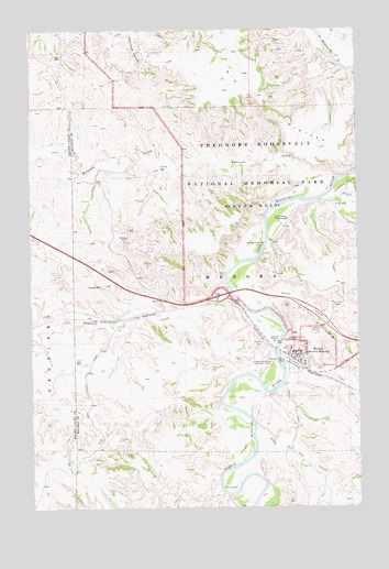
Medora, ND USGS Topographic Map
Click on map above to begin viewing in our Map Viewer.

This topographic map contains these locations and features:
Feature Name Type Latitude Longitude GNIS ID View Map
Andrews CreekStreamN46.9303°W103.5477°1035600View Map
Big PlateauPlainN46.9842°W103.5402°1034723View Map
Big Plateau SpringSpringN46.9689°W103.5063°1035452View Map
Billings County Ambulance ServiceBuildingN46.9074°W103.5266°2658792View Map
Billings County CourthouseBuildingN46.9127°W103.5226°2743374View Map
Billings County Courthouse MuseumBuildingN46.9131°W103.5227°2749136View Map
Billings County Sheriff's OfficeBuildingN46.9130°W103.5227°2734389View Map
Buddy Ranch Airport (historical)AirportN46.9203°W103.5196°1035320View Map
Burning Hills AmphitheatreLocaleN46.9144°W103.5455°2749140View Map
Chateau de Mores (historical)LocaleN46.9125°W103.5346°1034778View Map
Chautea de Mores Visitor CenterBuildingN46.9150°W103.5341°2749138View Map
City of MedoraCivilN46.9129°W103.5249°1036158View Map
Cottonwood CampgroundLocaleN46.9506°W103.5316°1034803View Map
DeMores Elementary SchoolSchoolN46.9135°W103.5235°2748079View Map
Ekblom SpringSpringN46.9633°W103.5177°1035453View Map
Harold Schafer Heritage CenterBuildingN46.9144°W103.5226°2749139View Map
Hellickson RanchLocaleN46.8781°W103.5105°1035774View Map
Knutson CreekStreamN46.9553°W103.5163°1034961View Map
Lone Tree SpringSpringN46.9836°W103.5599°1035457View Map
MedoraPopulated PlaceN46.9139°W103.5244°1035000View Map
Medora CemeteryCemeteryN46.9172°W103.5367°1035001View Map
Medora City HallBuildingN46.9128°W103.5219°2745151View Map
Medora Fire DepartmentBuildingN46.9143°W103.5262°2637753View Map
Medora Police DepartmentBuildingN46.9126°W103.5226°2734368View Map
Medora Post OfficePost OfficeN46.9150°W103.5237°2742553View Map
Medora Ranger StationLocaleN46.9161°W103.5238°1035450View Map
North Dakota Cowboy Hall of FameBuildingN46.9150°W103.5263°2749141View Map
Peaceful Valley RanchLocaleN46.9586°W103.5041°1035772View Map
Peaceful Valley Recreation SiteLocaleN46.9539°W103.5071°1035448View Map
Railroad CreekStreamN46.9156°W103.5321°1035077View Map
Rough Rider CampgroundLocaleN46.9389°W103.5485°1035449View Map
Sheep CreekStreamN46.9306°W103.5469°1035142View Map
Sheep Pasture SpringSpringN46.9847°W103.5355°1035459View Map
Spurgeon and Myers RanchLocaleN46.9636°W103.5994°1035773View Map
Sully CreekStreamN46.8958°W103.5399°1035193View Map
Sully Creek State Primitive ParkParkN46.8922°W103.5377°1035506View Map
Tomamichael SpringSpringN46.9658°W103.5505°1035451View Map
Wannagan SeepsSpringN46.9928°W103.5491°1035458View Map

Note: Coordinates in the location and feature list above are referenced to NAD83 datum.


Copyright (C) 2008-2025 Ryan Niemi / Sunset Dynamics ... All Rights Reserved