TopoQuest Logo
Do you find TopoQuest useful?
Help keep TopoQuest running and adding new maps/features by donating!
Bitcoin:  19c7KJd3qBynnjoSw5npx9KScwjBe4ifkT
Litecoin:  LXs6TkuXGGXo1vDsWCkWVdjQX94eUKd6ui
Home View Maps Find Maps Find Places Resources & Links


Gable Mountain, Montana Topographic Map

USGS Map Title: Gable Mountain, MT
USGS Map MRC: 48113H6
DRG (GeoTIFF) Download: o48113h6.tif


Neighboring USGS Topographic Map Quads:


  Mount Cleveland, MT  
48113H7
 

  Gable Mountain, MT  
48113H6
 

  Chief Mountain, MT  
48113H5
 

  Ahern Pass, MT  
48113G7
 

  Many Glacier, MT  
48113G6
 

  Lake Sherburne, MT  
48113G5


Map MRC Location:

N49°
W114°
N49°
W113°
H8 H7 H6 H5 H4 H3 H2 H1
G8 G7 G6 G5 G4 G3 G2 G1
F8 F7 F6 F5 F4 F3 F2 F1
E8 E7 E6 E5 E4 E3 E2 E1
D8 D7 D6 D5 D4 D3 D2 D1
C8 C7 C6 C5 C4 C3 C2 C1
B8 B7 B6 B5 B4 B3 B2 B1
A8 A7 A6 A5 A4 A3 A2 A1
N48°
W114°
N48°
W113°

Gable Mountain, MT USGS 1:24K Topographic Map Preview:
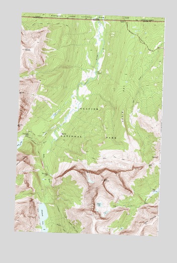
Gable Mountain, MT USGS Topographic Map
Click on map above to begin viewing in our Map Viewer.

This topographic map contains these locations and features:
Feature Name Type Latitude Longitude GNIS ID View Map
Bear Mountain PointCliffN48.9347°W113.7493°768603View Map
Belly River Ranger StationLocaleN48.9316°W113.7112°768690View Map
Cosley Lake Cutoff TrailTrailN48.9300°W113.7334°770128View Map
Dawn Mist FallsFallsN48.9081°W113.7228°770485View Map
Elizabeth LakeLakeN48.8817°W113.7250°771179View Map
Gable MountainSummitN48.9060°W113.6741°771668View Map
Gable PassGapN48.9155°W113.6354°771669View Map
Gable Pass TrailTrailN48.9197°W113.6693°771670View Map
Gros Ventre FallsFallsN48.9302°W113.7407°772009View Map
Lee RidgeRidgeN48.9192°W113.6492°773281View Map
Mokowanis RiverStreamN48.9264°W113.7198°774328View Map
North Fork Belly River TrailTrailN48.9936°W113.7287°774708View Map
Otatso LakeLakeN48.8919°W113.6766°774992View Map
PapooseSummitN48.9200°W113.6283°775072View Map
Port of Chief MountainLocaleN48.9967°W113.6593°769824View Map
Redgap CreekStreamN48.8786°W113.7232°775670View Map
Sentinel MountainSummitN48.9790°W113.7460°776347View Map
Slide LakeLakeN48.9014°W113.6255°776640View Map
Threemile CampsiteLocaleN48.9678°W113.6829°777611View Map

Note: Coordinates in the location and feature list above are referenced to NAD83 datum.


Copyright (C) 2008-2025 Ryan Niemi / Sunset Dynamics ... All Rights Reserved