TopoQuest Logo
Do you find TopoQuest useful?
Help keep TopoQuest running and adding new maps/features by donating!
Bitcoin:  19c7KJd3qBynnjoSw5npx9KScwjBe4ifkT
Litecoin:  LXs6TkuXGGXo1vDsWCkWVdjQX94eUKd6ui
Home View Maps Find Maps Find Places Resources & Links


Gage NE, Montana Topographic Map

USGS Map Title: Gage NE, MT
USGS Map MRC: 46108D3
DRG (GeoTIFF) Download: o46108d3.tif


Neighboring USGS Topographic Map Quads:


  Big Wall West, MT  
46108E4
 

  Big Wall East, MT  
46108E3
 

  Delphia, MT  
46108E2
 

  Gage, MT  
46108D4
 

  Gage NE, MT  
46108D3
 

  Chimney Butte, MT  
46108D2
 

  Signal Mountain, MT  
46108C4
 

  Dunn Mountain North, MT  
46108C3
 

  Cherry Spring, MT  
46108C2


Map MRC Location:

N47°
W109°
N47°
W108°
H8 H7 H6 H5 H4 H3 H2 H1
G8 G7 G6 G5 G4 G3 G2 G1
F8 F7 F6 F5 F4 F3 F2 F1
E8 E7 E6 E5 E4 E3 E2 E1
D8 D7 D6 D5 D4 D3 D2 D1
C8 C7 C6 C5 C4 C3 C2 C1
B8 B7 B6 B5 B4 B3 B2 B1
A8 A7 A6 A5 A4 A3 A2 A1
N46°
W109°
N46°
W108°

Gage NE, MT USGS 1:24K Topographic Map Preview:
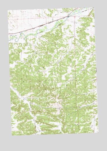
Gage NE, MT USGS Topographic Map
Click on map above to begin viewing in our Map Viewer.

This topographic map contains these locations and features:
Feature Name Type Latitude Longitude GNIS ID View Map
07N27E01DADD01 WellWellN46.3833°W108.2793°815914View Map
07N27E03CBB_01 WellWellN46.3875°W108.3410°815956View Map
07N27E10ABB_01 SpringSpringN46.3777°W108.3301°815870View Map
07N27E10BBAD01 WellWellN46.3783°W108.3368°815873View Map
08N27E12CACD01 WellWellN46.4602°W108.2948°816370View Map
08N27E15DCBA01 WellWellN46.4466°W108.3332°816307View Map
08N27E22ACBC01 WellWellN46.4361°W108.3271°816262View Map
08N27E23ACBA01 WellWellN46.4391°W108.3104°816276View Map
08N27E25BDBC01 WellWellN46.4230°W108.2948°816175View Map
08N27E27AACC01 WellWellN46.4247°W108.3257°816188View Map
08N27E28CCCA01 WellWellN46.4136°W108.3629°816116View Map
08N27E28CCCB01 WellWellN46.4161°W108.3640°816137View Map
08N27E29ACBB01 WellWellN46.4222°W108.3740°816172View Map
08N27E29ADBD01 WellWellN46.4219°W108.3679°816170View Map
08N27E29DCC_01 SpringSpringN46.4133°W108.3737°816113View Map
08N27E33ABBC01 WellWellN46.4111°W108.3535°816100View Map
08N27E33ADDC01 WellWellN46.4033°W108.3446°816062View Map
08N27E34BABC01 WellWellN46.4114°W108.3382°816101View Map
08N28E06BBAA01 WellWellN46.4914°W108.2721°816501View Map
08N28E18DABB01 WellWellN46.4486°W108.2610°816316View Map
08N28E19BAAD01 WellWellN46.4458°W108.2673°816301View Map
09N27E32C___01 WellWellN46.4939°W108.3568°816513View Map
09N27E35CACD01 WellWellN46.4958°W108.2926°816520View Map
Guffena Sudan DitchCanalN46.4847°W108.3260°805557View Map
Krueger Spendiff DitchCanalN46.4977°W108.2596°768094View Map
Milner Post Office (historical)Post OfficeN46.4780°W108.3501°1723113View Map

Note: Coordinates in the location and feature list above are referenced to NAD83 datum.


Copyright (C) 2008-2024 Ryan Niemi / Sunset Dynamics ... All Rights Reserved