TopoQuest Logo
Do you find TopoQuest useful?
Help keep TopoQuest running and adding new maps/features by donating!
Bitcoin:  19c7KJd3qBynnjoSw5npx9KScwjBe4ifkT
Litecoin:  LXs6TkuXGGXo1vDsWCkWVdjQX94eUKd6ui
Home View Maps Find Maps Find Places Resources & Links


Chimney Butte, Montana Topographic Map

USGS Map Title: Chimney Butte, MT
USGS Map MRC: 46108D2
DRG (GeoTIFF) Download: o46108d2.tif


Neighboring USGS Topographic Map Quads:


  Big Wall East, MT  
46108E3
 

  Delphia, MT  
46108E2
 

  Musselshell, MT  
46108E1
 

  Gage NE, MT  
46108D3
 

  Chimney Butte, MT  
46108D2
 

  Corey Flat, MT  
46108D1
 

  Dunn Mountain North, MT  
46108C3
 

  Cherry Spring, MT  
46108C2
 

  Steamboat Butte, MT  
46108C1


Map MRC Location:

N47°
W109°
N47°
W108°
H8 H7 H6 H5 H4 H3 H2 H1
G8 G7 G6 G5 G4 G3 G2 G1
F8 F7 F6 F5 F4 F3 F2 F1
E8 E7 E6 E5 E4 E3 E2 E1
D8 D7 D6 D5 D4 D3 D2 D1
C8 C7 C6 C5 C4 C3 C2 C1
B8 B7 B6 B5 B4 B3 B2 B1
A8 A7 A6 A5 A4 A3 A2 A1
N46°
W109°
N46°
W108°

Chimney Butte, MT USGS 1:24K Topographic Map Preview:
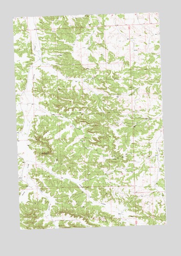
Chimney Butte, MT USGS Topographic Map
Click on map above to begin viewing in our Map Viewer.

This topographic map contains these locations and features:
Feature Name Type Latitude Longitude GNIS ID View Map
07N28E02DABC01 SpringSpringN46.3855°W108.1765°815935View Map
07N28E04BBCC01 WellWellN46.3908°W108.2337°815979View Map
08N28E03AAB_01 WellWellN46.4972°W108.1993°816526View Map
08N28E04CBBA01 WellWellN46.4775°W108.2335°816442View Map
08N28E29A___01 WellWellN46.4341°W108.2401°816249View Map
08N28E36ADDD01 WellWellN46.4064°W108.1518°816074View Map
08N29E08CACC01 WellWellN46.4561°W108.1321°816355View Map
08N29E20DBCB01 WellWellN46.4283°W108.1265°816210View Map
08N29E29CABA01 WellWellN46.4158°W108.1307°816127View Map
08N29E29CBAA01 WellWellN46.4155°W108.1332°816126View Map
08N29E32CDBB01 WellWellN46.3975°W108.1318°816021View Map
Carters CouleeValleyN46.4147°W108.2348°769632View Map
Chimney ButteSummitN46.4194°W108.2276°769830View Map
Fishel Post Office (historical)Post OfficeN46.3986°W108.1329°1723098View Map
Tepee CouleeValleyN46.4016°W108.2360°777469View Map
Y Bar CouleeValleyN46.4064°W108.2457°778713View Map

Note: Coordinates in the location and feature list above are referenced to NAD83 datum.


Copyright (C) 2008-2024 Ryan Niemi / Sunset Dynamics ... All Rights Reserved