TopoQuest Logo
Do you find TopoQuest useful?
Help keep TopoQuest running and adding new maps/features by donating!
Bitcoin:  19c7KJd3qBynnjoSw5npx9KScwjBe4ifkT
Litecoin:  LXs6TkuXGGXo1vDsWCkWVdjQX94eUKd6ui
Home View Maps Find Maps Find Places Resources & Links


Galesburg, Michigan Topographic Map

USGS Map Title: Galesburg, MI
USGS Map MRC: 42085C4
DRG (GeoTIFF) Download: o42085c4.tif


Neighboring USGS Topographic Map Quads:


  Kalamazoo NE, MI  
42085D5
 

  Delton, MI  
42085D4
 

  Banfield, MI  
42085D3
 

  Kalamazoo, MI  
42085C5
 

  Galesburg, MI  
42085C4
 

  Augusta, MI  
42085C3
 

  Portage, MI  
42085B5
 

  Adams Park, MI  
42085B4
 

  Climax, MI  
42085B3


Map MRC Location:

N43°
W86°
N43°
W85°
H8 H7 H6 H5 H4 H3 H2 H1
G8 G7 G6 G5 G4 G3 G2 G1
F8 F7 F6 F5 F4 F3 F2 F1
E8 E7 E6 E5 E4 E3 E2 E1
D8 D7 D6 D5 D4 D3 D2 D1
C8 C7 C6 C5 C4 C3 C2 C1
B8 B7 B6 B5 B4 B3 B2 B1
A8 A7 A6 A5 A4 A3 A2 A1
N42°
W86°
N42°
W85°

Galesburg, MI USGS 1:24K Topographic Map Preview:
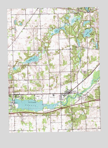
Galesburg, MI USGS Topographic Map
Click on map above to begin viewing in our Map Viewer.

This topographic map contains these locations and features:
Feature Name Type Latitude Longitude GNIS ID View Map
Andrews Estates Mobile Home ParkPopulated PlaceN42.2839°W85.3944°2627870View Map
Augusta - Ross Township Fire DepartmentBuildingN42.3699°W85.3949°2636095View Map
Bailey CemeteryCemeteryN42.2525°W85.3850°620443View Map
Ben Johnson Boy Scout CampLocaleN42.3478°W85.3872°621080View Map
Butterfield LakeLakeN42.3612°W85.4105°622383View Map
Campbell LakeLakeN42.3234°W85.4667°622660View Map
Charleston CemeteryCemeteryN42.2831°W85.4011°623112View Map
Charter Township of ComstockCivilN42.2888°W85.4741°1626126View Map
City of GalesburgCivilN42.2911°W85.4183°1626330View Map
Comstock Fire and Rescue Comstock EastBuildingN42.2882°W85.4591°2636202View Map
Comstock Township Fire DepartmentBuildingN42.2882°W85.4591°2627877View Map
Congregational United ChurchChurchN42.2880°W85.4203°2627861View Map
Congregational United Church of Christ Historical MarkerParkN42.2885°W85.4201°2611919View Map
Crum Park (historical)ParkN42.3225°W85.4006°624153View Map
East ComstockPopulated PlaceN42.2862°W85.4897°625165View Map
Ford CemeteryCemeteryN42.2678°W85.4531°626223View Map
Gale-Valley Estates Mobile Home ParkPopulated PlaceN42.2903°W85.4091°2627869View Map
GalesburgPopulated PlaceN42.2887°W85.4181°626603View Map
Galesburg - Charleston Fire DepartmentBuildingN42.2887°W85.4127°2636008View Map
Galesburg Baptist ChurchChurchN42.2823°W85.4314°2627859View Map
Galesburg City HallBuildingN42.2887°W85.4131°2627866View Map
Galesburg Old CemeteryCemeteryN42.2922°W85.4194°2627930View Map
Galesburg Police DepartmentBuildingN42.2887°W85.4127°2737450View Map
Galesburg Post OfficePost OfficeN42.2886°W85.4158°2627863View Map
Galesburg Rest AreaLocaleN42.2710°W85.4434°2611904View Map
Galesburg SpeedwayLocaleN42.2828°W85.3986°2627867View Map
Galesburg-Augusta Primary SchoolSchoolN42.2825°W85.4272°2627868View Map
Galesburgh Memorial LibraryBuildingN42.2886°W85.4136°2627864View Map
Galesburgh Memorial MuseumBuildingN42.2884°W85.4135°2627865View Map
Graham LakeLakeN42.3635°W85.4028°627071View Map
Greater Galesburg Census Designated Place (historical)CensusN42.2814°W85.4542°2393026View Map
Gull CreekStreamN42.2917°W85.3950°627506View Map
Gull LakePopulated PlaceN42.3709°W85.3867°627519View Map
Gull Lake View Golf CourseLocaleN42.3661°W85.3875°2627895View Map
Hickory Ridge Golf CourseLocaleN42.2903°W85.4778°2627876View Map
Hoover SchoolSchoolN42.3023°W85.4739°628549View Map
HowlandsburgPopulated PlaceN42.3350°W85.4036°1617630View Map
Howlandsburg CemeteryCemeteryN42.3345°W85.3961°628726View Map
Interchange 85CrossingN42.2739°W85.4286°2611901View Map
Interchange 88CrossingN42.2817°W85.3761°2611899View Map
Kalamazoo County Poor Farm CemeteryCemeteryN42.2875°W85.4458°2627924View Map
Kalamazoo Region Historical MarkerParkN42.2713°W85.4432°2611908View Map
Larry D Boven Airport (historical)AirportN42.3139°W85.4638°1623912View Map
LawndalePopulated PlaceN42.2864°W85.4622°1617674View Map
Mill PondReservoirN42.3397°W85.4034°632340View Map
Morrow LakeReservoirN42.2776°W85.4655°632730View Map
Oak Grove CemeteryCemeteryN42.3009°W85.4153°633820View Map
Pond Lily LakeLakeN42.3358°W85.3785°635220View Map
Richland Township Fire DepartmentBuildingN42.3676°W85.4556°2636242View Map
River Oaks County ParkParkN42.2814°W85.4500°2627875View Map
Rowe IslandIslandN42.2800°W85.4681°636341View Map
Saint Ann Catholic ChurchChurchN42.3717°W85.3833°2627896View Map
Saint Patrick Catholic ChurchChurchN42.2878°W85.4894°2627878View Map
Shafter Airport (historical)AirportN42.2965°W85.4249°1623911View Map
Shafter CemeteryCemeteryN42.2967°W85.4261°637640View Map
Sherman LakeLakeN42.3495°W85.3905°637765View Map
Suburban Medical CenterHospitalN42.2881°W85.4364°2627862View Map
Three LakesLakeN42.3516°W85.4327°1614816View Map
Wheaton CemeteryCemeteryN42.2522°W85.4625°2627925View Map
Yorkville Station (historical)LocaleN42.3694°W85.4028°2612214View Map

Note: Coordinates in the location and feature list above are referenced to NAD83 datum.


Copyright (C) 2008-2024 Ryan Niemi / Sunset Dynamics ... All Rights Reserved