TopoQuest Logo
Do you find TopoQuest useful?
Help keep TopoQuest running and adding new maps/features by donating!
Bitcoin:  19c7KJd3qBynnjoSw5npx9KScwjBe4ifkT
Litecoin:  LXs6TkuXGGXo1vDsWCkWVdjQX94eUKd6ui
Home View Maps Find Maps Find Places Resources & Links


Climax, Michigan Topographic Map

USGS Map Title: Climax, MI
USGS Map MRC: 42085B3
DRG (GeoTIFF) Download: o42085b3.tif


Neighboring USGS Topographic Map Quads:


  Galesburg, MI  
42085C4
 

  Augusta, MI  
42085C3
 

  Battle Creek, MI  
42085C2
 

  Adams Park, MI  
42085B4
 

  Climax, MI  
42085B3
 

  East Leroy, MI  
42085B2
 

  Mendon, MI  
42085A4
 

  Leonidas, MI  
42085A3
 

  Union City, MI  
42085A2


Map MRC Location:

N43°
W86°
N43°
W85°
H8 H7 H6 H5 H4 H3 H2 H1
G8 G7 G6 G5 G4 G3 G2 G1
F8 F7 F6 F5 F4 F3 F2 F1
E8 E7 E6 E5 E4 E3 E2 E1
D8 D7 D6 D5 D4 D3 D2 D1
C8 C7 C6 C5 C4 C3 C2 C1
B8 B7 B6 B5 B4 B3 B2 B1
A8 A7 A6 A5 A4 A3 A2 A1
N42°
W86°
N42°
W85°

Climax, MI USGS 1:24K Topographic Map Preview:
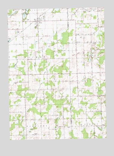
Climax, MI USGS Topographic Map
Click on map above to begin viewing in our Map Viewer.

This topographic map contains these locations and features:
Feature Name Type Latitude Longitude GNIS ID View Map
Adams CemeteryCemeteryN42.2344°W85.3361°2627932View Map
Athens ChurchChurchN42.1512°W85.2553°620297View Map
Berger SchoolSchoolN42.1448°W85.3519°621154View Map
Bigelow SchoolSchoolN42.1873°W85.2855°621373View Map
ClimaxPopulated PlaceN42.2384°W85.3350°623472View Map
Climax Mobile Home ParkPopulated PlaceN42.2394°W85.3497°2627883View Map
Climax Post OfficePost OfficeN42.2388°W85.3357°2627888View Map
Climax StationLocaleN42.2406°W85.3356°2627882View Map
Climax Township Fire DepartmentBuildingN42.2378°W85.3365°2636194View Map
Climax United Methodist ChurchChurchN42.2383°W85.3342°2627887View Map
Climax Village HallBuildingN42.2383°W85.3356°2627889View Map
Climax-Scotts Junior/Senior High SchoolSchoolN42.2328°W85.3378°2627890View Map
Daniel B. Eldred House Historical MarkerParkN42.2381°W85.3333°2611916View Map
Eldred DrainCanalN42.2222°W85.3300°2112736View Map
Gardners CornersPopulated PlaceN42.1292°W85.3530°626653View Map
Goose PondLakeN42.2281°W85.3630°626982View Map
Harrison CemeteryCemeteryN42.1797°W85.3644°2112747View Map
Harvey SchoolSchoolN42.1367°W85.2647°627908View Map
Hiscock SchoolSchoolN42.2470°W85.2572°628352View Map
Johnson DrainCanalN42.2050°W85.3642°2112749View Map
Langeland Climax ChapelChurchN42.2383°W85.3333°2627886View Map
Lawrence Memorial LibraryBuildingN42.2383°W85.3364°2627885View Map
Le Ferre LakeLakeN42.2198°W85.3735°630236View Map
Longman DrainCanalN42.1922°W85.3214°2112748View Map
Lynn SchoolSchoolN42.1364°W85.3044°631237View Map
McGinnis LakeLakeN42.2444°W85.3533°631899View Map
North Athens Baptist ChurchChurchN42.1508°W85.2556°2630118View Map
North Athens CemeteryCemeteryN42.1514°W85.2556°2630220View Map
Northside CemeteryCemeteryN42.1303°W85.3422°633701View Map
Pine CreekPopulated PlaceN42.1656°W85.2561°634904View Map
Pinecreek Post Office (historical)Post OfficeN42.1656°W85.2561°2630145View Map
Potter LakeLakeN42.2490°W85.3493°635345View Map
School Number 4SchoolN42.1806°W85.3480°637400View Map
Seeley SchoolSchoolN42.1728°W85.3144°637553View Map
South Climax Post Office (historical)Post OfficeN42.1800°W85.3500°2612225View Map
South Leroy Congregational CemeteryCemeteryN42.1875°W85.2603°2630217View Map
Spencer Mills CemeteryCemeteryN42.2211°W85.3556°2567101View Map
Stimpson CemeteryCemeteryN42.1378°W85.2522°2109295View Map
Township of ClimaxCivilN42.2018°W85.3544°1626098View Map
Village of ClimaxCivilN42.2383°W85.3360°2398580View Map
Wakeshma ChurchChurchN42.1364°W85.2997°2112745View Map
Wakeshma DrainCanalN42.1453°W85.3347°2112746View Map
Wakeshma Post Office (historical)Post OfficeN42.1347°W85.3133°2612219View Map
Walnut RidgeRidgeN42.2073°W85.2780°1615733View Map
West LeroyPopulated PlaceN42.2170°W85.2858°1617930View Map
West Leroy Bible ChurchChurchN42.2164°W85.2858°2630098View Map
West Leroy CemeteryCemeteryN42.2242°W85.2822°2109275View Map
West Leroy Post Office (historical)Post OfficeN42.2169°W85.2858°2630126View Map
Willow Swamp DrainCanalN42.2131°W85.3244°2112735View Map
WRKR-FM (Portage)TowerN42.1287°W85.3378°1625750View Map

Note: Coordinates in the location and feature list above are referenced to NAD83 datum.


Copyright (C) 2008-2024 Ryan Niemi / Sunset Dynamics ... All Rights Reserved