TopoQuest Logo
Do you find TopoQuest useful?
Help keep TopoQuest running and adding new maps/features by donating!
Bitcoin:  19c7KJd3qBynnjoSw5npx9KScwjBe4ifkT
Litecoin:  LXs6TkuXGGXo1vDsWCkWVdjQX94eUKd6ui
Home View Maps Find Maps Find Places Resources & Links


Gallatin Peak, California Topographic Map

USGS Map Title: Gallatin Peak, CA
USGS Map MRC: 40120E6
DRG (GeoTIFF) Download: o40120e6.tif


Neighboring USGS Topographic Map Quads:


  Spalding Tract, CA  
40120F7
 

  Troxel Point, CA  
40120F6
 

  Fredonyer Peak, CA  
40120F5
 

  Pikes Point, CA  
40120E7
 

  Gallatin Peak, CA  
40120E6
 

  Tunnison Mountain, CA  
40120E5
 

  Roop Mountain, CA  
40120D7
 

  Susanville, CA  
40120D6
 

  Johnstonville, CA  
40120D5


Map MRC Location:

N41°
W121°
N41°
W120°
H8 H7 H6 H5 H4 H3 H2 H1
G8 G7 G6 G5 G4 G3 G2 G1
F8 F7 F6 F5 F4 F3 F2 F1
E8 E7 E6 E5 E4 E3 E2 E1
D8 D7 D6 D5 D4 D3 D2 D1
C8 C7 C6 C5 C4 C3 C2 C1
B8 B7 B6 B5 B4 B3 B2 B1
A8 A7 A6 A5 A4 A3 A2 A1
N40°
W121°
N40°
W120°

Gallatin Peak, CA USGS 1:24K Topographic Map Preview:
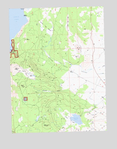
Gallatin Peak, CA USGS Topographic Map
Click on map above to begin viewing in our Map Viewer.

This topographic map contains these locations and features:
Feature Name Type Latitude Longitude GNIS ID View Map
Big Dry LakeLakeN40.5832°W120.6606°256919View Map
Black MountainSummitN40.5929°W120.7291°257136View Map
Colman LakeLakeN40.5122°W120.7177°258600View Map
Deans MeadowFlatN40.5579°W120.7216°259166View Map
Deans RidgeRidgeN40.5624°W120.7225°259168View Map
Eagle Lake Field StationLocaleN40.6171°W120.7280°1655284View Map
Eagles NestLocaleN40.5821°W120.7458°274673View Map
Five Dot RanchLocaleN40.5335°W120.6308°260177View Map
Gallatin BurnAreaN40.5610°W120.7405°260464View Map
Gallatin PeakSummitN40.5646°W120.7419°260466View Map
Greens PeakSummitN40.5071°W120.7058°260874View Map
Lower Dry LakeLakeN40.6113°W120.6755°263012View Map
Mahogany LakeLakeN40.5336°W120.7329°263123View Map
Mahogany PeakSummitN40.5466°W120.7363°263124View Map
Miners PointCapeN40.6143°W120.7388°263679View Map
Murrers RanchLocaleN40.5602°W120.6694°1655283View Map
Murrers Upper MeadowFlatN40.6046°W120.7016°263982View Map
Romstock CanyonValleyN40.5460°W120.6747°265558View Map
Round ValleyValleyN40.5146°W120.6672°265624View Map
Round Valley 228 DamDamN40.5157°W120.6613°1663788View Map
Round Valley ReservoirReservoirN40.5122°W120.6649°265630View Map
Summit LakeLakeN40.5752°W120.6619°267932View Map

Note: Coordinates in the location and feature list above are referenced to NAD83 datum.


Copyright (C) 2008-2024 Ryan Niemi / Sunset Dynamics ... All Rights Reserved