TopoQuest Logo
Do you find TopoQuest useful?
Help keep TopoQuest running and adding new maps/features by donating!
Bitcoin:  19c7KJd3qBynnjoSw5npx9KScwjBe4ifkT
Litecoin:  LXs6TkuXGGXo1vDsWCkWVdjQX94eUKd6ui
Home View Maps Find Maps Find Places Resources & Links


Galva, Illinois Topographic Map

USGS Map Title: Galva, IL
USGS Map MRC: 41090B1
DRG (GeoTIFF) Download: o41090b1.tif


Neighboring USGS Topographic Map Quads:


  Cambridge, IL  
41090C2
 

  German Corner, IL  
41090C1
 

  Kewanee North, IL  
41089C8
 

  Nekoma, IL  
41090B2
 

  Galva, IL  
41090B1
 

  Kewanee South, IL  
41089B8
 

  Oneida, IL  
41090A2
 

  Victoria, IL  
41090A1
 

  Lafayette, IL  
41089A8


Map MRC Location:

N42°
W91°
N42°
W90°
H8 H7 H6 H5 H4 H3 H2 H1
G8 G7 G6 G5 G4 G3 G2 G1
F8 F7 F6 F5 F4 F3 F2 F1
E8 E7 E6 E5 E4 E3 E2 E1
D8 D7 D6 D5 D4 D3 D2 D1
C8 C7 C6 C5 C4 C3 C2 C1
B8 B7 B6 B5 B4 B3 B2 B1
A8 A7 A6 A5 A4 A3 A2 A1
N41°
W91°
N41°
W90°

Galva, IL USGS 1:24K Topographic Map Preview:
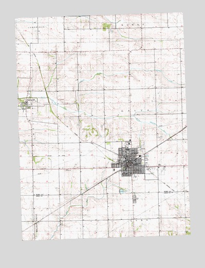
Galva, IL USGS Topographic Map
Click on map above to begin viewing in our Map Viewer.

This topographic map contains these locations and features:
Feature Name Type Latitude Longitude GNIS ID View Map
Assembly of God ChurchChurchN41.1642°W90.0373°425870View Map
Beal School (historical)SchoolN41.1356°W90.0801°1720334View Map
Bishop HillPopulated PlaceN41.2017°W90.1190°404474View Map
Bishop Hill CemeteryCemeteryN41.2023°W90.1140°425875View Map
Bishop Hill Community Fire Protection DistrictBuildingN41.2016°W90.1185°2640376View Map
Bishop Hill Historic DistrictParkN41.2011°W90.1187°1812537View Map
Bishop Hill Post OfficePost OfficeN41.2009°W90.1186°2788452View Map
Brown School (historical)SchoolN41.1650°W90.1151°1719896View Map
Burdoff School (historical)SchoolN41.2225°W90.0037°1719901View Map
Calhoun School (historical)SchoolN41.2220°W90.0418°1719903View Map
City of GalvaCivilN41.1692°W90.0372°2394847View Map
Community ChurchChurchN41.1998°W90.1148°425874View Map
Cromien School (historical)SchoolN41.1936°W90.0040°1747354View Map
Deem School (historical)SchoolN41.1953°W90.0415°1719904View Map
F V White SchoolSchoolN41.1692°W90.0462°425858View Map
First Baptist Church of GalvaChurchN41.1684°W90.0465°425868View Map
First Congregational ChurchChurchN41.1684°W90.0454°425867View Map
First United Methodist ChurchChurchN41.1684°W90.0446°425866View Map
Fort Sumpter School (historical)SchoolN41.1353°W90.1157°1720336View Map
Foursquare ChurchChurchN41.1678°W90.0423°425872View Map
GalvaPopulated PlaceN41.1675°W90.0426°428372View Map
Galva Autovue TheatreLocaleN41.1797°W90.0439°2634154View Map
Galva Bishop Hills Emergency Medical ServicesBuildingN41.1644°W90.0378°2673909View Map
Galva CemeteryCemeteryN41.1471°W90.0408°408865View Map
Galva Christian ChurchChurchN41.1561°W90.0293°425865View Map
Galva City Police DepartmentBuildingN41.1672°W90.0440°2757018View Map
Galva Elementary SchoolSchoolN41.1692°W90.0468°1812561View Map
Galva Fire DepartmentBuildingN41.1676°W90.0432°2640691View Map
Galva Grange HallBuildingN41.1642°W90.0918°428373View Map
Galva High SchoolSchoolN41.1773°W90.0434°425857View Map
Galva ParkParkN41.1584°W90.0390°425859View Map
Galva Post OfficePost OfficeN41.1660°W90.0463°1812562View Map
Galva Public LibraryBuildingN41.1678°W90.0462°1812563View Map
Goose CreekStreamN41.1967°W90.0801°409166View Map
Grace United Methodist ChurchChurchN41.1645°W90.0382°425871View Map
Hickory Grove School (historical)SchoolN41.1917°W90.0798°1719897View Map
Maple Grove School (historical)SchoolN41.1636°W90.0040°1747398View Map
Messiah Lutheran ChurchChurchN41.1628°W90.0465°425873View Map
Mount Pleasant School (historical)SchoolN41.2231°W90.1143°1719898View Map
Nasslund School (historical)SchoolN41.2228°W90.0801°1719899View Map
Octagon School (historical)SchoolN41.2420°W90.0068°1719902View Map
Potter School (historical)SchoolN41.1353°W90.0418°1720341View Map
Round Grove School (historical)SchoolN41.2417°W90.0607°1719900View Map
Saint Johns Catholic ChurchChurchN41.1675°W90.0384°425869View Map
Saint Johns CemeteryCemeteryN41.1803°W90.0223°417378View Map
Sipes School (historical)SchoolN41.1350°W90.0034°424095View Map
State Historic Site MuseumBuildingN41.1959°W90.1187°425864View Map
Township of GalvaCivilN41.1923°W90.0400°429037View Map
Trinity Baptist ChurchChurchN41.1678°W90.0423°1962341View Map
Veterans ParkParkN41.1661°W90.0365°425861View Map
Village of Bishop HillCivilN41.1995°W90.1175°2398127View Map
Washington ParkParkN41.1631°W90.0462°425862View Map
West Galva School (historical)SchoolN41.1642°W90.0801°1719895View Map
Wiley ParkParkN41.1692°W90.0490°421170View Map
WZUU-FM (Galva)TowerN41.1503°W90.0221°428492View Map

Note: Coordinates in the location and feature list above are referenced to NAD83 datum.


Copyright (C) 2008-2024 Ryan Niemi / Sunset Dynamics ... All Rights Reserved