TopoQuest Logo
Do you find TopoQuest useful?
Help keep TopoQuest running and adding new maps/features by donating!
Bitcoin:  19c7KJd3qBynnjoSw5npx9KScwjBe4ifkT
Litecoin:  LXs6TkuXGGXo1vDsWCkWVdjQX94eUKd6ui
Home View Maps Find Maps Find Places Resources & Links


Kewanee North, Illinois Topographic Map

USGS Map Title: Kewanee North, IL
USGS Map MRC: 41089C8
DRG (GeoTIFF) Download: o41089c8.tif


Neighboring USGS Topographic Map Quads:


  Atkinson, IL  
41090D1
 

  Annawan, IL  
41089D8
 

  Mineral, IL  
41089D7
 

  German Corner, IL  
41090C1
 

  Kewanee North, IL  
41089C8
 

  Neponset, IL  
41089C7
 

  Galva, IL  
41090B1
 

  Kewanee South, IL  
41089B8
 

  Elmira, IL  
41089B7


Map MRC Location:

N42°
W90°
N42°
W89°
H8 H7 H6 H5 H4 H3 H2 H1
G8 G7 G6 G5 G4 G3 G2 G1
F8 F7 F6 F5 F4 F3 F2 F1
E8 E7 E6 E5 E4 E3 E2 E1
D8 D7 D6 D5 D4 D3 D2 D1
C8 C7 C6 C5 C4 C3 C2 C1
B8 B7 B6 B5 B4 B3 B2 B1
A8 A7 A6 A5 A4 A3 A2 A1
N41°
W90°
N41°
W89°

Kewanee North, IL USGS 1:24K Topographic Map Preview:
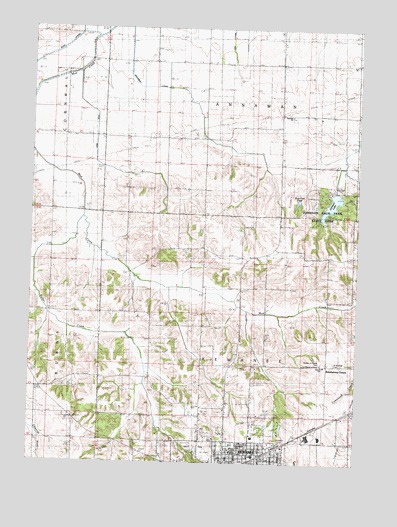
Kewanee North, IL USGS Topographic Map
Click on map above to begin viewing in our Map Viewer.

This topographic map contains these locations and features:
Feature Name Type Latitude Longitude GNIS ID View Map
Acme DitchCanalN41.3364°W89.9740°403336View Map
Acme School (historical)SchoolN41.3439°W89.9776°403337View Map
Baker ParkParkN41.2525°W89.9365°1747346View Map
Beyer School (historical)SchoolN41.2656°W89.9254°404364View Map
Blinn School (historical)SchoolN41.3342°W89.9048°404562View Map
Bobtown School (historical)SchoolN41.2936°W89.9562°404640View Map
Brandenburg CornersLocaleN41.2786°W89.8865°404798View Map
Broadbent Lateral DitchCanalN41.3703°W89.9629°1725093View Map
Burns School (historical)SchoolN41.3650°W89.9382°405249View Map
Chief Black Hawk Picnic AreaLocaleN41.3220°W89.8843°1812541View Map
Chief Keokuk CampgroundLocaleN41.3261°W89.8904°1812542View Map
Chief Pontiac Picnic AreaLocaleN41.3225°W89.8993°1812543View Map
Chief Shabbona Picnic AreaLocaleN41.3236°W89.8884°1812544View Map
Chief Tecumseh Picnic AreaLocaleN41.3267°W89.8859°1812545View Map
Church of PeaceChurchN41.2786°W89.8887°1747353View Map
Cosner School (historical)SchoolN41.2939°W89.9965°406607View Map
Enslow School (historical)SchoolN41.2645°W89.8823°408037View Map
Fairview ChurchChurchN41.3503°W89.9004°408199View Map
Garden of Peace CemeteryCemeteryN41.2789°W89.8887°1747373View Map
Henning School (historical)SchoolN41.3067°W89.8759°410063View Map
Hickory PointSummitN41.3734°W89.9934°1748454View Map
Hold Ridge School (historical)SchoolN41.3459°W89.8757°410376View Map
Huntville School (historical)SchoolN41.3086°W89.9182°410704View Map
Illinois Youth Center - KewaneeBuildingN41.2522°W89.8914°2740113View Map
Johnson LakeReservoirN41.3248°W89.8852°1747385View Map
Johnson Sauk Trail Lake DamDamN41.3284°W89.8884°1692086View Map
Johnson Sauk Trail State ParkParkN41.3214°W89.8904°1747386View Map
Kewanee Community Fire Protection DistrictBuildingN41.2519°W89.9257°2640539View Map
Kuster School (historical)SchoolN41.2792°W89.8818°411626View Map
Lincoln SchoolSchoolN41.2784°W89.8873°1747394View Map
Lyle Elementary SchoolSchoolN41.2534°W89.9223°1747395View Map
Monroe School (historical)SchoolN41.2639°W89.9157°413737View Map
Moon School (historical)SchoolN41.3431°W89.9451°413767View Map
Northeast ParkParkN41.2539°W89.9223°1747404View Map
Orthodox CemeteryCemeteryN41.2559°W89.9028°1747407View Map
Pace CemeteryCemeteryN41.3064°W89.9540°1952079View Map
Palmer School (historical)SchoolN41.3681°W89.9048°415318View Map
Ryan Round BarnBuildingN41.3239°W89.8962°1812592View Map
Saint Michael CemeteryCemeteryN41.2789°W89.8834°1747416View Map
Sauk Trail PondReservoirN41.3254°W89.8981°1747418View Map
Singing Bird Picnic AreaLocaleN41.3217°W89.8862°1812601View Map
Taylor School (historical)SchoolN41.2717°W89.9971°419571View Map
The Prophets Picnic AreaLocaleN41.3267°W89.8768°1812602View Map
Township of AnnawanCivilN41.3653°W89.9147°428593View Map
Township of KewaneeCivilN41.2780°W89.9152°429206View Map
Union School (historical)SchoolN41.3225°W89.9715°420133View Map
Walker CreekStreamN41.3206°W89.9801°420406View Map
Walker School (historical)SchoolN41.2756°W89.9615°420413View Map
Weston School (historical)SchoolN41.2878°W89.9340°420968View Map

Note: Coordinates in the location and feature list above are referenced to NAD83 datum.


Copyright (C) 2008-2025 Ryan Niemi / Sunset Dynamics ... All Rights Reserved