TopoQuest Logo
Do you find TopoQuest useful?
Help keep TopoQuest running and adding new maps/features by donating!
Bitcoin:  19c7KJd3qBynnjoSw5npx9KScwjBe4ifkT
Litecoin:  LXs6TkuXGGXo1vDsWCkWVdjQX94eUKd6ui
Home View Maps Find Maps Find Places Resources & Links


Ashley, Illinois Topographic Map

USGS Map Title: Ashley, IL
USGS Map MRC: 38089C2
DRG (GeoTIFF) Download: o38089c2.tif


Neighboring USGS Topographic Map Quads:


  Hoyleton, IL  
38089D3
 

  Irvington, IL  
38089D2
 

  Walnut Hill, IL  
38089D1
 

  Beaucoup, IL  
38089C3
 

  Ashley, IL  
38089C2
 

  Woodlawn, IL  
38089C1
 

  Todds Mill, IL  
38089B3
 

  Tamaroa, IL  
38089B2
 

  Waltonville, IL  
38089B1


Map MRC Location:

N39°
W90°
N39°
W89°
H8 H7 H6 H5 H4 H3 H2 H1
G8 G7 G6 G5 G4 G3 G2 G1
F8 F7 F6 F5 F4 F3 F2 F1
E8 E7 E6 E5 E4 E3 E2 E1
D8 D7 D6 D5 D4 D3 D2 D1
C8 C7 C6 C5 C4 C3 C2 C1
B8 B7 B6 B5 B4 B3 B2 B1
A8 A7 A6 A5 A4 A3 A2 A1
N38°
W90°
N38°
W89°

Ashley, IL USGS 1:24K Topographic Map Preview:
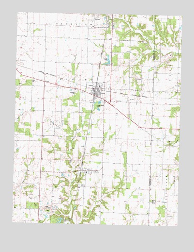
Ashley, IL USGS Topographic Map
Click on map above to begin viewing in our Map Viewer.

This topographic map contains these locations and features:
Feature Name Type Latitude Longitude GNIS ID View Map
AshleyPopulated PlaceN38.3295°W89.1909°403676View Map
Ashley Baptist ChurchChurchN38.3295°W89.1909°1985575View Map
Ashley Community Consolidated SchoolSchoolN38.3320°W89.1862°1823751View Map
Ashley DamDamN38.3450°W89.1801°1691442View Map
Ashley Fire Protection DistrictBuildingN38.3293°W89.1887°2640326View Map
Ashley LakeLakeN38.3474°W89.1805°403677View Map
Ashley Oil FieldOilfieldN38.3084°W89.2201°424581View Map
Ashley Police DepartmentBuildingN38.3273°W89.1942°2758914View Map
Ashley Post OfficePost OfficeN38.3279°W89.1889°2788675View Map
Ashley ReservoirReservoirN38.3450°W89.1801°1691443View Map
Brick CemeteryCemeteryN38.3373°W89.1590°404836View Map
Brick School (historical)SchoolN38.3370°W89.1584°1705831View Map
Casner School (historical)SchoolN38.3334°W89.1270°1705772View Map
City of AshleyCivilN38.3289°W89.1891°2394001View Map
Dry Arm School (historical)SchoolN38.2809°W89.2295°1705833View Map
Du Bois Oil FieldOilfieldN38.2653°W89.2351°424846View Map
DuBois CenterPopulated PlaceN38.2517°W89.2115°422638View Map
Fairview Church (historical)ChurchN38.3020°W89.2290°1705834View Map
Fairview School (historical)SchoolN38.3164°W89.2290°1705835View Map
Flannigan School (historical)SchoolN38.3523°W89.1776°1705836View Map
Howard School (historical)SchoolN38.2859°W89.1651°1705841View Map
I C R R ReservoirReservoirN38.2509°W89.2145°1691445View Map
I C R R Reservoir DamDamN38.2534°W89.2134°1691444View Map
Indepent Order of Odd fellows CemeteryCemeteryN38.3278°W89.2045°1823794View Map
Liberty CemeteryCemeteryN38.3342°W89.2379°411986View Map
Liberty School (historical)SchoolN38.3464°W89.2331°1705843View Map
Logan CemeteryCemeteryN38.3448°W89.1787°412510View Map
Minson CemeteryCemeteryN38.2648°W89.1451°413662View Map
Minson Church (historical)ChurchN38.2645°W89.1448°1705782View Map
Mount Zion CemeteryCemeteryN38.2978°W89.1315°1815703View Map
Mount Zion ChurchChurchN38.2978°W89.1320°414123View Map
Old Town School (historical)SchoolN38.3681°W89.1940°1705846View Map
PyramidPopulated PlaceN38.3342°W89.2279°423095View Map
Quinn CemeteryCemeteryN38.2559°W89.1328°416319View Map
RadomPopulated PlaceN38.2820°W89.1923°416347View Map
Radom Post OfficePost OfficeN38.2817°W89.1956°2788862View Map
Saint Michaels CemeteryCemeteryN38.2731°W89.1995°417638View Map
Topping CemeteryCemeteryN38.3109°W89.2142°419783View Map
Township of AshleyCivilN38.3309°W89.2016°428609View Map
Township of Du BoisCivilN38.2577°W89.2026°428915View Map
Township of RichviewCivilN38.3745°W89.2014°429635View Map
Union ChurchChurchN38.3412°W89.1451°420050View Map
Village of RadomCivilN38.2798°W89.1921°2399035View Map
White Swan School (historical)SchoolN38.3731°W89.1273°1705792View Map

Note: Coordinates in the location and feature list above are referenced to NAD83 datum.


Copyright (C) 2008-2024 Ryan Niemi / Sunset Dynamics ... All Rights Reserved