TopoQuest Logo
Do you find TopoQuest useful?
Help keep TopoQuest running and adding new maps/features by donating!
Bitcoin:  19c7KJd3qBynnjoSw5npx9KScwjBe4ifkT
Litecoin:  LXs6TkuXGGXo1vDsWCkWVdjQX94eUKd6ui
Home View Maps Find Maps Find Places Resources & Links


Hoyleton, Illinois Topographic Map

USGS Map Title: Hoyleton, IL
USGS Map MRC: 38089D3
DRG (GeoTIFF) Download: o38089d3.tif


Neighboring USGS Topographic Map Quads:


  Beckemeyer, IL  
38089E4
 

  Carlyle, IL  
38089E3
 

  Centralia West, IL  
38089E2
 

  Addieville, IL  
38089D4
 

  Hoyleton, IL  
38089D3
 

  Irvington, IL  
38089D2
 

  Nashville, IL  
38089C4
 

  Beaucoup, IL  
38089C3
 

  Ashley, IL  
38089C2


Map MRC Location:

N39°
W90°
N39°
W89°
H8 H7 H6 H5 H4 H3 H2 H1
G8 G7 G6 G5 G4 G3 G2 G1
F8 F7 F6 F5 F4 F3 F2 F1
E8 E7 E6 E5 E4 E3 E2 E1
D8 D7 D6 D5 D4 D3 D2 D1
C8 C7 C6 C5 C4 C3 C2 C1
B8 B7 B6 B5 B4 B3 B2 B1
A8 A7 A6 A5 A4 A3 A2 A1
N38°
W90°
N38°
W89°

Hoyleton, IL USGS 1:24K Topographic Map Preview:
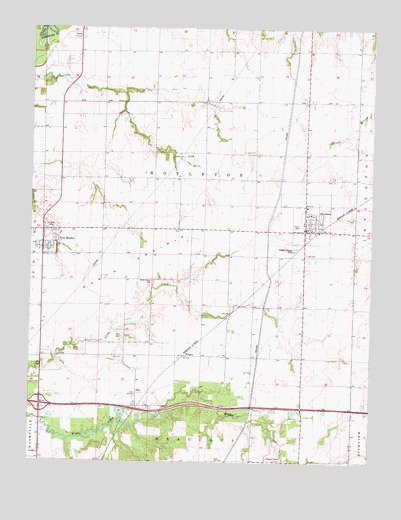
Hoyleton, IL USGS Topographic Map
Click on map above to begin viewing in our Map Viewer.

This topographic map contains these locations and features:
Feature Name Type Latitude Longitude GNIS ID View Map
Elm Point School (historical)SchoolN38.4206°W89.3306°1823762View Map
Haun School (historical)SchoolN38.4128°W89.2742°1823769View Map
HoyletonPopulated PlaceN38.4417°W89.2742°410632View Map
Hoyleton Community Fire Protection District New Minden StationBuildingN38.4357°W89.3699°2640407View Map
Hoyleton Consolidated Elementary SchoolSchoolN38.4489°W89.2737°1823773View Map
Hoyleton Fire Protection DistrictBuildingN38.4429°W89.2721°2640629View Map
Hoyleton Post OfficePost OfficeN38.4422°W89.2731°1985974View Map
HuegelyPopulated PlaceN38.4056°W89.3184°422827View Map
Interchange 50CrossingN38.3914°W89.3709°1823775View Map
New MindenPopulated PlaceN38.4414°W89.3704°414449View Map
North PrairieFlatN38.4264°W89.3545°414642View Map
North Prairie CemeteryCemeteryN38.4273°W89.3304°414643View Map
North Prairie Church (historical)ChurchN38.4273°W89.3301°1823790View Map
Pleasant Grove CemeteryCemeteryN38.3756°W89.2826°415779View Map
Pleasant Grove School (historical)SchoolN38.3762°W89.2817°1823797View Map
Saint Johns CemeteryCemeteryN38.4437°W89.3698°417369View Map
Saint Johns School (historical)SchoolN38.4828°W89.3295°1823803View Map
Sassafras School (historical)SchoolN38.4939°W89.2820°1823805View Map
Township of HoyletonCivilN38.4506°W89.3137°429152View Map
Trinity CemeteryCemeteryN38.4434°W89.2759°419852View Map
Trinity Lutheran ChurchChurchN38.4445°W89.2748°1985975View Map
Trinity Lutheran SchoolSchoolN38.4439°W89.2748°1985976View Map
Unverfehrt Stock FarmLocaleN38.4833°W89.2536°2680999View Map
Village of HoyletonCivilN38.4459°W89.2722°2398550View Map
Village of New MindenCivilN38.4385°W89.3705°2399478View Map
Walnut School (historical)SchoolN38.4570°W89.3392°1823809View Map
Zion CemeteryCemeteryN38.4112°W89.3415°421630View Map
Zion CemeteryCemeteryN38.4353°W89.2740°421631View Map
Zion Evangelical United ChurchChurchN38.4423°W89.2720°1985977View Map

Note: Coordinates in the location and feature list above are referenced to NAD83 datum.


Copyright (C) 2008-2025 Ryan Niemi / Sunset Dynamics ... All Rights Reserved