TopoQuest Logo
Do you find TopoQuest useful?
Help keep TopoQuest running and adding new maps/features by donating!
Bitcoin:  19c7KJd3qBynnjoSw5npx9KScwjBe4ifkT
Litecoin:  LXs6TkuXGGXo1vDsWCkWVdjQX94eUKd6ui
Home View Maps Find Maps Find Places Resources & Links


Garrison West, Texas Topographic Map

USGS Map Title: Garrison West, TX
USGS Map MRC: 31094G5
DRG (GeoTIFF) Download: o31094g5.tif


Neighboring USGS Topographic Map Quads:


  Mount Enterprise, TX  
31094H6
 

  Caledonia, TX  
31094H5
 

  Timpson, TX  
31094H4
 

  Trawick, TX  
31094G6
 

  Garrison West, TX  
31094G5
 

  Garrison East, TX  
31094G4
 

  Nacogdoches North, TX  
31094F6
 

  Appleby, TX  
31094F5
 

  Martinsville, TX  
31094F4


Map MRC Location:

N32°
W95°
N32°
W94°
H8 H7 H6 H5 H4 H3 H2 H1
G8 G7 G6 G5 G4 G3 G2 G1
F8 F7 F6 F5 F4 F3 F2 F1
E8 E7 E6 E5 E4 E3 E2 E1
D8 D7 D6 D5 D4 D3 D2 D1
C8 C7 C6 C5 C4 C3 C2 C1
B8 B7 B6 B5 B4 B3 B2 B1
A8 A7 A6 A5 A4 A3 A2 A1
N31°
W95°
N31°
W94°

Garrison West, TX USGS 1:24K Topographic Map Preview:
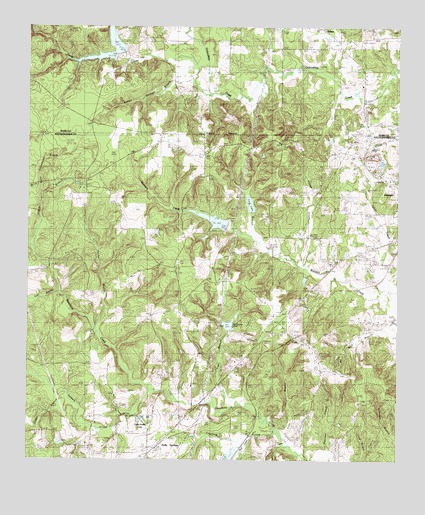
Garrison West, TX USGS Topographic Map
Click on map above to begin viewing in our Map Viewer.

This topographic map contains these locations and features:
Feature Name Type Latitude Longitude GNIS ID View Map
Bellevue SpringSpringN31.8063°W94.5824°1998415View Map
Burnt Schoolhouse BranchStreamN31.8268°W94.6205°1353371View Map
Camp TonkawaLocaleN31.8280°W94.6072°1353683View Map
Case BranchStreamN31.7982°W94.6152°1353919View Map
Cedar BranchStreamN31.7680°W94.6113°1354039View Map
Clear BranchStreamN31.8146°W94.5497°1354611View Map
Crawford CreekStreamN31.7588°W94.5410°1355327View Map
Curtis Smith LakeReservoirN31.7617°W94.5869°1355488View Map
Fenton Springs BranchStreamN31.8591°W94.5697°1357288View Map
FitzePopulated PlaceN31.7857°W94.5344°1379771View Map
Fitze BranchStreamN31.7563°W94.5388°1357369View Map
Ford LakeReservoirN31.8238°W94.5502°1357547View Map
Ford Lake DamDamN31.8235°W94.5502°1861876View Map
Galilee CemeteryCemeteryN31.7671°W94.5030°1357824View Map
Garrison DivisionCivilN31.7932°W94.5281°1938770View Map
Holly SpringsPopulated PlaceN31.7543°W94.5808°1379948View Map
Holly Springs CemeteryCemeteryN31.7582°W94.5847°1359449View Map
Indian CreekStreamN31.7907°W94.5008°1359924View Map
Lakeland FarmLocaleN31.7546°W94.5547°1360872View Map
McKinney LakeReservoirN31.7890°W94.5574°1362500View Map
McKinney Lake DamDamN31.7868°W94.5585°1861874View Map
Mill BranchStreamN31.8110°W94.6233°1362851View Map
Mount Union ChurchChurchN31.8388°W94.5655°1363326View Map
Mud CreekStreamN31.7571°W94.5491°1363400View Map
Nalls CemeteryCemeteryN31.8488°W94.5577°1363577View Map
Old Briley Town ChurchChurchN31.7943°W94.5372°1364401View Map
Sandy CreekStreamN31.8618°W94.5685°1367716View Map
Soil Conservation Service Site 20 DamDamN31.8185°W94.5585°1863050View Map
Soil Conservation Service Site 20 ReservoirReservoirN31.8183°W94.5603°1863051View Map
Soil Conservation Service Site 3 DamDamN31.8668°W94.5969°1861252View Map
Soil Conservation Service Site 3 ReservoirReservoirN31.8667°W94.5976°1861253View Map
Strickland CemeteryCemeteryN31.7985°W94.5485°1369276View Map
Telesco CreekStreamN31.7699°W94.5835°1369693View Map
Tiger BranchStreamN31.7657°W94.5552°1369930View Map
Tonkawa SpringSpringN31.8296°W94.6072°1998419View Map
Tucker BranchStreamN31.7866°W94.6022°1370180View Map
Village CreekStreamN31.8055°W94.5313°1370648View Map
Walnut Grove ChurchChurchN31.8313°W94.5663°1370816View Map
Whispering PinesPopulated PlaceN31.7768°W94.5199°1380768View Map
White and Red SpringsSpringN31.8252°W94.5085°1998420View Map
Wolf BranchStreamN31.7902°W94.5022°1371831View Map

Note: Coordinates in the location and feature list above are referenced to NAD83 datum.


Copyright (C) 2008-2025 Ryan Niemi / Sunset Dynamics ... All Rights Reserved