TopoQuest Logo
Do you find TopoQuest useful?
Help keep TopoQuest running and adding new maps/features by donating!
Bitcoin:  19c7KJd3qBynnjoSw5npx9KScwjBe4ifkT
Litecoin:  LXs6TkuXGGXo1vDsWCkWVdjQX94eUKd6ui
Home View Maps Find Maps Find Places Resources & Links


Nacogdoches North, Texas Topographic Map

USGS Map Title: Nacogdoches North, TX
USGS Map MRC: 31094F6
DRG (GeoTIFF) Download: o31094f6.tif


Neighboring USGS Topographic Map Quads:


  Cushing, TX  
31094G7
 

  Trawick, TX  
31094G6
 

  Garrison West, TX  
31094G5
 

  Lake Nacogdoches North, TX  
31094F7
 

  Nacogdoches North, TX  
31094F6
 

  Appleby, TX  
31094F5
 

  Lake Nacogdoches South, TX  
31094E7
 

  Nacogdoches South, TX  
31094E6
 

  Woden, TX  
31094E5


Map MRC Location:

N32°
W95°
N32°
W94°
H8 H7 H6 H5 H4 H3 H2 H1
G8 G7 G6 G5 G4 G3 G2 G1
F8 F7 F6 F5 F4 F3 F2 F1
E8 E7 E6 E5 E4 E3 E2 E1
D8 D7 D6 D5 D4 D3 D2 D1
C8 C7 C6 C5 C4 C3 C2 C1
B8 B7 B6 B5 B4 B3 B2 B1
A8 A7 A6 A5 A4 A3 A2 A1
N31°
W95°
N31°
W94°

Nacogdoches North, TX USGS 1:24K Topographic Map Preview:
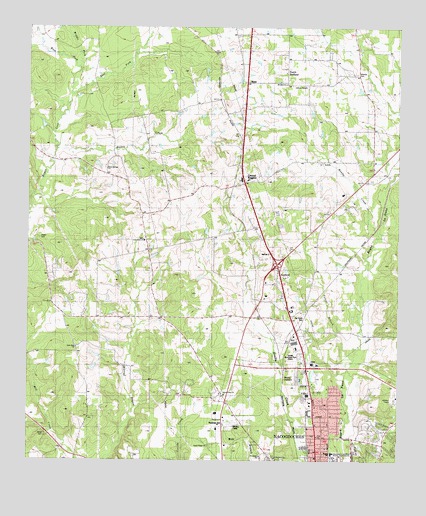
Nacogdoches North, TX USGS Topographic Map
Click on map above to begin viewing in our Map Viewer.

This topographic map contains these locations and features:
Feature Name Type Latitude Longitude GNIS ID View Map
Bailey CreekStreamN31.7149°W94.7397°1351412View Map
Banita CreekStreamN31.6896°W94.6308°1381012View Map
Bonita CreekStreamN31.6899°W94.6313°1352659View Map
Bonita JunctionPopulated PlaceN31.6496°W94.6635°1379442View Map
Central HeightsPopulated PlaceN31.7052°W94.6769°1354222View Map
Central Heights Elementary SchoolSchoolN31.7343°W94.6638°2007389View Map
Central Heights SchoolSchoolN31.7343°W94.6638°1354223View Map
Dragon StadiumParkN31.6449°W94.6255°2027888View Map
Earnest L Johnson DamDamN31.7252°W94.6535°1861862View Map
Earnest L Johnson LakeReservoirN31.7252°W94.6535°1861863View Map
East Fork Bayou LocoStreamN31.7277°W94.7372°1356611View Map
Hayter CemeteryCemeteryN31.6893°W94.7463°1890002View Map
Homer Bryce StadiumParkN31.6257°W94.6447°2027845View Map
Jerry W Allen DamDamN31.6835°W94.7185°1861866View Map
Jerry W Allen LakeReservoirN31.6835°W94.7185°1861867View Map
Johnson CemeteryCemeteryN31.7368°W94.6399°1889741View Map
Johnson ChapelChurchN31.7330°W94.6566°1360325View Map
KSAU-FM (Nacogdoches)TowerN31.6293°W94.6791°1385950View Map
KTBQ-FM (Nacogdoches)TowerN31.7085°W94.6885°1385949View Map
Lily Grove ChurchChurchN31.6888°W94.7102°1361195View Map
Lily Grove ChurchChurchN31.7171°W94.7491°1361196View Map
Lone Star ChurchChurchN31.6580°W94.7327°1361667View Map
MahlPopulated PlaceN31.7338°W94.6763°1380131View Map
Middle Fork Bayou LocoStreamN31.7274°W94.7372°1362720View Map
Millards CrossingBuildingN31.6535°W94.6563°2014501View Map
Mount Zion ChurchChurchN31.7338°W94.6635°1889739View Map
Nacogdoches County Constable's Office Precinct 1BuildingN31.6931°W94.6727°2751426View Map
Nacogdoches County Emergency Medical ServiceBuildingN31.6322°W94.6524°2720854View Map
Nacogdoches Fire Department Station 1BuildingN31.6322°W94.6524°2655374View Map
Nacogdoches Medical CenterHospitalN31.6531°W94.6540°2015728View Map
Nacogdoches Post OfficePost OfficeN31.6312°W94.6411°2731627View Map
Nacogdoches SpringsSpringN31.6252°W94.6585°1998416View Map
North RedlandPopulated PlaceN31.7371°W94.6630°1889738View Map
Old North CemeteryCemeteryN31.6677°W94.6569°1889740View Map
Old North ChurchChurchN31.6680°W94.6574°1364452View Map
Raguet Elementary SchoolSchoolN31.6277°W94.6483°2007351View Map
RedfieldPopulated PlaceN31.6796°W94.6649°1366273View Map
Redfield Census Designated PlaceCensusN31.6805°W94.6629°2586977View Map
Redfield StationLocaleN31.6780°W94.6533°1366274View Map
Robert W Murphey DamDamN31.7035°W94.6635°1861864View Map
Robert W Murphey LakeReservoirN31.7048°W94.6636°1861865View Map
Rock Springs ChurchChurchN31.7088°W94.7238°1366702View Map
Saint James ChurchChurchN31.6632°W94.6558°1367160View Map
Saint Matthew ChurchChurchN31.6260°W94.6663°1889967View Map
Sandy Ridge ChurchChurchN31.6299°W94.6888°1367727View Map
Stephen F Austin University Intramural FieldsParkN31.6257°W94.6447°2027668View Map
Stone CemeteryCemeteryN31.6324°W94.7438°1369233View Map
Sunset CemeteryCemeteryN31.6555°W94.6574°1369413View Map
Texas Forest Service Nacogdoches OfficeBuildingN31.6418°W94.6821°2655578View Map
Toliver BranchStreamN31.6549°W94.6399°1369990View Map
Union Cross ChurchChurchN31.6438°W94.6827°1370451View Map
William R Johnson ColiseumParkN31.6257°W94.6447°2027498View Map

Note: Coordinates in the location and feature list above are referenced to NAD83 datum.


Copyright (C) 2008-2025 Ryan Niemi / Sunset Dynamics ... All Rights Reserved