TopoQuest Logo
Do you find TopoQuest useful?
Help keep TopoQuest running and adding new maps/features by donating!
Bitcoin:  19c7KJd3qBynnjoSw5npx9KScwjBe4ifkT
Litecoin:  LXs6TkuXGGXo1vDsWCkWVdjQX94eUKd6ui
Home View Maps Find Maps Find Places Resources & Links


Gates Park, Montana Topographic Map

USGS Map Title: Gates Park, MT
USGS Map MRC: 47112G8
DRG (GeoTIFF) Download: o47112g8.tif


Neighboring USGS Topographic Map Quads:


  Pentagon Mountain, MT  
47113H1
 

  Porphyry Reef, MT  
47112H8
 

  Mount Wright, MT  
47112H7
 

  Three Sisters, MT  
47113G1
 

  Gates Park, MT  
47112G8
 

  Our Lake, MT  
47112G7
 

  Slategoat Mountain, MT  
47113F1
 

  Glenn Creek, MT  
47112F8
 

  Arsenic Mountain, MT  
47112F7


Map MRC Location:

N48°
W113°
N48°
W112°
H8 H7 H6 H5 H4 H3 H2 H1
G8 G7 G6 G5 G4 G3 G2 G1
F8 F7 F6 F5 F4 F3 F2 F1
E8 E7 E6 E5 E4 E3 E2 E1
D8 D7 D6 D5 D4 D3 D2 D1
C8 C7 C6 C5 C4 C3 C2 C1
B8 B7 B6 B5 B4 B3 B2 B1
A8 A7 A6 A5 A4 A3 A2 A1
N47°
W113°
N47°
W112°

Gates Park, MT USGS 1:24K Topographic Map Preview:
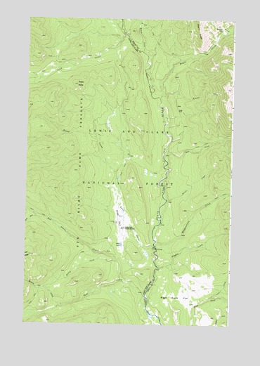
Gates Park, MT USGS Topographic Map
Click on map above to begin viewing in our Map Viewer.

This topographic map contains these locations and features:
Feature Name Type Latitude Longitude GNIS ID View Map
Biggs Creek FlatFlatN47.7627°W112.9098°779897View Map
Dryden CreekStreamN47.7730°W112.9187°800720View Map
Frazier CreekStreamN47.8436°W112.9189°783697View Map
Gates CreekStreamN47.7824°W112.9220°800833View Map
Gates LakeLakeN47.7826°W112.9416°800834View Map
Gates ParkFlatN47.7944°W112.9434°800835View Map
Gates Park Guard StationLocaleN47.7897°W112.9403°800836View Map
Headquarters CreekStreamN47.7819°W112.9209°784686View Map
Hoxsey CreekStreamN47.7761°W112.9439°800964View Map
Lick CreekStreamN47.8691°W112.9417°801058View Map
Lone ParkFlatN47.8377°W112.9092°786483View Map
Lynx CreekStreamN47.7611°W112.8864°786736View Map
Miners CreekStreamN47.7580°W112.9759°801172View Map
Ninemile ParkFlatN47.8713°W112.8820°788014View Map
Rabbit ButteSummitN47.8480°W112.9698°801329View Map
Ray CreekStreamN47.8202°W112.9162°801339View Map
Red Shale CreekStreamN47.7677°W112.9414°801351View Map
Rock CreekStreamN47.7574°W112.9262°801374View Map
Route CreekStreamN47.8427°W112.9198°801395View Map
South Fork Red Shale CreekStreamN47.7938°W112.9931°801494View Map
Spruce CreekStreamN47.8008°W112.9148°801526View Map
Sun River Game PreserveParkN47.8127°W112.9892°801566View Map
Tenmile ParkFlatN47.8636°W112.8939°798894View Map
Wrong CreekStreamN47.8616°W112.9306°801722View Map

Note: Coordinates in the location and feature list above are referenced to NAD83 datum.


Copyright (C) 2008-2024 Ryan Niemi / Sunset Dynamics ... All Rights Reserved