TopoQuest Logo
Do you find TopoQuest useful?
Help keep TopoQuest running and adding new maps/features by donating!
Bitcoin:  19c7KJd3qBynnjoSw5npx9KScwjBe4ifkT
Litecoin:  LXs6TkuXGGXo1vDsWCkWVdjQX94eUKd6ui
Home View Maps Find Maps Find Places Resources & Links


Gay Hill, Texas Topographic Map

USGS Map Title: Gay Hill, TX
USGS Map MRC: 30096C4
DRG (GeoTIFF) Download: o30096c4.tif


Neighboring USGS Topographic Map Quads:


  Lyons, TX  
30096D5
 

  Snook, TX  
30096D4
 

  Clay, TX  
30096D3
 

  Somerville, TX  
30096C5
 

  Gay Hill, TX  
30096C4
 

  Independence, TX  
30096C3
 

  Burton, TX  
30096B5
 

  Brenham, TX  
30096B4
 

  Chappell Hill, TX  
30096B3


Map MRC Location:

N31°
W97°
N31°
W96°
H8 H7 H6 H5 H4 H3 H2 H1
G8 G7 G6 G5 G4 G3 G2 G1
F8 F7 F6 F5 F4 F3 F2 F1
E8 E7 E6 E5 E4 E3 E2 E1
D8 D7 D6 D5 D4 D3 D2 D1
C8 C7 C6 C5 C4 C3 C2 C1
B8 B7 B6 B5 B4 B3 B2 B1
A8 A7 A6 A5 A4 A3 A2 A1
N30°
W97°
N30°
W96°

Gay Hill, TX USGS 1:24K Topographic Map Preview:
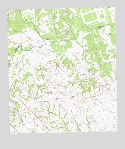
Gay Hill, TX USGS Topographic Map
Click on map above to begin viewing in our Map Viewer.

This topographic map contains these locations and features:
Feature Name Type Latitude Longitude GNIS ID View Map
Baker LakeReservoirN30.3495°W96.4335°1854370View Map
Baker Lake DamDamN30.3519°W96.4286°1854369View Map
Bridge CreekStreamN30.3480°W96.4186°1372716View Map
Butler LakeReservoirN30.3179°W96.4433°1854342View Map
Butler Lake DamDamN30.3202°W96.4419°1854341View Map
Cataract CreekStreamN30.3563°W96.3877°1332325View Map
Chriesman BranchStreamN30.3305°W96.4630°1332799View Map
Clay CreekStreamN30.3433°W96.4211°1332908View Map
Clay Creek Oil FieldOilfieldN30.3141°W96.4077°1332909View Map
Dallas Oil FieldOilfieldN30.2610°W96.4022°1333888View Map
Davidson CreekStreamN30.3433°W96.4575°1373348View Map
Frieden CemeteryCemeteryN30.2699°W96.4716°1336215View Map
Frieden ChurchChurchN30.2758°W96.4775°1336216View Map
Gay HillPopulated PlaceN30.2719°W96.4941°1336452View Map
Gay Hill-Independence DivisionCivilN30.2867°W96.4108°1938775View Map
Johnson LakeReservoirN30.2962°W96.4360°1854344View Map
Johnson Lake DamDamN30.2952°W96.4352°1854343View Map
McCormick LakeReservoirN30.2968°W96.3919°1854340View Map
McCormick Lake DamDamN30.2952°W96.3886°1854339View Map
Oak Rest CemeteryCemeteryN30.2955°W96.4455°1343000View Map
Old Gay Hill ChurchChurchN30.2899°W96.4541°1343153View Map
Old Yegua CreekStreamN30.3435°W96.4277°1343246View Map
Prairie Hill SchoolSchoolN30.2847°W96.4280°1344510View Map
Rancho Verde AirportAirportN30.2769°W96.4414°2675914View Map
Red HouseBuildingN30.2824°W96.4577°2031698View Map
Saint Peter ChurchChurchN30.2572°W96.4672°1346095View Map
ScofieldPopulated PlaceN30.3538°W96.4400°1379039View Map
Thompson CreekStreamN30.3424°W96.4577°1348502View Map
Wallace CemeteryCemeteryN30.2797°W96.4939°1349391View Map
Wolf CreekStreamN30.3335°W96.4780°1350463View Map

Note: Coordinates in the location and feature list above are referenced to NAD83 datum.


Copyright (C) 2008-2025 Ryan Niemi / Sunset Dynamics ... All Rights Reserved