TopoQuest Logo
Do you find TopoQuest useful?
Help keep TopoQuest running and adding new maps/features by donating!
Bitcoin:  19c7KJd3qBynnjoSw5npx9KScwjBe4ifkT
Litecoin:  LXs6TkuXGGXo1vDsWCkWVdjQX94eUKd6ui
Home View Maps Find Maps Find Places Resources & Links


Genesee, Wisconsin Topographic Map

USGS Map Title: Genesee, WI
USGS Map MRC: 42088H3
DRG (GeoTIFF) Download: o42088h3.tif


Neighboring USGS Topographic Map Quads:


  Oconomowoc East, WI  
43088A4
 

  Hartland, WI  
43088A3
 

  Waukesha, WI  
43088A2
 

  Eagle, WI  
42088H4
 

  Genesee, WI  
42088H3
 

  Muskego, WI  
42088H2
 

  East Troy, WI  
42088G4
 

  Mukwonago, WI  
42088G3
 

  Waterford, WI  
42088G2


Map MRC Location:

N43°
W89°
N43°
W88°
H8 H7 H6 H5 H4 H3 H2 H1
G8 G7 G6 G5 G4 G3 G2 G1
F8 F7 F6 F5 F4 F3 F2 F1
E8 E7 E6 E5 E4 E3 E2 E1
D8 D7 D6 D5 D4 D3 D2 D1
C8 C7 C6 C5 C4 C3 C2 C1
B8 B7 B6 B5 B4 B3 B2 B1
A8 A7 A6 A5 A4 A3 A2 A1
N42°
W89°
N42°
W88°

Genesee, WI USGS 1:24K Topographic Map Preview:
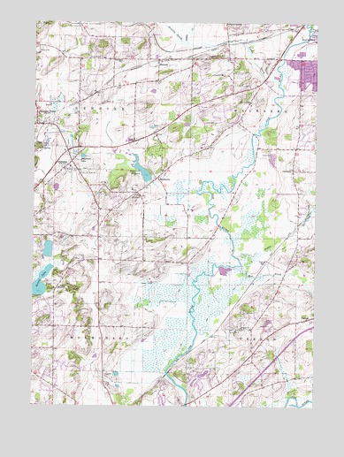
Genesee, WI USGS Topographic Map
Click on map above to begin viewing in our Map Viewer.

This topographic map contains these locations and features:
Feature Name Type Latitude Longitude GNIS ID View Map
BethesdaPopulated PlaceN42.9878°W88.3184°1577515View Map
Bethesda SchoolSchoolN42.9878°W88.3370°1561648View Map
Big Bend - Vernon Fire Department Station 2BuildingN42.8972°W88.2732°2697720View Map
Brandy BrookStreamN42.9931°W88.3079°1562148View Map
Fox Run Shopping CenterLocaleN42.9889°W88.2675°2113336View Map
GeneseePopulated PlaceN42.9528°W88.3590°1565456View Map
Genesee CreekStreamN42.9456°W88.3020°1577221View Map
Genesee DepotPopulated PlaceN42.9667°W88.3712°1565457View Map
Genesee Oak Opening And Fen State Natural AreaParkN42.9536°W88.3731°2093529View Map
Genesee Village CemeteryCemeteryN42.9522°W88.3525°2096442View Map
Hayslope LakeLakeN42.9561°W88.3535°1566219View Map
Hidden Lakes Dam G 1167DamN42.8817°W88.3001°1793330View Map
Laitsch D2938 DamDamN42.9267°W88.3668°1792495View Map
Lawrence SchoolSchoolN42.9745°W88.2793°1567894View Map
Magee Elementary SchoolSchoolN42.9697°W88.3728°1850388View Map
Merrill Hills Country ClubLocaleN42.9831°W88.2922°2113340View Map
Mill BrookStreamN42.9197°W88.2873°1569465View Map
North Branch Genesee CreekStreamN42.9647°W88.3643°1577220View Map
Oak Knoll CemeteryCemeteryN42.9505°W88.3392°2096602View Map
Oakdale SchoolSchoolN42.9522°W88.2606°1570695View Map
Pebble BrookStreamN42.9233°W88.2843°1571138View Map
Pebble CreekStreamN42.9800°W88.2670°1571139View Map
Rose Glen Elementary SchoolSchoolN42.9747°W88.2942°2716400View Map
Saint Johns Evangelical Lutheran SchoolSchoolN42.8752°W88.3431°2716755View Map
Saint Pauls CemeteryCemeteryN42.9886°W88.3456°1573462View Map
SaylesvillePopulated PlaceN42.9495°W88.3204°1573762View Map
Saylesville MillpondReservoirN42.9516°W88.3269°1573763View Map
Saylesville Roller Mill DamDamN42.9486°W88.3240°1792288View Map
South Branch Genesee CreekStreamN42.9647°W88.3643°1577219View Map
Spring BrookStreamN42.9542°W88.3329°1577230View Map
Spring LakeLakeN42.9146°W88.3722°1574685View Map
Town of GeneseeCivilN42.9734°W88.3614°1583260View Map
Town of MukwonagoCivilN42.8911°W88.3697°1583771View Map
VernonPopulated PlaceN42.9036°W88.2523°1576063View Map
Vernon Center CemeteryCemeteryN42.9025°W88.2614°2096624View Map
Vernon ChurchChurchN42.9006°W88.2823°1576065View Map
Vernon Evangelical Lutheran CemeteryCemeteryN42.9005°W88.2828°2096625View Map
Vernon Marsh Refuge Flowage H2.117 DamDamN42.8867°W88.3168°1793537View Map
Vernon Marsh Refuge Middle Flowage H2.117 DamDamN42.9217°W88.2868°1793538View Map
Vernon StationLocaleN42.9225°W88.2709°1576067View Map
Waukesha Christian AcademySchoolN43.0000°W88.2901°1576582View Map
Waukesha Fire Department Station 3BuildingN42.9906°W88.2502°2113167View Map
West High SchoolSchoolN42.9686°W88.2784°2716353View Map
Willow Springs Lake 3.10ReservoirN42.9257°W88.3683°1792496View Map

Note: Coordinates in the location and feature list above are referenced to NAD83 datum.


Copyright (C) 2008-2024 Ryan Niemi / Sunset Dynamics ... All Rights Reserved