TopoQuest Logo
Do you find TopoQuest useful?
Help keep TopoQuest running and adding new maps/features by donating!
Bitcoin:  19c7KJd3qBynnjoSw5npx9KScwjBe4ifkT
Litecoin:  LXs6TkuXGGXo1vDsWCkWVdjQX94eUKd6ui
Home View Maps Find Maps Find Places Resources & Links


Geraldine, Montana Topographic Map

USGS Map Title: Geraldine, MT
USGS Map MRC: 47110E3
DRG (GeoTIFF) Download: o47110e3.tif


Neighboring USGS Topographic Map Quads:


  Montague, MT  
47110F4
 

  Geraldine NE, MT  
47110F3
 

  Dammel Reservoir, MT  
47110F2
 

  Lepleys Creek, MT  
47110E4
 

  Geraldine, MT  
47110E3
 

  Square Butte, MT  
47110E2
 

  Palisade Butte, MT  
47110D4
 

  Jiggs Flat, MT  
47110D3
 

  Pownal, MT  
47110D2


Map MRC Location:

N48°
W111°
N48°
W110°
H8 H7 H6 H5 H4 H3 H2 H1
G8 G7 G6 G5 G4 G3 G2 G1
F8 F7 F6 F5 F4 F3 F2 F1
E8 E7 E6 E5 E4 E3 E2 E1
D8 D7 D6 D5 D4 D3 D2 D1
C8 C7 C6 C5 C4 C3 C2 C1
B8 B7 B6 B5 B4 B3 B2 B1
A8 A7 A6 A5 A4 A3 A2 A1
N47°
W111°
N47°
W110°

Geraldine, MT USGS 1:24K Topographic Map Preview:
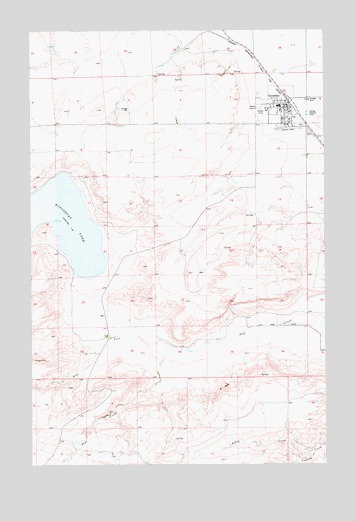
Geraldine, MT USGS Topographic Map
Click on map above to begin viewing in our Map Viewer.

This topographic map contains these locations and features:
Feature Name Type Latitude Longitude GNIS ID View Map
21N11E01ACCA01 WellWellN47.6066°W110.2666°824024View Map
21N11E01CBDC01 WellWellN47.6019°W110.2760°823998View Map
21N11E01DBDB01 WellWellN47.6030°W110.2652°824007View Map
21N11E01DBDD01 WellWellN47.6019°W110.2641°823997View Map
21N11E01DCCC01 WellWellN47.5969°W110.2677°823966View Map
Central Montana Cooperative ElevatorLocaleN47.6036°W110.2658°1750330View Map
Chouteau County Waterfowl Production AreaParkN47.5598°W110.3386°2765240View Map
Community United Methodist ChurchChurchN47.6019°W110.2691°1750320View Map
General Mills Incorporated ElevatorLocaleN47.6036°W110.2658°1750331View Map
GeraldinePopulated PlaceN47.6036°W110.2658°771740View Map
GeraldineLocaleN47.6039°W110.2655°1750262View Map
Geraldine AirportAirportN47.5973°W110.2713°806420View Map
Geraldine Branch LibraryBuildingN47.6036°W110.2658°1750358View Map
Geraldine CemeteryCemeteryN47.5950°W110.2563°1750368View Map
Geraldine ClinicHospitalN47.6036°W110.2658°1750321View Map
Geraldine Post OfficePost OfficeN47.6033°W110.2668°1750263View Map
Geraldine Public SchoolsSchoolN47.6033°W110.2696°1750194View Map
Geraldine Volunteer Fire Department and AmbulanceBuildingN47.6027°W110.2649°2546528View Map
Kelley CreekStreamN47.5036°W110.2569°772961View Map
Kingsbury LakeLakeN47.5691°W110.3653°785757View Map
Lonetree (historical)Populated PlaceN47.5416°W110.2841°1750142View Map
Lonetree Post Office (historical)Post OfficeN47.5416°W110.2841°1750143View Map
Town of GeraldineCivilN47.6022°W110.2662°2412678View Map
West Fork Flat CreekStreamN47.5347°W110.3185°793026View Map

Note: Coordinates in the location and feature list above are referenced to NAD83 datum.


Copyright (C) 2008-2025 Ryan Niemi / Sunset Dynamics ... All Rights Reserved