TopoQuest Logo
Do you find TopoQuest useful?
Help keep TopoQuest running and adding new maps/features by donating!
Bitcoin:  19c7KJd3qBynnjoSw5npx9KScwjBe4ifkT
Litecoin:  LXs6TkuXGGXo1vDsWCkWVdjQX94eUKd6ui
Home View Maps Find Maps Find Places Resources & Links


Palisade Butte, Montana Topographic Map

USGS Map Title: Palisade Butte, MT
USGS Map MRC: 47110D4
DRG (GeoTIFF) Download: o47110d4.tif


Neighboring USGS Topographic Map Quads:


  Carter Mountain, MT  
47110E5
 

  Lepleys Creek, MT  
47110E4
 

  Geraldine, MT  
47110E3
 

  Arrow Peak, MT  
47110D5
 

  Palisade Butte, MT  
47110D4
 

  Jiggs Flat, MT  
47110D3
 

  Byrne Creek, MT  
47110C5
 

  Geyser, MT  
47110C4
 

  Leiberg Coulee, MT  
47110C3


Map MRC Location:

N48°
W111°
N48°
W110°
H8 H7 H6 H5 H4 H3 H2 H1
G8 G7 G6 G5 G4 G3 G2 G1
F8 F7 F6 F5 F4 F3 F2 F1
E8 E7 E6 E5 E4 E3 E2 E1
D8 D7 D6 D5 D4 D3 D2 D1
C8 C7 C6 C5 C4 C3 C2 C1
B8 B7 B6 B5 B4 B3 B2 B1
A8 A7 A6 A5 A4 A3 A2 A1
N47°
W111°
N47°
W110°

Palisade Butte, MT USGS 1:24K Topographic Map Preview:
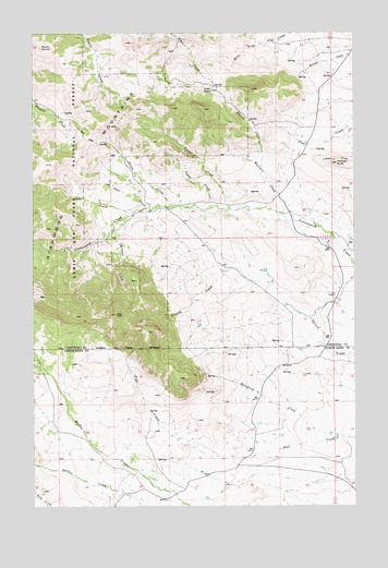
Palisade Butte, MT USGS Topographic Map
Click on map above to begin viewing in our Map Viewer.

This topographic map contains these locations and features:
Feature Name Type Latitude Longitude GNIS ID View Map
19N10E13BC__01 SpringSpringN47.4116°W110.4027°822739View Map
19N10E14DA__01 SpringSpringN47.4080°W110.4083°822725View Map
19N10E15DA__01 SpringSpringN47.4094°W110.4300°822726View Map
19N10E15DC__01 SpringSpringN47.4053°W110.4337°822694View Map
19N10E17AC__01 SpringSpringN47.4116°W110.4772°822740View Map
19N10E17BB__01 SpringSpringN47.4152°W110.4877°822772View Map
19N10E17BD__01 SpringSpringN47.4116°W110.4824°822741View Map
19N10E17DA__01 SpringSpringN47.4080°W110.4719°822727View Map
19N10E19AA__01 SpringSpringN47.4005°W110.4933°822674View Map
19N10E19AD__01 SpringSpringN47.3969°W110.4933°822648View Map
19N10E20AB__01 SpringSpringN47.4005°W110.4772°822673View Map
19N10E20DA__01 SpringSpringN47.3933°W110.4719°822629View Map
19N10E21AB__01 SpringSpringN47.4003°W110.4558°822672View Map
19N10E22DB__01 SpringSpringN47.3933°W110.4347°822628View Map
19N10E22DC__01 SpringSpringN47.3897°W110.4347°822612View Map
19N10E24BB__01 SpringSpringN47.4005°W110.4027°822671View Map
19N10E24BC__01 SpringSpringN47.3969°W110.4027°822647View Map
19N10E24BD__01 SpringSpringN47.3969°W110.3974°822646View Map
19N10E27CB__01 SpringSpringN47.3789°W110.4452°822546View Map
19N10E28AC__01 SpringSpringN47.3825°W110.4560°822568View Map
19N10E28CA__01 WellWellN47.3789°W110.4613°822547View Map
19N10E28CA__02 WellWellN47.3789°W110.4613°822548View Map
19N10E28CA__03 SpringSpringN47.3789°W110.4613°822549View Map
19N10E28CB__01 SpringSpringN47.3789°W110.4666°822550View Map
19N10E29BD__01 SpringSpringN47.3825°W110.4824°822569View Map
Boyd CreekStreamN47.4527°W110.4613°780333View Map
Chimney CreekStreamN47.4458°W110.4716°781225View Map
Corral CreekStreamN47.4575°W110.4605°1750408View Map
East PeakSummitN47.4258°W110.4680°782941View Map
In-moolsh CreekStreamN47.4542°W110.4450°791373View Map
Jensen SpringSpringN47.4849°W110.4309°772814View Map
Knerville Post Office (historical)Post OfficeN47.3944°W110.3799°1750610View Map
Mansfield CreekStreamN47.3936°W110.3835°786821View Map
Merrill CreekStreamN47.4650°W110.4110°787188View Map
Mount KennonSummitN47.4961°W110.4972°785680View Map
Palisade ButteSummitN47.4658°W110.3819°788596View Map
Shed CreekStreamN47.4539°W110.4524°790309View Map
Timber CreekStreamN47.4533°W110.4235°792186View Map
Tolan CreekStreamN47.4547°W110.4297°792233View Map
Warren CreekStreamN47.4508°W110.3991°792841View Map

Note: Coordinates in the location and feature list above are referenced to NAD83 datum.


Copyright (C) 2008-2025 Ryan Niemi / Sunset Dynamics ... All Rights Reserved