TopoQuest Logo
Do you find TopoQuest useful?
Help keep TopoQuest running and adding new maps/features by donating!
Bitcoin:  19c7KJd3qBynnjoSw5npx9KScwjBe4ifkT
Litecoin:  LXs6TkuXGGXo1vDsWCkWVdjQX94eUKd6ui
Home View Maps Find Maps Find Places Resources & Links


Aspen Lake, Oregon Topographic Map

USGS Map Title: Aspen Lake, OR
USGS Map MRC: 42122C1
DRG (GeoTIFF) Download: o42122c1.tif


Neighboring USGS Topographic Map Quads:


  Lake of the Woods North, OR  
42122D2
 

  Pelican Bay, OR  
42122D1
 

  Shoalwater Bay, OR  
42121D8
 

  Lake of the Woods South, OR  
42122C2
 

  Aspen Lake, OR  
42122C1
 

  Howard Bay, OR  
42121C8
 

  Surveyor Mountain, OR  
42122B2
 

  Spencer Creek, OR  
42122B1
 

  Keno, OR  
42121B8


Map MRC Location:

N43°
W123°
N43°
W122°
H8 H7 H6 H5 H4 H3 H2 H1
G8 G7 G6 G5 G4 G3 G2 G1
F8 F7 F6 F5 F4 F3 F2 F1
E8 E7 E6 E5 E4 E3 E2 E1
D8 D7 D6 D5 D4 D3 D2 D1
C8 C7 C6 C5 C4 C3 C2 C1
B8 B7 B6 B5 B4 B3 B2 B1
A8 A7 A6 A5 A4 A3 A2 A1
N42°
W123°
N42°
W122°

Aspen Lake, OR USGS 1:24K Topographic Map Preview:
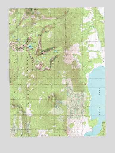
Aspen Lake, OR USGS Topographic Map
Click on map above to begin viewing in our Map Viewer.

This topographic map contains these locations and features:
Feature Name Type Latitude Longitude GNIS ID View Map
Aspen ButteSummitN42.3154°W122.0875°1137324View Map
Aspen Butte Cinder PitMineN42.2560°W122.0550°1167666View Map
Aspen LakeLakeN42.2830°W122.0107°1161255View Map
Aspen Lake Cinder PitMineN42.2554°W122.0547°1156254View Map
Bridge CreekStreamN42.3068°W122.0247°1154960View Map
Buck PeakSummitN42.2790°W122.1217°1138807View Map
Camp CreekStreamN42.3318°W122.0053°1154962View Map
Clover LakeLakeN42.3250°W122.1156°1139851View Map
Coyote LakeLakeN42.3591°W122.0914°1140330View Map
Denny CreekStreamN42.3651°W122.0022°1140897View Map
Eb LakeLakeN42.3482°W122.1208°1141657View Map
Echo LakeLakeN42.3408°W122.0957°1141664View Map
Grampian HillsRangeN42.2790°W122.0845°1154957View Map
Hemlock LakeLakeN42.3485°W122.0890°1143479View Map
Lake ComoLakeN42.3445°W122.1135°1140020View Map
Lake HarrietteLakeN42.3375°W122.0984°1143323View Map
Little Aspen ButteSummitN42.2860°W122.0681°1145071View Map
Moss Creek TrailTrailN42.3560°W122.0839°1146505View Map
Mount CarmineSummitN42.3332°W122.0828°1139381View Map
Mount HarrimanSummitN42.3732°W122.0920°1143325View Map
Mountain Lakes WildernessReserveN42.3441°W122.1102°1637884View Map
Mystic LakeLakeN42.3241°W122.0897°1146719View Map
Paragon LakeLakeN42.3291°W122.0814°1147424View Map
South CreekStreamN42.3004°W122.0239°1154959View Map
South PassGapN42.3304°W122.0678°1154958View Map
South Pass LakeLakeN42.3328°W122.0649°1150060View Map
South Pass Lake TrailTrailN42.3357°W122.0564°1150061View Map
Storm LakeLakeN42.3591°W122.1233°1150459View Map
Swan CreekStreamN42.3124°W122.0192°1154961View Map
Zeb LakeLakeN42.3472°W122.1198°1152769View Map

Note: Coordinates in the location and feature list above are referenced to NAD83 datum.


Copyright (C) 2008-2024 Ryan Niemi / Sunset Dynamics ... All Rights Reserved