TopoQuest Logo
Do you find TopoQuest useful?
Help keep TopoQuest running and adding new maps/features by donating!
Bitcoin:  19c7KJd3qBynnjoSw5npx9KScwjBe4ifkT
Litecoin:  LXs6TkuXGGXo1vDsWCkWVdjQX94eUKd6ui
Home View Maps Find Maps Find Places Resources & Links


Spencer Creek, Oregon Topographic Map

USGS Map Title: Spencer Creek, OR
USGS Map MRC: 42122B1
DRG (GeoTIFF) Download: o42122b1.tif


Neighboring USGS Topographic Map Quads:


  Lake of the Woods South, OR  
42122C2
 

  Aspen Lake, OR  
42122C1
 

  Howard Bay, OR  
42121C8
 

  Surveyor Mountain, OR  
42122B2
 

  Spencer Creek, OR  
42122B1
 

  Keno, OR  
42121B8
 

  Mule Hill, OR  
42122A2
 

  Chicken Hills, OR  
42122A1
 

  Hamaker Mountain, OR  
42121A8


Map MRC Location:

N43°
W123°
N43°
W122°
H8 H7 H6 H5 H4 H3 H2 H1
G8 G7 G6 G5 G4 G3 G2 G1
F8 F7 F6 F5 F4 F3 F2 F1
E8 E7 E6 E5 E4 E3 E2 E1
D8 D7 D6 D5 D4 D3 D2 D1
C8 C7 C6 C5 C4 C3 C2 C1
B8 B7 B6 B5 B4 B3 B2 B1
A8 A7 A6 A5 A4 A3 A2 A1
N42°
W123°
N42°
W122°

Spencer Creek, OR USGS 1:24K Topographic Map Preview:
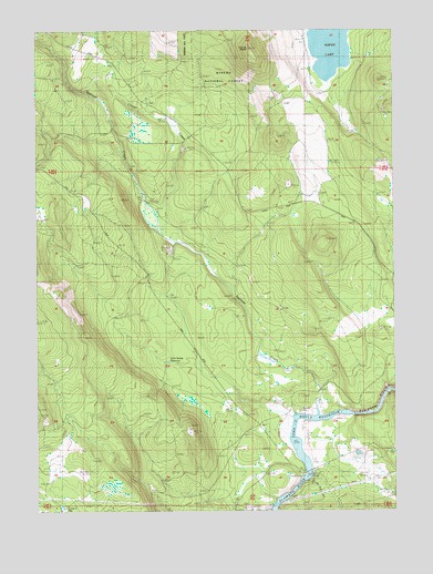
Spencer Creek, OR USGS Topographic Map
Click on map above to begin viewing in our Map Viewer.

This topographic map contains these locations and features:
Feature Name Type Latitude Longitude GNIS ID View Map
Camp Day (historical)MilitaryN42.1542°W122.0264°1154967View Map
Camp Sa-wa-li-na-isLocaleN42.1554°W122.0283°1139265View Map
Camp Three ReservoirReservoirN42.1260°W122.1173°1139192View Map
Chase (historical)Populated PlaceN42.1404°W122.0053°1162791View Map
Clover ButteSummitN42.2449°W122.0503°1139844View Map
Clover CreekStreamN42.1971°W122.0811°1139849View Map
Clover Station (historical)Populated PlaceN42.2221°W122.0720°1154968View Map
Forest (historical)LocaleN42.1513°W122.0275°1154966View Map
Forest Post Office (historical)Post OfficeN42.1513°W122.0275°1165265View Map
Grub Spring ReservoirReservoirN42.1636°W122.0801°1143144View Map
John C Boyle ReservoirReservoirN42.1399°W122.0335°1162467View Map
Klamath River Recreation SiteParkN42.1360°W122.0289°1154965View Map
McCollum (historical)LocaleN42.1360°W122.0275°1154964View Map
Pioneer Park Boat RampLocaleN42.1341°W122.0329°2700271View Map
Spencer BridgeBridgeN42.1346°W122.0317°1162468View Map
Spencer CemeteryCemeteryN42.1510°W122.0343°1150109View Map
Spencer CreekStreamN42.1493°W122.0278°1150111View Map

Note: Coordinates in the location and feature list above are referenced to NAD83 datum.


Copyright (C) 2008-2025 Ryan Niemi / Sunset Dynamics ... All Rights Reserved