TopoQuest Logo
Do you find TopoQuest useful?
Help keep TopoQuest running and adding new maps/features by donating!
Bitcoin:  19c7KJd3qBynnjoSw5npx9KScwjBe4ifkT
Litecoin:  LXs6TkuXGGXo1vDsWCkWVdjQX94eUKd6ui
Home View Maps Find Maps Find Places Resources & Links


Gibbon, Oregon Topographic Map

USGS Map Title: Gibbon, OR
USGS Map MRC: 45118F3
DRG (GeoTIFF) Download: o45118f3.tif


Neighboring USGS Topographic Map Quads:


  Athena, OR  
45118G4
 

  Weston Mountain, OR  
45118G3
 

  Blalock Mountain, OR  
45118G2
 

  Thorn Hollow, OR  
45118F4
 

  Gibbon, OR  
45118F3
 

  Bingham Springs, OR  
45118F2
 

  Meacham, OR  
45118E4
 

  Duncan, OR  
45118E3
 

  Thimbleberry Mountain, OR  
45118E2


Map MRC Location:

N46°
W119°
N46°
W118°
H8 H7 H6 H5 H4 H3 H2 H1
G8 G7 G6 G5 G4 G3 G2 G1
F8 F7 F6 F5 F4 F3 F2 F1
E8 E7 E6 E5 E4 E3 E2 E1
D8 D7 D6 D5 D4 D3 D2 D1
C8 C7 C6 C5 C4 C3 C2 C1
B8 B7 B6 B5 B4 B3 B2 B1
A8 A7 A6 A5 A4 A3 A2 A1
N45°
W119°
N45°
W118°

Gibbon, OR USGS 1:24K Topographic Map Preview:
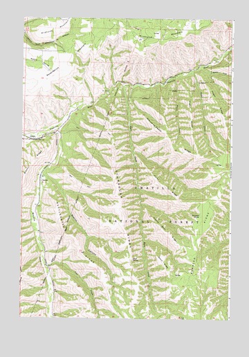
Gibbon, OR USGS Topographic Map
Click on map above to begin viewing in our Map Viewer.

This topographic map contains these locations and features:
Feature Name Type Latitude Longitude GNIS ID View Map
Bobsled CreekStreamN45.7310°W118.2680°1138375View Map
BoniferLocaleN45.6821°W118.3630°1138418View Map
Boston CanyonValleyN45.6843°W118.3630°1138451View Map
Conway (historical)LocaleN45.6443°W118.3580°1153252View Map
Forks RidgeRidgeN45.6810°W118.2913°1142309View Map
GibbonPopulated PlaceN45.6996°W118.3650°1142712View Map
Gibbon Post Office (historical)Post OfficeN45.6996°W118.3650°1165306View Map
Gibbon RidgeRidgeN45.6910°W118.3669°1142713View Map
Hagar CreekStreamN45.7274°W118.2769°1143192View Map
Hagar RidgeRidgeN45.7157°W118.2588°1143193View Map
Hagen CreekStreamN45.7251°W118.2850°1143194View Map
Hagen RidgeRidgeN45.7093°W118.2744°1143195View Map
Line CreekStreamN45.6515°W118.3605°1145046View Map
Meacham CreekStreamN45.7024°W118.3583°1146039View Map
Mikecha (historical)LocaleN45.7004°W118.3622°1167738View Map
Plenty Bear RidgeRidgeN45.6607°W118.2866°1147804View Map
Rattlesnake RidgeRidgeN45.6565°W118.3413°1148241View Map
Reservation MountainSummitN45.7310°W118.3472°1148381View Map
Rock SpringSpringN45.6497°W118.3084°1148636View Map
Ryan CreekStreamN45.7224°W118.3152°1148873View Map
Short RidgeRidgeN45.6487°W118.2897°1149440View Map
Starve-to-Death RidgeRidgeN45.7007°W118.2880°1150358View Map
Stumbough RidgeRidgeN45.6701°W118.3144°1150502View Map
Thompson SpringSpringN45.6684°W118.2688°1151118View Map

Note: Coordinates in the location and feature list above are referenced to NAD83 datum.


Copyright (C) 2008-2024 Ryan Niemi / Sunset Dynamics ... All Rights Reserved