TopoQuest Logo
Do you find TopoQuest useful?
Help keep TopoQuest running and adding new maps/features by donating!
Bitcoin:  19c7KJd3qBynnjoSw5npx9KScwjBe4ifkT
Litecoin:  LXs6TkuXGGXo1vDsWCkWVdjQX94eUKd6ui
Home View Maps Find Maps Find Places Resources & Links


Thimbleberry Mountain, Oregon Topographic Map

USGS Map Title: Thimbleberry Mountain, OR
USGS Map MRC: 45118E2
DRG (GeoTIFF) Download: o45118e2.tif


Neighboring USGS Topographic Map Quads:


  Gibbon, OR  
45118F3
 

  Bingham Springs, OR  
45118F2
 

  Andies Prairie, OR  
45118F1
 

  Duncan, OR  
45118E3
 

  Thimbleberry Mountain, OR  
45118E2
 

  Sanderson Spring, OR  
45118E1
 

  Huron, OR  
45118D3
 

  Drumhill Ridge, OR  
45118D2
 

  Summerville, OR  
45118D1


Map MRC Location:

N46°
W119°
N46°
W118°
H8 H7 H6 H5 H4 H3 H2 H1
G8 G7 G6 G5 G4 G3 G2 G1
F8 F7 F6 F5 F4 F3 F2 F1
E8 E7 E6 E5 E4 E3 E2 E1
D8 D7 D6 D5 D4 D3 D2 D1
C8 C7 C6 C5 C4 C3 C2 C1
B8 B7 B6 B5 B4 B3 B2 B1
A8 A7 A6 A5 A4 A3 A2 A1
N45°
W119°
N45°
W118°

Thimbleberry Mountain, OR USGS 1:24K Topographic Map Preview:
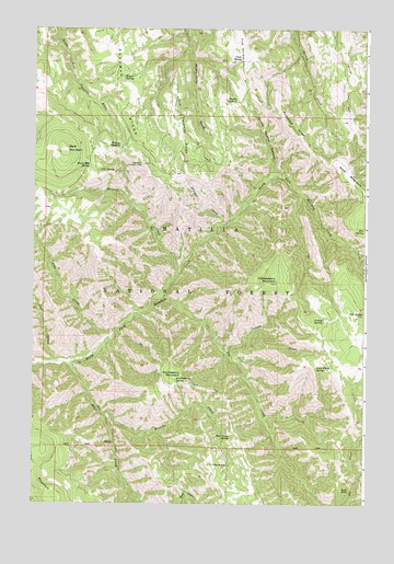
Thimbleberry Mountain, OR USGS Topographic Map
Click on map above to begin viewing in our Map Viewer.

This topographic map contains these locations and features:
Feature Name Type Latitude Longitude GNIS ID View Map
Banjo SpringSpringN45.6121°W118.2170°1137498View Map
Bear Camp SpringSpringN45.5176°W118.1751°1137638View Map
Bear CreekStreamN45.5368°W118.2363°1137696View Map
Black MountainSummitN45.5929°W118.2388°1138207View Map
Black Mountain SpringSpringN45.5885°W118.2295°1138208View Map
Canyon CreekStreamN45.5399°W118.1777°1139324View Map
Cold SpringSpringN45.5875°W118.2262°1139950View Map
Creek SpringSpringN45.6168°W118.1729°1140424View Map
Dead Horse SpringSpringN45.5358°W118.1439°1140700View Map
Dusty SaddleGapN45.6062°W118.1752°1141425View Map
Dusty Saddle CanyonValleyN45.5862°W118.1605°1141426View Map
End SpringSpringN45.5722°W118.1263°1141878View Map
Farley SpringSpringN45.5484°W118.1414°1142017View Map
Goodman Lookout TowerTowerN45.5890°W118.2099°1163714View Map
Goodman RidgeRidgeN45.6110°W118.2188°1142846View Map
Gray RockSummitN45.5040°W118.1344°1143006View Map
Hellhole CreekStreamN45.5604°W118.1966°1143461View Map
Hoskins CreekStreamN45.5235°W118.2238°1143827View Map
Huckleberry MountainSummitN45.5343°W118.1944°1143882View Map
Huckleberry SpringSpringN45.5326°W118.1963°1143890View Map
Jake CreekStreamN45.5371°W118.2425°1144213View Map
Little Goodman RidgeRidgeN45.6021°W118.1969°1145172View Map
McDonald RidgeRidgeN45.5993°W118.1527°1145970View Map
North Side SpringSpringN45.5346°W118.1997°1161864View Map
Pileup SaddleGapN45.5940°W118.2180°1147668View Map
Pole SpringSpringN45.5502°W118.1263°1147859View Map
Pot CreekStreamN45.5537°W118.2022°1147929View Map
Rocky BedgroundSummitN45.5851°W118.1341°1148653View Map
Slusher CreekStreamN45.5735°W118.1794°1149737View Map
The KnobSummitN45.5104°W118.1822°1151023View Map
Thimbleberry MountainSummitN45.5579°W118.1591°1151058View Map
Trap CreekStreamN45.5432°W118.2233°1151389View Map
Wilbur MountainSummitN45.5012°W118.2413°1152324View Map

Note: Coordinates in the location and feature list above are referenced to NAD83 datum.


Copyright (C) 2008-2024 Ryan Niemi / Sunset Dynamics ... All Rights Reserved