TopoQuest Logo
Do you find TopoQuest useful?
Help keep TopoQuest running and adding new maps/features by donating!
Bitcoin:  19c7KJd3qBynnjoSw5npx9KScwjBe4ifkT
Litecoin:  LXs6TkuXGGXo1vDsWCkWVdjQX94eUKd6ui
Home View Maps Find Maps Find Places Resources & Links


Gilbertville, Iowa Topographic Map

USGS Map Title: Gilbertville, IA
USGS Map MRC: 42092D2
DRG (GeoTIFF) Download: o42092d2.tif


Neighboring USGS Topographic Map Quads:


  Waterloo North, IA  
42092E3
 

  Dunkerton, IA  
42092E2
 

  Littleton, IA  
42092E1
 

  Waterloo South, IA  
42092D3
 

  Gilbertville, IA  
42092D2
 

  Jesup, IA  
42092D1
 

  Eagle Center, IA  
42092C3
 

  La Porte City, IA  
42092C2
 

  Brandon, IA  
42092C1


Map MRC Location:

N43°
W93°
N43°
W92°
H8 H7 H6 H5 H4 H3 H2 H1
G8 G7 G6 G5 G4 G3 G2 G1
F8 F7 F6 F5 F4 F3 F2 F1
E8 E7 E6 E5 E4 E3 E2 E1
D8 D7 D6 D5 D4 D3 D2 D1
C8 C7 C6 C5 C4 C3 C2 C1
B8 B7 B6 B5 B4 B3 B2 B1
A8 A7 A6 A5 A4 A3 A2 A1
N42°
W93°
N42°
W92°

Gilbertville, IA USGS 1:24K Topographic Map Preview:
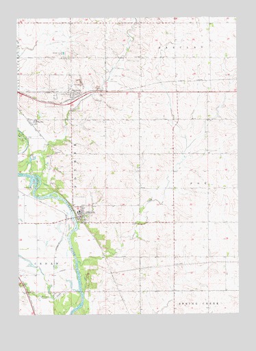
Gilbertville, IA USGS Topographic Map
Click on map above to begin viewing in our Map Viewer.

This topographic map contains these locations and features:
Feature Name Type Latitude Longitude GNIS ID View Map
Barclay TownhallBuildingN42.4836°W92.1799°463638View Map
Black Hawk County ParkParkN42.4144°W92.2168°2046169View Map
Cedar River Natural Resource AreaParkN42.3861°W92.2224°2046167View Map
City of GilbertvilleCivilN42.4190°W92.2142°2394895View Map
City of RaymondCivilN42.4694°W92.2296°2396326View Map
Don Bosco High SchoolSchoolN42.4185°W92.2154°2046166View Map
GilbertvillePopulated PlaceN42.4161°W92.2149°456900View Map
Gilbertville Police DepartmentBuildingN42.4172°W92.2149°2046162View Map
Gilbertville Post OfficePost OfficeN42.4167°W92.2141°2046160View Map
Gilbertville Town HallBuildingN42.4167°W92.2149°2046161View Map
Gilbertville Volunteer Fire DepartmentBuildingN42.4163°W92.2155°2046163View Map
Gilbertville Wastewater PlantLocaleN42.4119°W92.2128°2728354View Map
Immaculate Conception - Saint Joseph SchoolSchoolN42.4179°W92.2164°2046165View Map
Immaculate Conception ChurchChurchN42.4175°W92.2160°2046164View Map
Indian CreekStreamN42.3972°W92.2166°457788View Map
Miller CreekStreamN42.3847°W92.2157°459106View Map
Poyner CreekStreamN42.4333°W92.2374°460382View Map
Poyner Township CemeteryCemeteryN42.4435°W92.2299°463639View Map
Prairie View Acres Mobile Home ParkPopulated PlaceN42.4833°W92.2210°2002036View Map
Public Square ParkParkN42.4155°W92.2138°2046171View Map
RaymarPopulated PlaceN42.4553°W92.2402°460540View Map
RaymondPopulated PlaceN42.4689°W92.2196°460541View Map
RaymondLocaleN42.4667°W92.2193°2046155View Map
Raymond City HallBuildingN42.4686°W92.2174°2046154View Map
Raymond ParkParkN42.4653°W92.2280°2046159View Map
Raymond Post OfficePost OfficeN42.4669°W92.2193°2046157View Map
Raymond QuarryMineN42.4600°W92.1964°2630967View Map
Raymond United Methodist ChurchChurchN42.4692°W92.2177°2046156View Map
Raymond Volunteer Fire DepartmentBuildingN42.4685°W92.2175°2577490View Map
Saint Joseph's CemeteryCemeteryN42.4683°W92.2135°1958792View Map
Saint Josephs CemeteryCemeteryN42.4683°W92.2135°2046218View Map
Saint Josephs SchoolSchoolN42.4769°W92.2155°2046158View Map
Saint Mary's CemeteryCemeteryN42.4169°W92.2146°1958312View Map
Saint Marys Catholic CemeteryCemeteryN42.4191°W92.2182°2046219View Map
Schmidt ParkParkN42.4217°W92.2152°2046168View Map
Township of PoynerCivilN42.4590°W92.2148°468567View Map
Veterans ParkParkN42.4133°W92.2152°2046170View Map

Note: Coordinates in the location and feature list above are referenced to NAD83 datum.


Copyright (C) 2008-2025 Ryan Niemi / Sunset Dynamics ... All Rights Reserved