TopoQuest Logo
Do you find TopoQuest useful?
Help keep TopoQuest running and adding new maps/features by donating!
Bitcoin:  19c7KJd3qBynnjoSw5npx9KScwjBe4ifkT
Litecoin:  LXs6TkuXGGXo1vDsWCkWVdjQX94eUKd6ui
Home View Maps Find Maps Find Places Resources & Links


Glacier, Washington Topographic Map

USGS Map Title: Glacier, WA
USGS Map MRC: 48121H8
DRG (GeoTIFF) Download: o48121h8.tif


Neighboring USGS Topographic Map Quads:


  Maple Falls, WA  
48122H1
 

  Glacier, WA  
48121H8
 

  Bearpaw Mountain, WA  
48121H7
 

  Canyon Lake, WA  
48122G1
 

  Groat Mountain, WA  
48121G8
 

  Mount Baker, WA  
48121G7


Map MRC Location:

N49°
W122°
N49°
W121°
H8 H7 H6 H5 H4 H3 H2 H1
G8 G7 G6 G5 G4 G3 G2 G1
F8 F7 F6 F5 F4 F3 F2 F1
E8 E7 E6 E5 E4 E3 E2 E1
D8 D7 D6 D5 D4 D3 D2 D1
C8 C7 C6 C5 C4 C3 C2 C1
B8 B7 B6 B5 B4 B3 B2 B1
A8 A7 A6 A5 A4 A3 A2 A1
N48°
W122°
N48°
W121°

Glacier, WA USGS 1:24K Topographic Map Preview:
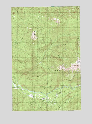
Glacier, WA USGS Topographic Map
Click on map above to begin viewing in our Map Viewer.

This topographic map contains these locations and features:
Feature Name Type Latitude Longitude GNIS ID View Map
Bald LakeLakeN48.9708°W121.9573°1516077View Map
Canyon CreekStreamN48.9073°W121.9901°1517358View Map
Canyon Creek CampgroundLocaleN48.9490°W121.9324°1528556View Map
Canyon RidgeRidgeN48.9790°W121.9429°1531563View Map
Church MountainSummitN48.9268°W121.8821°1517770View Map
Church SaddleGapN48.9198°W121.9357°1528551View Map
Clean CreekStreamN48.9648°W121.8999°1528554View Map
Coal CreekStreamN48.9048°W121.9060°1517892View Map
Cornell CreekStreamN48.8982°W121.9688°1518112View Map
Davis CreekStreamN48.8818°W121.9307°1518505View Map
Dippy CreekStreamN48.8968°W121.9465°1528548View Map
Douglas Fir CampgroundLocaleN48.9026°W121.9157°1534578View Map
Gallop CreekStreamN48.8940°W121.9432°1519880View Map
GlacierPopulated PlaceN48.8901°W121.9457°1519971View Map
Glacier Census Designated PlaceCensusN48.8902°W121.9323°2408296View Map
Glacier Chamber of CommerceBuildingN48.8896°W121.9458°2356589View Map
Glacier CreekStreamN48.8921°W121.9393°1519980View Map
Glacier Public Service CenterLocaleN48.8882°W121.9379°1529793View Map
Hedrick CreekStreamN48.8987°W121.9707°1520667View Map
Horseshoe BendBendN48.9007°W121.8910°1528547View Map
Hurst CreekStreamN48.8962°W121.9318°1528549View Map
Jim CreekStreamN48.9332°W121.9485°1528553View Map
Kaisoots MountainSummitN48.9666°W121.9610°1516089View Map
Kidney CreekStreamN48.9471°W121.9318°1521654View Map
Kidney LakesLakeN48.9304°W121.8782°1521656View Map
Little CreekStreamN48.8837°W121.9340°1522196View Map
Little MountainSummitN48.9115°W121.8938°1528555View Map
Lookout CreekStreamN48.9026°W121.8915°1531568View Map
Maple CreekStreamN48.9018°W121.9188°1528550View Map
Mount Baker-Snoqualmie National ForestForestN48.8832°W121.8846°1534194View Map
Thompson CreekStreamN48.8790°W121.9140°1527107View Map
WarnickPopulated PlaceN48.9021°W121.9893°1527813View Map
Warnick BridgeBridgeN48.9046°W121.9918°2608044View Map
West Church RidgeRidgeN48.9198°W121.9426°1528552View Map
West Cornell CreekStreamN48.8885°W121.9604°1527920View Map
Whatcom County Fire District 19 Glacier Fire and RescueBuildingN48.8897°W121.9472°2643595View Map
Whistler CreekStreamN48.9637°W121.8779°1528039View Map

Note: Coordinates in the location and feature list above are referenced to NAD83 datum.


Copyright (C) 2008-2024 Ryan Niemi / Sunset Dynamics ... All Rights Reserved