TopoQuest Logo
Do you find TopoQuest useful?
Help keep TopoQuest running and adding new maps/features by donating!
Bitcoin:  19c7KJd3qBynnjoSw5npx9KScwjBe4ifkT
Litecoin:  LXs6TkuXGGXo1vDsWCkWVdjQX94eUKd6ui
Home View Maps Find Maps Find Places Resources & Links


Maple Falls, Washington Topographic Map

USGS Map Title: Maple Falls, WA
USGS Map MRC: 48122H1
DRG (GeoTIFF) Download: o48122h1.tif


Neighboring USGS Topographic Map Quads:


  Kendall, WA  
48122H2
 

  Maple Falls, WA  
48122H1
 

  Glacier, WA  
48121H8
 

  Deming, WA  
48122G2
 

  Canyon Lake, WA  
48122G1
 

  Groat Mountain, WA  
48121G8


Map MRC Location:

N49°
W123°
N49°
W122°
H8 H7 H6 H5 H4 H3 H2 H1
G8 G7 G6 G5 G4 G3 G2 G1
F8 F7 F6 F5 F4 F3 F2 F1
E8 E7 E6 E5 E4 E3 E2 E1
D8 D7 D6 D5 D4 D3 D2 D1
C8 C7 C6 C5 C4 C3 C2 C1
B8 B7 B6 B5 B4 B3 B2 B1
A8 A7 A6 A5 A4 A3 A2 A1
N48°
W123°
N48°
W122°

Maple Falls, WA USGS 1:24K Topographic Map Preview:
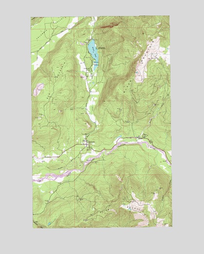
Maple Falls, WA USGS Topographic Map
Click on map above to begin viewing in our Map Viewer.

This topographic map contains these locations and features:
Feature Name Type Latitude Longitude GNIS ID View Map
Black MountainSummitN48.9646°W122.0310°1516615View Map
Black Mountain Boy Scout CampLocaleN48.9810°W122.0674°1516616View Map
Boulder CreekStreamN48.9254°W122.0368°1516842View Map
Clauson Lime QuarryMineN48.9640°W122.0811°2605690View Map
Doaks CreekStreamN48.9426°W122.0726°1518820View Map
Kendall AirstripAirportN48.9149°W122.1129°1533802View Map
Kendall QuarryMineN48.9130°W122.1163°2605646View Map
Kendall QuarryMineN48.9567°W122.1207°2605691View Map
Maple CreekStreamN48.9121°W122.0796°1522691View Map
Maple FallsPopulated PlaceN48.9243°W122.0771°1522693View Map
Maple Falls Census Designated PlaceCensusN48.9136°W122.1047°2408171View Map
Maple Falls Elementary SchoolSchoolN48.9268°W122.0793°1530711View Map
Maple Falls LibraryBuildingN48.9238°W122.0768°2610223View Map
Maple Falls Post OfficePost OfficeN48.9245°W122.0819°2606975View Map
Red MountainSummitN48.9454°W122.1068°1524945View Map
Silver LakeLakeN48.9785°W122.0699°1525783View Map
Silver Lake ParkParkN48.9682°W122.0732°1525785View Map
Silver Lake Park Boat LaunchLocaleN48.9713°W122.0691°2607959View Map
Silver Lake Park CampgroundLocaleN48.9671°W122.0722°2608231View Map
Wildcat CreekStreamN48.9112°W122.0046°1528136View Map

Note: Coordinates in the location and feature list above are referenced to NAD83 datum.


Copyright (C) 2008-2024 Ryan Niemi / Sunset Dynamics ... All Rights Reserved