TopoQuest Logo
Do you find TopoQuest useful?
Help keep TopoQuest running and adding new maps/features by donating!
Bitcoin:  19c7KJd3qBynnjoSw5npx9KScwjBe4ifkT
Litecoin:  LXs6TkuXGGXo1vDsWCkWVdjQX94eUKd6ui
Home View Maps Find Maps Find Places Resources & Links


Glover Gap, West Virginia Topographic Map

USGS Map Title: Glover Gap, WV
USGS Map MRC: 39080E4
DRG (GeoTIFF) Download: o39080e4.tif


Neighboring USGS Topographic Map Quads:


  Littleton, WV  
39080F5
 

  Hundred, WV  
39080F4
 

  Wadestown, WV  
39080F3
 

  Big Run, WV  
39080E5
 

  Glover Gap, WV  
39080E4
 

  Mannington, WV  
39080E3
 

  Folsom, WV  
39080D5
 

  Wallace, WV  
39080D4
 

  Shinnston, WV  
39080D3


Map MRC Location:

N40°
W81°
N40°
W80°
H8 H7 H6 H5 H4 H3 H2 H1
G8 G7 G6 G5 G4 G3 G2 G1
F8 F7 F6 F5 F4 F3 F2 F1
E8 E7 E6 E5 E4 E3 E2 E1
D8 D7 D6 D5 D4 D3 D2 D1
C8 C7 C6 C5 C4 C3 C2 C1
B8 B7 B6 B5 B4 B3 B2 B1
A8 A7 A6 A5 A4 A3 A2 A1
N39°
W81°
N39°
W80°

Glover Gap, WV USGS 1:24K Topographic Map Preview:
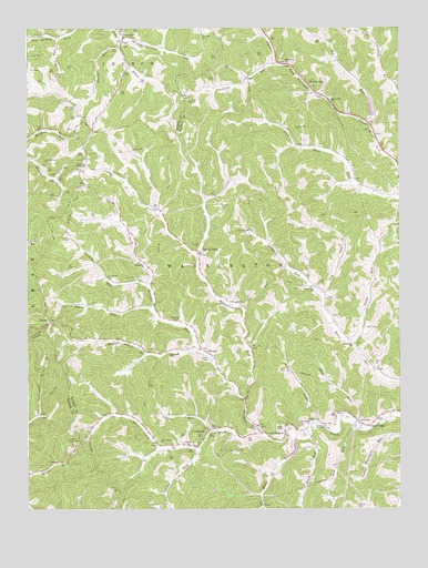
Glover Gap, WV USGS Topographic Map
Click on map above to begin viewing in our Map Viewer.

This topographic map contains these locations and features:
Feature Name Type Latitude Longitude GNIS ID View Map
Anderson CemeteryCemeteryN39.6237°W80.4404°1534942View Map
Atha CemeteryCemeteryN39.5473°W80.3859°1535070View Map
Bartholomew ForkStreamN39.5281°W80.4273°1535286View Map
Beaty CemeteryCemeteryN39.5209°W80.4145°1535442View Map
Beechlick RunStreamN39.6154°W80.4159°1535565View Map
Big Jim RunStreamN39.6226°W80.4904°1535873View Map
Big RunStreamN39.6001°W80.3856°1535952View Map
BrinkPopulated PlaceN39.5481°W80.4929°1536353View Map
Brush RunStreamN39.5184°W80.4054°1536483View Map
Camp RunStreamN39.5156°W80.4429°1536950View Map
Carpenter CemeteryCemeteryN39.6051°W80.4840°1537051View Map
Centenary ChurchChurchN39.5426°W80.3901°1537149View Map
Charles Beatty SpringSpringN39.5234°W80.4226°1677952View Map
Cunningham CemeteryCemeteryN39.5176°W80.4559°1537911View Map
Cunningham School (historical)SchoolN39.5231°W80.4634°1717933View Map
Curtis ChurchChurchN39.5165°W80.4462°1537940View Map
CurtisvillePopulated PlaceN39.5209°W80.4390°1537943View Map
Deep ValleyPopulated PlaceN39.5220°W80.3881°1554278View Map
Dents Run ChurchChurchN39.5579°W80.4037°1538135View Map
EarnshawPopulated PlaceN39.6226°W80.4676°1538497View Map
Evans RunStreamN39.5531°W80.4576°1538759View Map
Evergreen ChurchChurchN39.5637°W80.4606°1538769View Map
Furbee CemeteryCemeteryN39.6065°W80.4456°1539301View Map
Furbee School (historical)SchoolN39.6137°W80.4226°1717948View Map
George Williams SpringSpringN39.5665°W80.4359°1677956View Map
Glover GapLocaleN39.6098°W80.4048°1539473View Map
Glover Gap ChurchChurchN39.6162°W80.4134°1539474View Map
Glover Gap School (historical)SchoolN39.6065°W80.3981°1539475View Map
Green CemeteryCemeteryN39.5545°W80.3995°1539669View Map
Harker RunStreamN39.6198°W80.4687°1539953View Map
Hayhurst CemeteryCemeteryN39.5490°W80.4493°1540085View Map
Hibbs RunStreamN39.5426°W80.3909°1540192View Map
Higginbotham CemeteryCemeteryN39.5909°W80.4945°1540238View Map
Higginbotham RunStreamN39.6223°W80.4684°1540239View Map
Huey RunStreamN39.5179°W80.4076°1540550View Map
Huey Run School (historical)SchoolN39.5015°W80.4212°1717953View Map
Ice CemeteryCemeteryN39.5195°W80.4081°1540649View Map
Ice CemeteryCemeteryN39.5598°W80.4643°1540650View Map
Joes RunStreamN39.5204°W80.3893°1540944View Map
Jones CemeteryCemeteryN39.5584°W80.4012°1541010View Map
Laurel RunStreamN39.5201°W80.4387°1541525View Map
LogansportPopulated PlaceN39.5193°W80.4137°1542314View Map
Logansport United Methodist ChurchChurchN39.5181°W80.4145°1717959View Map
Long DrainStreamN39.5229°W80.4034°1542365View Map
Mannington Memorial CemeteryCemeteryN39.5220°W80.4040°1542722View Map
Metz School (historical)SchoolN39.5426°W80.4259°1717969View Map
Murray CemeteryCemeteryN39.5790°W80.4351°1544016View Map
Murray School (historical)SchoolN39.5812°W80.4368°1717972View Map
Myers ChapelChurchN39.5895°W80.4809°1544029View Map
Owen Davy ForkStreamN39.5193°W80.4204°1544483View Map
Price RunStreamN39.5229°W80.3895°1545262View Map
Rex RunStreamN39.5562°W80.4012°1545514View Map
RymerPopulated PlaceN39.5409°W80.4401°1546209View Map
Rymer CemeteryCemeteryN39.5390°W80.4393°1546210View Map
Rymer United Methodist ChurchChurchN39.5409°W80.4395°1717977View Map
Satterfield (historical)Populated PlaceN39.5429°W80.3898°1717979View Map
Schupp CemeteryCemeteryN39.5373°W80.3829°1546510View Map
Seven PinesPopulated PlaceN39.5668°W80.4418°1549921View Map
Shaffer CemeteryCemeteryN39.5681°W80.4440°1546605View Map
Snider CemeteryCemeteryN39.5709°W80.4868°1547029View Map
Snodgrass CemeteryCemeteryN39.5609°W80.4729°1547038View Map
Snodgrass School (historical)SchoolN39.5640°W80.4612°1717982View Map
Starkey RunStreamN39.5579°W80.4590°1547346View Map
State Road School (historical)SchoolN39.5940°W80.4076°1717983View Map
Sullivan CemeteryCemeteryN39.5004°W80.3895°1547706View Map
The Little Red Church (historical)ChurchN39.5931°W80.3976°1717984View Map
Thorne and Huey CemeteryCemeteryN39.5212°W80.4093°1548051View Map
Upper Buffalo Creek Structure Number 22 DamDamN39.6017°W80.3848°1559026View Map
Upper Buffalo Creek Structure Number Two DamDamN39.5184°W80.4098°1559014View Map
Upper Dents Run School (historical)SchoolN39.5579°W80.4040°1717986View Map
Warrior ForkStreamN39.5418°W80.4440°1548807View Map
West School (historical)SchoolN39.5226°W80.3884°1548942View Map
Whetstone A M D DamDamN39.5384°W80.3815°1559002View Map
White School (historical)SchoolN39.5793°W80.4590°1717989View Map
Yost CemeteryCemeteryN39.6023°W80.4837°1549461View Map

Note: Coordinates in the location and feature list above are referenced to NAD83 datum.


Copyright (C) 2008-2024 Ryan Niemi / Sunset Dynamics ... All Rights Reserved