TopoQuest Logo
Do you find TopoQuest useful?
Help keep TopoQuest running and adding new maps/features by donating!
Bitcoin:  19c7KJd3qBynnjoSw5npx9KScwjBe4ifkT
Litecoin:  LXs6TkuXGGXo1vDsWCkWVdjQX94eUKd6ui
Home View Maps Find Maps Find Places Resources & Links


Big Run, West Virginia Topographic Map

USGS Map Title: Big Run, WV
USGS Map MRC: 39080E5
DRG (GeoTIFF) Download: o39080e5.tif


Neighboring USGS Topographic Map Quads:


  Wileyville, WV  
39080F6
 

  Littleton, WV  
39080F5
 

  Hundred, WV  
39080F4
 

  Pine Grove, WV  
39080E6
 

  Big Run, WV  
39080E5
 

  Glover Gap, WV  
39080E4
 

  Center Point, WV  
39080D6
 

  Folsom, WV  
39080D5
 

  Wallace, WV  
39080D4


Map MRC Location:

N40°
W81°
N40°
W80°
H8 H7 H6 H5 H4 H3 H2 H1
G8 G7 G6 G5 G4 G3 G2 G1
F8 F7 F6 F5 F4 F3 F2 F1
E8 E7 E6 E5 E4 E3 E2 E1
D8 D7 D6 D5 D4 D3 D2 D1
C8 C7 C6 C5 C4 C3 C2 C1
B8 B7 B6 B5 B4 B3 B2 B1
A8 A7 A6 A5 A4 A3 A2 A1
N39°
W81°
N39°
W80°

Big Run, WV USGS 1:24K Topographic Map Preview:
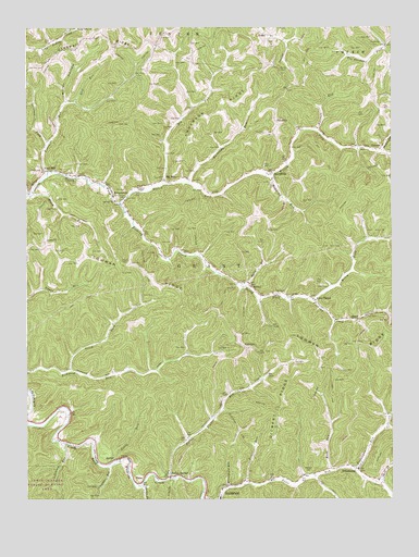
Big Run, WV USGS Topographic Map
Click on map above to begin viewing in our Map Viewer.

This topographic map contains these locations and features:
Feature Name Type Latitude Longitude GNIS ID View Map
Allen CemeteryCemeteryN39.5567°W80.5229°1534881View Map
Allen ChapelLocaleN39.5534°W80.5268°1534882View Map
Anderson RidgeRidgeN39.6031°W80.5581°1534948View Map
Anderson-Bane CemeteryCemeteryN39.6248°W80.5376°1717731View Map
ArcherPopulated PlaceN39.5106°W80.5951°1553739View Map
Arches ForkStreamN39.5037°W80.5857°1535000View Map
Ashcamp RunStreamN39.5151°W80.6123°1535058View Map
Aunty RunStreamN39.5104°W80.5945°1535082View Map
BanePopulated PlaceN39.5045°W80.5876°1553797View Map
Bear RunStreamN39.5043°W80.5493°1535396View Map
Big RunStreamN39.5834°W80.5779°1535939View Map
Big RunPopulated PlaceN39.5845°W80.5776°1549594View Map
Big Run CemeteryCemeteryN39.6173°W80.5678°2586336View Map
Big Run Post OfficePost OfficeN39.5845°W80.5773°1717780View Map
Borden CemeteryCemeteryN39.6140°W80.5376°1536241View Map
Buck RunStreamN39.5076°W80.5206°1536573View Map
BurchfieldPopulated PlaceN39.5868°W80.5409°1536732View Map
Burchfield CemeteryCemeteryN39.5840°W80.5418°1717732View Map
Burchfield Methodist ChurchChurchN39.5851°W80.5409°1717781View Map
Carpenter RunStreamN39.5087°W80.5973°1537057View Map
Chutes CemeteryCemeteryN39.5626°W80.5904°1537341View Map
CoburnPopulated PlaceN39.5929°W80.5034°1554167View Map
Creswell RidgeRidgeN39.6148°W80.6229°1537818View Map
District 1CivilN39.5725°W80.5952°1928213View Map
Elm Grove School (historical)SchoolN39.5667°W80.5793°1717672View Map
FairviewPopulated PlaceN39.5398°W80.5498°1554432View Map
Fallen TimberLocaleN39.5062°W80.5757°1538855View Map
Fallen Timber RunStreamN39.5056°W80.5759°1538859View Map
Falling Timber School (historical)SchoolN39.5287°W80.5531°1717675View Map
Four MilePopulated PlaceN39.5870°W80.6190°1539174View Map
Fourmile RunStreamN39.5867°W80.6176°1539187View Map
Garrison ForkStreamN39.5942°W80.6176°1539351View Map
Gilbert RidgeRidgeN39.5237°W80.5393°1539392View Map
Gilbert School (historical)SchoolN39.5187°W80.5390°1717678View Map
Glade ForkStreamN39.5037°W80.5040°1539430View Map
Haymond RunStreamN39.5868°W80.5409°1540089View Map
HazelPopulated PlaceN39.5476°W80.5118°1554669View Map
Hickory Knob School (historical)SchoolN39.5359°W80.5234°1717685View Map
Higgins ChapelChurchN39.5829°W80.5868°1540240View Map
Ice CemeteryCemeteryN39.5167°W80.5704°1540648View Map
Kendall School (historical)SchoolN39.5506°W80.5701°1717688View Map
Kilcoyne CemeteryCemeteryN39.5548°W80.5398°1541188View Map
KingstownPopulated PlaceN39.5795°W80.5920°1541228View Map
KodolPopulated PlaceN39.6229°W80.5406°1554894View Map
Lieuts-Bates CemeteryCemeteryN39.5231°W80.6137°1717749View Map
Lone Valley Church (historical)ChurchN39.5968°W80.5326°1717695View Map
Long CemeteryCemeteryN39.5715°W80.5426°1542363View Map
Long Valley ChurchChurchN39.6248°W80.6070°1542428View Map
Lowman ChurchChurchN39.5790°W80.5948°1542595View Map
Lowman RidgeRidgeN39.5590°W80.5820°1542596View Map
Lowman School (historical)SchoolN39.5620°W80.5951°1717697View Map
Merrifield RunStreamN39.5031°W80.5562°1543131View Map
Merrifield School (historical)SchoolN39.5693°W80.5065°1717701View Map
Miller HollowValleyN39.6048°W80.6118°1543387View Map
MobleyPopulated PlaceN39.5570°W80.5487°1549829View Map
Mobley RunStreamN39.5565°W80.5501°1543476View Map
Morgan CemeteryCemeteryN39.5073°W80.5295°1543537View Map
Morgan RunStreamN39.5923°W80.5029°1543552View Map
North Fork Richwood RunStreamN39.5340°W80.6098°1544218View Map
Oak Grove School (historical)SchoolN39.6020°W80.5615°1717707View Map
Pickenpaw RunStreamN39.5076°W80.5129°1544792View Map
Pleasant Valley Church (historical)ChurchN39.5817°W80.5581°1717711View Map
PricetownPopulated PlaceN39.5076°W80.5115°1545265View Map
Pricetown CemeteryCemeteryN39.5056°W80.5045°1717764View Map
Pricetown Church of ChristChurchN39.5051°W80.5048°1717765View Map
Raccoon RunStreamN39.5973°W80.5251°1545365View Map
Rockcamp RunStreamN39.5834°W80.5684°1545949View Map
Sheep RunStreamN39.5817°W80.6234°1546654View Map
Shuman CemeteryCemeteryN39.5970°W80.5429°1546756View Map
SincerityPopulated PlaceN39.5992°W80.5390°1555631View Map
Slip RunStreamN39.6051°W80.6087°1546947View Map
Stoneking CemeteryCemeteryN39.6201°W80.5054°1547478View Map
Tea Garden School (historical)SchoolN39.6195°W80.5026°1717723View Map
Tenmile RunStreamN39.5037°W80.5040°1547970View Map
Utt CemeteryCemeteryN39.6223°W80.5787°1548580View Map
Utt School (historical)SchoolN39.6217°W80.5818°1717725View Map
Wiley ForkStreamN39.5531°W80.5273°1549148View Map
Willey CemeteryCemeteryN39.5840°W80.5768°1717775View Map
Willey ForkStreamN39.5779°W80.5926°1549158View Map
Willow Grove School (historical)SchoolN39.5548°W80.6229°1717730View Map

Note: Coordinates in the location and feature list above are referenced to NAD83 datum.


Copyright (C) 2008-2024 Ryan Niemi / Sunset Dynamics ... All Rights Reserved