TopoQuest Logo
Do you find TopoQuest useful?
Help keep TopoQuest running and adding new maps/features by donating!
Bitcoin:  19c7KJd3qBynnjoSw5npx9KScwjBe4ifkT
Litecoin:  LXs6TkuXGGXo1vDsWCkWVdjQX94eUKd6ui
Home View Maps Find Maps Find Places Resources & Links


Gold Hill, Utah Topographic Map

USGS Map Title: Gold Hill, UT
USGS Map MRC: 40113B7
DRG (GeoTIFF) Download: o40113b7.tif


Neighboring USGS Topographic Map Quads:


  Elephant Knoll, UT  
40113C8


  North of Gold Hill Wash, UT  
40113C6
 

  Ochre Mountain, UT  
40113B8
 

  Gold Hill, UT  
40113B7
 

  Gold Hill Wash, UT  
40113B6
 

  Ibapah, UT  
40113A8
 

  Clifton, UT  
40113A7
 

  Goshute Wash, UT  
40113A6


Map MRC Location:

N41°
W114°
N41°
W113°
H8 H7 H6 H5 H4 H3 H2 H1
G8 G7 G6 G5 G4 G3 G2 G1
F8 F7 F6 F5 F4 F3 F2 F1
E8 E7 E6 E5 E4 E3 E2 E1
D8 D7 D6 D5 D4 D3 D2 D1
C8 C7 C6 C5 C4 C3 C2 C1
B8 B7 B6 B5 B4 B3 B2 B1
A8 A7 A6 A5 A4 A3 A2 A1
N40°
W114°
N40°
W113°

Gold Hill, UT USGS 1:24K Topographic Map Preview:
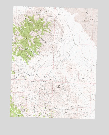
Gold Hill, UT USGS Topographic Map
Click on map above to begin viewing in our Map Viewer.

This topographic map contains these locations and features:
Feature Name Type Latitude Longitude GNIS ID View Map
Accident CanyonValleyN40.2427°W113.8650°1425044View Map
Alvarado MineMineN40.1702°W113.8117°1425099View Map
Busby CanyonValleyN40.2433°W113.8058°1426211View Map
Cane SpringSpringN40.1653°W113.8407°1426333View Map
Dutch MountainSummitN40.2249°W113.8433°1435473View Map
Garrison MinesMineN40.2447°W113.8356°1428154View Map
Gold HillPopulated PlaceN40.1663°W113.8306°1428231View Map
Gold HillSummitN40.1597°W113.8058°1428232View Map
Little ValleyValleyN40.1741°W113.8572°1429816View Map
Lucky Day KnobSummitN40.1333°W113.8186°1430006View Map
Lucy L GulchValleyN40.1505°W113.8353°1430012View Map
Ochre SpringsSpringN40.1462°W113.8516°1430945View Map
Pool CanyonValleyN40.1933°W113.8250°1431403View Map
Royal GulchValleyN40.2430°W113.8644°1432037View Map
Rube MineMineN40.1813°W113.8103°1432042View Map
Silver Hill MineMineN40.2174°W113.8392°1432459View Map
Spotted Fawn CanyonValleyN40.2138°W113.7983°1432809View Map
Stardust MineMineN40.1908°W113.8525°1432924View Map
Timm MineMineN40.1955°W113.8492°1433531View Map
Tribune GulchValleyN40.1966°W113.8206°1433669View Map
United States MineMineN40.1569°W113.8311°1433787View Map
Wilson HillSummitN40.2463°W113.8367°1434377View Map
Woodman PeakSummitN40.2038°W113.8664°1434459View Map

Note: Coordinates in the location and feature list above are referenced to NAD83 datum.


Copyright (C) 2008-2025 Ryan Niemi / Sunset Dynamics ... All Rights Reserved