TopoQuest Logo
Do you find TopoQuest useful?
Help keep TopoQuest running and adding new maps/features by donating!
Bitcoin:  19c7KJd3qBynnjoSw5npx9KScwjBe4ifkT
Litecoin:  LXs6TkuXGGXo1vDsWCkWVdjQX94eUKd6ui
Home View Maps Find Maps Find Places Resources & Links


Ibapah, Utah Topographic Map

USGS Map Title: Ibapah, UT
USGS Map MRC: 40113A8
DRG (GeoTIFF) Download: o40113a8.tif


Neighboring USGS Topographic Map Quads:


  Ferber Peak, NV  
40114B1
 

  Ochre Mountain, UT  
40113B8
 

  Gold Hill, UT  
40113B7
 

  Ferber Peak SE, NV  
40114A1
 

  Ibapah, UT  
40113A8
 

  Clifton, UT  
40113A7
 

  Georgetta Ranch, NV  
39114H1
 

  Goshute, UT  
39113H8
 

  Goshute Canyon, UT  
39113H7


Map MRC Location:

N41°
W114°
N41°
W113°
H8 H7 H6 H5 H4 H3 H2 H1
G8 G7 G6 G5 G4 G3 G2 G1
F8 F7 F6 F5 F4 F3 F2 F1
E8 E7 E6 E5 E4 E3 E2 E1
D8 D7 D6 D5 D4 D3 D2 D1
C8 C7 C6 C5 C4 C3 C2 C1
B8 B7 B6 B5 B4 B3 B2 B1
A8 A7 A6 A5 A4 A3 A2 A1
N40°
W114°
N40°
W113°

Ibapah, UT USGS 1:24K Topographic Map Preview:
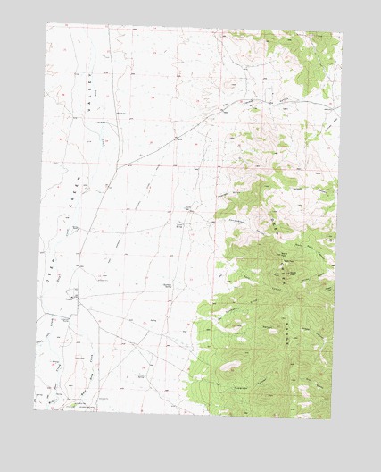
Ibapah, UT USGS Topographic Map
Click on map above to begin viewing in our Map Viewer.

This topographic map contains these locations and features:
Feature Name Type Latitude Longitude GNIS ID View Map
Chadman SpringSpringN40.0412°W113.9444°1426515View Map
Christiansen CanyonValleyN40.0602°W113.9381°1426624View Map
Deep Creek Pony Express MonumentParkN40.0294°W113.9869°1435395View Map
Dewey MineMineN40.0460°W113.9011°1427382View Map
East Deep CreekStreamN40.0308°W113.9944°1427678View Map
Greasewood SpringSpringN40.0119°W113.9546°1441458View Map
Guilmette GulchValleyN40.0313°W113.9253°1428427View Map
Hicks GulchValleyN40.0477°W113.8789°1428688View Map
IbapahPopulated PlaceN40.0366°W113.9853°1437592View Map
Ibapah CemeteryCemeteryN40.0335°W113.9780°1435733View Map
Ibapah Elementary SchoolSchoolN40.0366°W113.9844°1435734View Map
Ibapah PeakSummitN40.0388°W113.8892°1848357View Map
Kelly CanyonValleyN40.0308°W113.9439°1429313View Map
Middle Deep CreekStreamN40.0233°W113.9956°1430267View Map
Nicholes RanchLocaleN40.0588°W113.9844°1430710View Map
North PassGapN40.0508°W113.8975°1430834View Map
North PeakSummitN40.0527°W113.8986°1430836View Map
North SpringSpringN40.0665°W113.9395°1430854View Map
Open A CanyonValleyN40.0085°W113.9564°1431013View Map
Pony Express CanyonValleyN40.1024°W113.9644°1431399View Map
Secret SpringSpringN40.0612°W113.9403°1432306View Map
Sevy CanyonValleyN40.0452°W113.9297°1432345View Map
Sheridan GulchValleyN40.0688°W113.9336°1432397View Map
Simonson CanyonValleyN40.0035°W113.9278°1432475View Map
South PeakSummitN40.0466°W113.8947°1432745View Map
The Church of Jesus Christ of Latter Day SaintsChurchN40.0355°W113.8833°1436960View Map
West Deep CreekStreamN40.0308°W113.9944°1434063View Map

Note: Coordinates in the location and feature list above are referenced to NAD83 datum.


Copyright (C) 2008-2025 Ryan Niemi / Sunset Dynamics ... All Rights Reserved