TopoQuest Logo
Do you find TopoQuest useful?
Help keep TopoQuest running and adding new maps/features by donating!
Bitcoin:  19c7KJd3qBynnjoSw5npx9KScwjBe4ifkT
Litecoin:  LXs6TkuXGGXo1vDsWCkWVdjQX94eUKd6ui
Home View Maps Find Maps Find Places Resources & Links


Goldfield, Nevada Topographic Map

USGS Map Title: Goldfield, NV
USGS Map MRC: 37117F2
DRG (GeoTIFF) Download: o37117f2.tif


Neighboring USGS Topographic Map Quads:


  Alkali, NV  
37117G3
 

  McMahon Ridge, NV  
37117G2
 

  Mud Lake South, NV  
37117G1
 

  Montezuma Peak, NV  
37117F3
 

  Goldfield, NV  
37117F2
 

  East of Goldfield, NV  
37117F1
 

  Montezuma Peak SE, NV  
37117E3
 

  Ralston, NV  
37117E2
 

  Stonewall Spring, NV  
37117E1


Map MRC Location:

N38°
W118°
N38°
W117°
H8 H7 H6 H5 H4 H3 H2 H1
G8 G7 G6 G5 G4 G3 G2 G1
F8 F7 F6 F5 F4 F3 F2 F1
E8 E7 E6 E5 E4 E3 E2 E1
D8 D7 D6 D5 D4 D3 D2 D1
C8 C7 C6 C5 C4 C3 C2 C1
B8 B7 B6 B5 B4 B3 B2 B1
A8 A7 A6 A5 A4 A3 A2 A1
N37°
W118°
N37°
W117°

Goldfield, NV USGS 1:24K Topographic Map Preview:
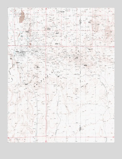
Goldfield, NV USGS Topographic Map
Click on map above to begin viewing in our Map Viewer.

This topographic map contains these locations and features:
Feature Name Type Latitude Longitude GNIS ID View Map
American Mill (historical)LocaleN37.7160°W117.2415°853225View Map
Banner MountainSummitN37.7255°W117.1898°845349View Map
Black Butte MineMineN37.7194°W117.1434°853218View Map
Blackcap MountainSummitN37.6972°W117.1570°845772View Map
Brownie MountainSummitN37.7135°W117.1867°845383View Map
Chispa HillsSummitN37.6769°W117.1601°839505View Map
Cole MountainSummitN37.7274°W117.1315°851620View Map
Columbia (historical)Populated PlaceN37.7244°W117.2312°854790View Map
Columbia MillLocaleN37.7380°W117.2317°845800View Map
Columbia MountainSummitN37.7269°W117.2254°839639View Map
Columbia Post OfficePost OfficeN37.7244°W117.2312°864313View Map
Columbia Sampling and Ore Company Mill (historical)LocaleN37.7266°W117.2323°853226View Map
Combination Fraction MineMineN37.7194°W117.1434°853213View Map
Combination Mill (historical)LocaleN37.7133°W117.2270°853211View Map
Consolidated MineMineN37.7194°W117.1434°853215View Map
Daisy Mine SyndicateMineN37.7194°W117.1434°853221View Map
DiamondfieldLocaleN37.7460°W117.1901°864017View Map
Diamondfield MinesMineN37.7194°W117.1434°853216View Map
Diamondfield Post Office (historical)Post OfficeN37.7460°W117.1901°864791View Map
Esmeralda County Sheriff's OfficeBuildingN37.7078°W117.2335°2740047View Map
Espina HillSummitN37.7108°W117.1529°845456View Map
Florence HillPopulated PlaceN37.7077°W117.2187°845834View Map
Florence Mill (historical)LocaleN37.7127°W117.2081°853229View Map
Florence MineMineN37.7110°W117.2142°840513View Map
Gaillac MineMineN37.6277°W117.2401°853496View Map
Gardner Mill (historical)LocaleN37.7055°W117.2426°853230View Map
GoldfieldPopulated PlaceN37.7085°W117.2356°854468View Map
Goldfield Airport (historical)AirportN37.7180°W117.2384°864062View Map
Goldfield Census Designated PlaceCensusN37.7122°W117.2379°2583930View Map
Goldfield Chlorination Mill (historical)LocaleN37.7310°W117.2379°853222View Map
Goldfield Consolidated Mill (historical)LocaleN37.7388°W117.2317°853223View Map
Goldfield Consolidated MinesMineN37.7194°W117.1434°853212View Map
Goldfield Consolidated Mines Company Mill (historical)LocaleN37.7124°W117.2251°853232View Map
Goldfield Elementary SchoolSchoolN37.7091°W117.2337°855091View Map
Goldfield Fire DepartmentBuildingN37.7058°W117.2353°2581424View Map
Goldfield High School (historical)SchoolN37.7083°W117.2336°2076626View Map
Goldfield Mining DistrictCivilN37.7194°W117.1434°856586View Map
Goldfield Post OfficePost OfficeN37.7079°W117.2414°864651View Map
Goldfield SummitSummitN37.6797°W117.2279°864016View Map
Jumbo Mill (historical)LocaleN37.7155°W117.2209°853233View Map
Jumbotown (historical)Populated PlaceN37.7155°W117.2209°854789View Map
Keith (historical)LocaleN37.6888°W117.2312°856657View Map
Kinkead Mill (historical)LocaleN37.7230°W117.2145°853227View Map
Laguna MineMineN37.7241°W117.2220°853494View Map
McLaughlins WellWellN37.7241°W117.1776°851628View Map
Meda PassGapN37.6852°W117.1920°842047View Map
Merger MineMineN37.7222°W117.2187°853495View Map
Mira MountainRidgeN37.6805°W117.2167°854945View Map
Morena RidgeRidgeN37.7358°W117.2237°842242View Map
Myers MountainSummitN37.6955°W117.2162°842381View Map
Nevada Goldfield Reduction Company Mill (historical)LocaleN37.7235°W117.2304°853224View Map
Nevada Metal Extraction Company Mill (historical)LocaleN37.7194°W117.1434°853234View Map
New Western Reduction Company Mill (historical)LocaleN37.7038°W117.2423°853231View Map
Old Junction (historical)LocaleN37.7469°W117.2409°851606View Map
Pozo CanyonValleyN37.7052°W117.2390°842969View Map
Preble MountainSummitN37.7035°W117.1673°842972View Map
Quartzite MineMineN37.7194°W117.1434°853217View Map
Rabbit SpringSpringN37.7030°W117.2458°843046View Map
Red Rock (historical)LocaleN37.6899°W117.1962°857811View Map
Redrock (historical)LocaleN37.7027°W117.2020°851605View Map
Ruby HillsSummitN37.7402°W117.1959°845641View Map
Sandstorm Kendall MineMineN37.7194°W117.1434°853214View Map
Silver Pick MineMineN37.7235°W117.2337°843711View Map
Simerone MineMineN37.7194°W117.1434°853220View Map
Spearhead PointCapeN37.6977°W117.2409°843913View Map
Spiking Mill (historical)LocaleN37.7085°W117.2120°853228View Map
Tognoni SpringsSpringN37.7373°W117.1566°844338View Map
Vernal MineMineN37.7194°W117.1434°853219View Map
Vindicator MountainSummitN37.7288°W117.2051°844589View Map

Note: Coordinates in the location and feature list above are referenced to NAD83 datum.


Copyright (C) 2008-2025 Ryan Niemi / Sunset Dynamics ... All Rights Reserved