TopoQuest Logo
Do you find TopoQuest useful?
Help keep TopoQuest running and adding new maps/features by donating!
Bitcoin:  19c7KJd3qBynnjoSw5npx9KScwjBe4ifkT
Litecoin:  LXs6TkuXGGXo1vDsWCkWVdjQX94eUKd6ui
Home View Maps Find Maps Find Places Resources & Links


Montezuma Peak, Nevada Topographic Map

USGS Map Title: Montezuma Peak, NV
USGS Map MRC: 37117F3
DRG (GeoTIFF) Download: o37117f3.tif


Neighboring USGS Topographic Map Quads:


  Paymaster Ridge, NV  
37117G4
 

  Alkali, NV  
37117G3
 

  McMahon Ridge, NV  
37117G2
 

  Split Mountain, NV  
37117F4
 

  Montezuma Peak, NV  
37117F3
 

  Goldfield, NV  
37117F2
 

  Montezuma Peak SW, NV  
37117E4
 

  Montezuma Peak SE, NV  
37117E3
 

  Ralston, NV  
37117E2


Map MRC Location:

N38°
W118°
N38°
W117°
H8 H7 H6 H5 H4 H3 H2 H1
G8 G7 G6 G5 G4 G3 G2 G1
F8 F7 F6 F5 F4 F3 F2 F1
E8 E7 E6 E5 E4 E3 E2 E1
D8 D7 D6 D5 D4 D3 D2 D1
C8 C7 C6 C5 C4 C3 C2 C1
B8 B7 B6 B5 B4 B3 B2 B1
A8 A7 A6 A5 A4 A3 A2 A1
N37°
W118°
N37°
W117°

Montezuma Peak, NV USGS 1:24K Topographic Map Preview:
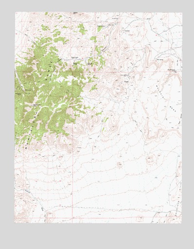
Montezuma Peak, NV USGS Topographic Map
Click on map above to begin viewing in our Map Viewer.

This topographic map contains these locations and features:
Feature Name Type Latitude Longitude GNIS ID View Map
Arizona MineMineN37.7177°W117.3331°853647View Map
Brewster MineMineN37.7285°W117.3520°856886View Map
Brickyard SpringSpringN37.7194°W117.3325°848506View Map
Bullion MineMineN37.7177°W117.3331°853645View Map
Burchard MineMineN37.7285°W117.3520°856892View Map
Caracas MineMineN37.7177°W117.3331°853646View Map
Carroll PeakSummitN37.6888°W117.3590°851633View Map
Congress MineMineN37.6374°W117.2620°853497View Map
Crocket MineMineN37.7285°W117.3520°856884View Map
Dago Joe SpringSpringN37.7192°W117.3217°839907View Map
GemfieldPopulated PlaceN37.7397°W117.2951°856029View Map
Hubbard MineMineN37.7285°W117.3520°856888View Map
Indian SpringsSpringN37.7416°W117.3086°848564View Map
Light MineMineN37.7285°W117.3520°856891View Map
Malpais MesaSummitN37.6797°W117.2759°841918View Map
MontezumaPopulated PlaceN37.7038°W117.3690°856088View Map
Montezuma MineMineN37.7016°W117.3679°853498View Map
Montezuma Mining DistrictCivilN37.7177°W117.3329°853499View Map
Montezuma PeakSummitN37.6947°W117.3623°842214View Map
Montezuma Post Office (historical)Post OfficeN37.7038°W117.3690°864834View Map
Montezuma RangeRangeN37.6466°W117.3731°854534View Map
Montezuma SpringSpringN37.7013°W117.3712°842215View Map
Mountain Queen MineMineN37.7285°W117.3520°856885View Map
Nevada Eagle MineMineN37.7127°W117.2931°854543View Map
Norfolk MineMineN37.7285°W117.3520°856889View Map
Osceola MineMineN37.7285°W117.3520°856887View Map
Red SpringsSpringN37.7440°W117.3088°851640View Map
Savage MineMineN37.7285°W117.3520°856883View Map
Slaughterhouse SpringSpringN37.7147°W117.2567°843758View Map
Southern MineMineN37.7285°W117.3520°856890View Map
Sulphur SpringSpringN37.7088°W117.2912°851626View Map
West SpringPopulated PlaceN37.7222°W117.2706°856171View Map

Note: Coordinates in the location and feature list above are referenced to NAD83 datum.


Copyright (C) 2008-2024 Ryan Niemi / Sunset Dynamics ... All Rights Reserved