TopoQuest Logo
Do you find TopoQuest useful?
Help keep TopoQuest running and adding new maps/features by donating!
Bitcoin:  19c7KJd3qBynnjoSw5npx9KScwjBe4ifkT
Litecoin:  LXs6TkuXGGXo1vDsWCkWVdjQX94eUKd6ui
Home View Maps Find Maps Find Places Resources & Links


Good Hope, South Carolina Topographic Map

USGS Map Title: Good Hope, SC
USGS Map MRC: 34081A8
DRG (GeoTIFF) Download: o34081a8.tif


Neighboring USGS Topographic Map Quads:


  Ninety Six, SC  
34082B1
 

  Dyson, SC  
34081B8
 

  Chappells, SC  
34081B7
 

  Kirksey, SC  
34082A1
 

  Good Hope, SC  
34081A8
 

  Saluda North, SC  
34081A7
 

  Limestone, SC  
33082H1
 

  Owdoms, SC  
33081H8
 

  Saluda South, SC  
33081H7


Map MRC Location:

N35°
W82°
N35°
W81°
H8 H7 H6 H5 H4 H3 H2 H1
G8 G7 G6 G5 G4 G3 G2 G1
F8 F7 F6 F5 F4 F3 F2 F1
E8 E7 E6 E5 E4 E3 E2 E1
D8 D7 D6 D5 D4 D3 D2 D1
C8 C7 C6 C5 C4 C3 C2 C1
B8 B7 B6 B5 B4 B3 B2 B1
A8 A7 A6 A5 A4 A3 A2 A1
N34°
W82°
N34°
W81°

Good Hope, SC USGS 1:24K Topographic Map Preview:
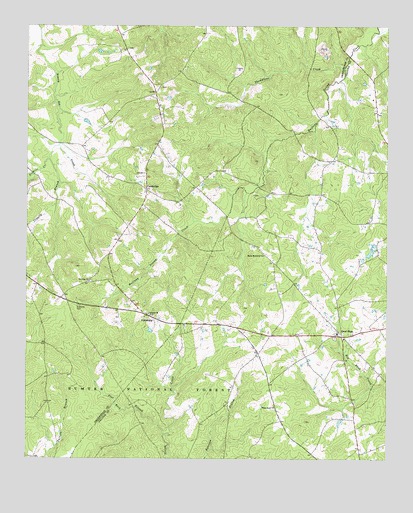
Good Hope, SC USGS Topographic Map
Click on map above to begin viewing in our Map Viewer.

This topographic map contains these locations and features:
Feature Name Type Latitude Longitude GNIS ID View Map
Adams PondReservoirN34.0601°W81.8782°1239051View Map
Adams Pond Dam D-1593DamN34.0601°W81.8782°1239050View Map
Antioch ChurchChurchN34.0418°W81.9573°1229354View Map
Brooks School (historical)SchoolN34.0824°W81.9582°1234057View Map
Butler Memorial ChurchChurchN34.0590°W81.9176°1247075View Map
CambridgePopulated PlaceN34.0776°W81.9584°1229503View Map
Cedar Grove School (historical)SchoolN34.0693°W81.9207°1232547View Map
Celestia (historical)Populated PlaceN34.0060°W81.9568°1232548View Map
Conally BranchStreamN34.0904°W81.9901°1229583View Map
Cooper Church (historical)ChurchN34.1068°W81.9537°1234078View Map
EulalaPopulated PlaceN34.0307°W81.9193°1232566View Map
Eulala School (historical)SchoolN34.0354°W81.9232°1232567View Map
Eulala School (historical)SchoolN34.0260°W81.9257°1232568View Map
Fairfax School (historical)SchoolN34.0832°W81.8768°1232570View Map
Fairview School (historical)SchoolN34.0907°W81.9540°1234106View Map
Flat Rock BranchStreamN34.0071°W81.9518°1247766View Map
FriendshipPopulated PlaceN34.0421°W81.9596°1231300View Map
Friendship CemeteryCemeteryN34.0404°W81.9587°1241311View Map
Friendship ChurchChurchN34.0410°W81.9587°1252135View Map
Good HopePopulated PlaceN34.0354°W81.8907°1245763View Map
Good Hope ChurchChurchN34.0362°W81.8921°1232577View Map
Mayson Fire and Rescue Number 300BuildingN34.0342°W81.8898°2578866View Map
Mount Greer School (historical)SchoolN34.0018°W81.9837°1234173View Map
Mount Olive ChurchChurchN34.0512°W81.9782°1249621View Map
Mount Olive School (historical)SchoolN34.0510°W81.9782°1234175View Map
Mountain CreekStreamN34.0210°W81.9490°1251999View Map
Oak Grove School (historical)SchoolN34.0951°W81.9860°1252140View Map
Sixmile CreekStreamN34.0907°W81.9890°1250912View Map
Thompsons CreekStreamN34.1132°W81.8898°1230410View Map
Traywick Church (historical)ChurchN34.0807°W81.8979°1232642View Map
Trinity Rosenwald School (historical)SchoolN34.0371°W81.8790°1232643View Map
Trinity School (historical)SchoolN34.0349°W81.8896°1232644View Map
White Rock ChurchChurchN34.0151°W81.9137°1230491View Map

Note: Coordinates in the location and feature list above are referenced to NAD83 datum.


Copyright (C) 2008-2025 Ryan Niemi / Sunset Dynamics ... All Rights Reserved