TopoQuest Logo
Do you find TopoQuest useful?
Help keep TopoQuest running and adding new maps/features by donating!
Bitcoin:  19c7KJd3qBynnjoSw5npx9KScwjBe4ifkT
Litecoin:  LXs6TkuXGGXo1vDsWCkWVdjQX94eUKd6ui
Home View Maps Find Maps Find Places Resources & Links


Goose Lake, Minnesota Topographic Map

USGS Map Title: Goose Lake, MN
USGS Map MRC: 47093B8
DRG (GeoTIFF) Download: o47093b8.tif


Neighboring USGS Topographic Map Quads:


  Ball Club, MN  
47093C8
 

  Deer River, MN  
47093C7
 

  Boy River, MN  
47094B1
 

  Goose Lake, MN  
47093B8


Map MRC Location:

N48°
W94°
N48°
W93°
H8 H7 H6 H5 H4 H3 H2 H1
G8 G7 G6 G5 G4 G3 G2 G1
F8 F7 F6 F5 F4 F3 F2 F1
E8 E7 E6 E5 E4 E3 E2 E1
D8 D7 D6 D5 D4 D3 D2 D1
C8 C7 C6 C5 C4 C3 C2 C1
B8 B7 B6 B5 B4 B3 B2 B1
A8 A7 A6 A5 A4 A3 A2 A1
N47°
W94°
N47°
W93°

Goose Lake, MN USGS 1:24K Topographic Map Preview:
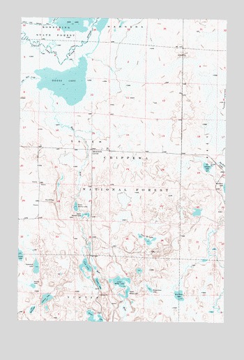
Goose Lake, MN USGS Topographic Map
Click on map above to begin viewing in our Map Viewer.

This topographic map contains these locations and features:
Feature Name Type Latitude Longitude GNIS ID View Map
Bear RiverStreamN47.2219°W93.9813°655289View Map
Cedar LakeLakeN47.1409°W93.9516°655684View Map
Chain O' LakesLakeN47.1583°W93.9208°655693View Map
Dewey LakeLakeN47.1394°W93.9910°655986View Map
Dirty Nose LakeLakeN47.1361°W93.9026°656003View Map
Elevenmile CornerPopulated PlaceN47.1958°W93.9563°656139View Map
Goose LakeLakeN47.2235°W93.9728°656411View Map
Johnson LakeLakeN47.1890°W93.8866°656808View Map
Johnson Lake Trail SystemTrailN47.1833°W93.9147°659317View Map
Little Bear CreekStreamN47.2244°W93.9880°657030View Map
Lower Menton LakeLakeN47.1722°W93.9656°657241View Map
Lower Milton LakeLakeN47.1415°W93.9377°657242View Map
Mink LakeLakeN47.1296°W93.9914°657405View Map
Mud Goose Lake Wildlife Management AreaParkN47.2458°W93.9947°659369View Map
Sullivan LakeLakeN47.1343°W93.9829°658536View Map
Tamarack LakeLakeN47.1471°W93.9891°658605View Map
Taylor LakeLakeN47.1525°W93.9995°658620View Map
Tidd LakeLakeN47.1474°W93.9594°658687View Map
Township of SalemCivilN47.1962°W93.9659°665537View Map
Upper Menton LakeLakeN47.1689°W93.9597°658821View Map
Upper Milton LakeLakeN47.1369°W93.9347°658822View Map
Zimmerman LakeLakeN47.1387°W93.9204°659086View Map

Note: Coordinates in the location and feature list above are referenced to NAD83 datum.


Copyright (C) 2008-2025 Ryan Niemi / Sunset Dynamics ... All Rights Reserved