TopoQuest Logo
Do you find TopoQuest useful?
Help keep TopoQuest running and adding new maps/features by donating!
Bitcoin:  19c7KJd3qBynnjoSw5npx9KScwjBe4ifkT
Litecoin:  LXs6TkuXGGXo1vDsWCkWVdjQX94eUKd6ui
Home View Maps Find Maps Find Places Resources & Links


Deer River, Minnesota Topographic Map

USGS Map Title: Deer River, MN
USGS Map MRC: 47093C7
DRG (GeoTIFF) Download: o47093c7.tif


Neighboring USGS Topographic Map Quads:


  Deer River NE, MN  
47093D7


  Ball Club, MN  
47093C8
 

  Deer River, MN  
47093C7
 

  Cohasset West, MN  
47093C6
 

  Goose Lake, MN  
47093B8


  Siseebakwet Lake, MN  
47093B6


Map MRC Location:

N48°
W94°
N48°
W93°
H8 H7 H6 H5 H4 H3 H2 H1
G8 G7 G6 G5 G4 G3 G2 G1
F8 F7 F6 F5 F4 F3 F2 F1
E8 E7 E6 E5 E4 E3 E2 E1
D8 D7 D6 D5 D4 D3 D2 D1
C8 C7 C6 C5 C4 C3 C2 C1
B8 B7 B6 B5 B4 B3 B2 B1
A8 A7 A6 A5 A4 A3 A2 A1
N47°
W94°
N47°
W93°

Deer River, MN USGS 1:24K Topographic Map Preview:
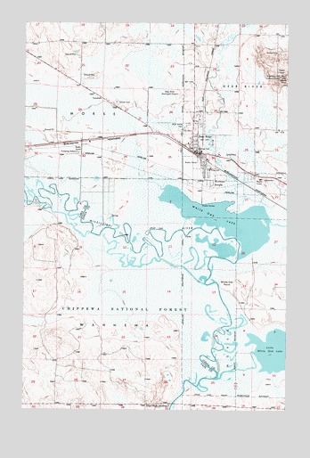
Deer River, MN USGS Topographic Map
Click on map above to begin viewing in our Map Viewer.

This topographic map contains these locations and features:
Feature Name Type Latitude Longitude GNIS ID View Map
Bethany Lutheran ChurchChurchN47.3389°W93.7956°2095397View Map
Blueberry Hill Lookout TowerTowerN47.3577°W93.7538°659790View Map
Blueberry Hills Golf CourseLocaleN47.3611°W93.7833°2095391View Map
City of Deer RiverCivilN47.3409°W93.7961°2394489View Map
City of ZempleCivilN47.3197°W93.7850°2397399View Map
Days High LandingPopulated PlaceN47.2522°W93.8058°655943View Map
Deer RiverPopulated PlaceN47.3330°W93.7927°655967View Map
Deer RiverStreamN47.3147°W93.7794°655968View Map
Deer RiverLocaleN47.3328°W93.7922°2095403View Map
Deer River AmbulanceBuildingN47.3439°W93.7923°2721246View Map
Deer River Bible ChurchChurchN47.3331°W93.7925°2095386View Map
Deer River Church of GodChurchN47.3194°W93.7883°2095398View Map
Deer River District Ranger OfficeLocaleN47.3463°W93.7955°659438View Map
Deer River Fire DepartmentBuildingN47.3368°W93.7957°2666645View Map
Deer River High SchoolSchoolN47.3344°W93.7917°2095408View Map
Deer River Municipal Airport (historical)AirportN47.3522°W93.8002°659425View Map
Deer River Police DepartmentBuildingN47.3323°W93.7913°2095395View Map
Deer River Post OfficePost OfficeN47.3336°W93.7941°2095396View Map
Deer River Wayside ParkParkN47.3361°W93.8000°2096935View Map
Duluth Clinic - Deer RiverHospitalN47.3417°W93.7953°2095394View Map
Essentia Health - Deer RiverHospitalN47.3440°W93.7921°2095389View Map
Evangelical Covenant ChurchChurchN47.3331°W93.7906°2095402View Map
Homestead Nursing HomeHospitalN47.3444°W93.7922°2095388View Map
King Elementary SchoolSchoolN47.3281°W93.7867°656894View Map
Liston Evergreen Mobile Home ParkPopulated PlaceN47.3419°W93.7956°2095393View Map
Little White Oak LakeLakeN47.2691°W93.7547°657151View Map
Olivet CemeteryCemeteryN47.3494°W93.8316°657669View Map
Redeemer Lutheran ChurchChurchN47.3183°W93.7872°2095399View Map
Richard R Shadley Memorial CemeteryCemeteryN47.2825°W93.7591°2095270View Map
Saint Augustine ChurchChurchN47.3331°W93.7925°2095385View Map
Saint Mary's ChurchChurchN47.3342°W93.7931°2095400View Map
Township of MorseCivilN47.3512°W93.8434°665042View Map
Township of WahnenaCivilN47.2858°W93.8508°665893View Map
United Methodist ChurchChurchN47.3336°W93.7931°2095401View Map
Unorganized Territory of WahnenaCivilN47.2731°W93.8640°2393826View Map
White Oak LakeLakeN47.3117°W93.7797°658989View Map
White Oak PointCapeN47.2911°W93.7783°658990View Map
ZemplePopulated PlaceN47.3230°W93.7855°659083View Map

Note: Coordinates in the location and feature list above are referenced to NAD83 datum.


Copyright (C) 2008-2025 Ryan Niemi / Sunset Dynamics ... All Rights Reserved