TopoQuest Logo
Do you find TopoQuest useful?
Help keep TopoQuest running and adding new maps/features by donating!
Bitcoin:  19c7KJd3qBynnjoSw5npx9KScwjBe4ifkT
Litecoin:  LXs6TkuXGGXo1vDsWCkWVdjQX94eUKd6ui
Home View Maps Find Maps Find Places Resources & Links


Gooseberry Park, Montana Topographic Map

USGS Map Title: Gooseberry Park, MT
USGS Map MRC: 48113A1
DRG (GeoTIFF) Download: o48113a1.tif


Neighboring USGS Topographic Map Quads:


  Crescent Cliff, MT  
48113B2
 

  Morningstar Mountain, MT  
48113B1
 

  Swift Reservoir, MT  
48112B8
 

  Gable Peaks, MT  
48113A2
 

  Gooseberry Park, MT  
48113A1
 

  Gateway Pass, MT  
48112A8
 

  Trilobite Peak, MT  
47113H2
 

  Pentagon Mountain, MT  
47113H1
 

  Porphyry Reef, MT  
47112H8


Map MRC Location:

N49°
W114°
N49°
W113°
H8 H7 H6 H5 H4 H3 H2 H1
G8 G7 G6 G5 G4 G3 G2 G1
F8 F7 F6 F5 F4 F3 F2 F1
E8 E7 E6 E5 E4 E3 E2 E1
D8 D7 D6 D5 D4 D3 D2 D1
C8 C7 C6 C5 C4 C3 C2 C1
B8 B7 B6 B5 B4 B3 B2 B1
A8 A7 A6 A5 A4 A3 A2 A1
N48°
W114°
N48°
W113°

Gooseberry Park, MT USGS 1:24K Topographic Map Preview:
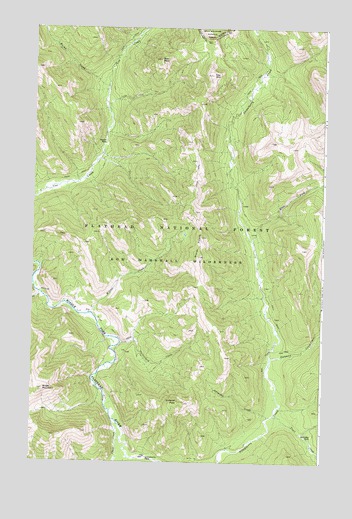
Gooseberry Park, MT USGS Topographic Map
Click on map above to begin viewing in our Map Viewer.

This topographic map contains these locations and features:
Feature Name Type Latitude Longitude GNIS ID View Map
Bear PeakSummitN48.1161°W113.0706°768605View Map
Burnt CreekStreamN48.1077°W113.0931°780634View Map
Cap MountainSummitN48.1116°W113.0484°769581View Map
Clack CreekStreamN48.0122°W113.0895°781302View Map
East Fork Strawberry CreekStreamN48.0641°W113.0309°782908View Map
Gateway CreekStreamN48.0297°W113.0223°783865View Map
Gooseberry ParkFlatN48.0010°W113.0757°2761681View Map
Grimsley CreekStreamN48.0130°W113.0231°771997View Map
Grimsley ParkFlatN48.0072°W113.0070°771998View Map
Pale CreekStreamN48.0488°W113.1223°788595View Map
Ringer MountainSummitN48.0211°W113.1198°789596View Map
Slideout PeakSummitN48.0169°W113.0592°776643View Map
Switchback CreekStreamN48.0347°W113.0862°777384View Map
Trail CreekStreamN48.0133°W113.0203°792319View Map
Wapiti ParkFlatN48.0913°W113.0937°778099View Map
Winter CreekStreamN48.0425°W113.1001°778607View Map
Winter PointsSummitN48.0591°W113.0537°778609View Map

Note: Coordinates in the location and feature list above are referenced to NAD83 datum.


Copyright (C) 2008-2024 Ryan Niemi / Sunset Dynamics ... All Rights Reserved