TopoQuest Logo
Do you find TopoQuest useful?
Help keep TopoQuest running and adding new maps/features by donating!
Bitcoin:  19c7KJd3qBynnjoSw5npx9KScwjBe4ifkT
Litecoin:  LXs6TkuXGGXo1vDsWCkWVdjQX94eUKd6ui
Home View Maps Find Maps Find Places Resources & Links


Morningstar Mountain, Montana Topographic Map

USGS Map Title: Morningstar Mountain, MT
USGS Map MRC: 48113B1
DRG (GeoTIFF) Download: o48113b1.tif


Neighboring USGS Topographic Map Quads:


  Hyde Creek, MT  
48113C2
 

  Half Dome Crag, MT  
48113C1
 

  Mitten Lake, MT  
48112C8
 

  Crescent Cliff, MT  
48113B2
 

  Morningstar Mountain, MT  
48113B1
 

  Swift Reservoir, MT  
48112B8
 

  Gable Peaks, MT  
48113A2
 

  Gooseberry Park, MT  
48113A1
 

  Gateway Pass, MT  
48112A8


Map MRC Location:

N49°
W114°
N49°
W113°
H8 H7 H6 H5 H4 H3 H2 H1
G8 G7 G6 G5 G4 G3 G2 G1
F8 F7 F6 F5 F4 F3 F2 F1
E8 E7 E6 E5 E4 E3 E2 E1
D8 D7 D6 D5 D4 D3 D2 D1
C8 C7 C6 C5 C4 C3 C2 C1
B8 B7 B6 B5 B4 B3 B2 B1
A8 A7 A6 A5 A4 A3 A2 A1
N48°
W114°
N48°
W113°

Morningstar Mountain, MT USGS 1:24K Topographic Map Preview:
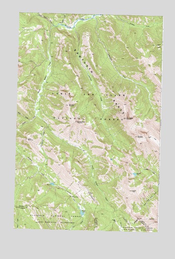
Morningstar Mountain, MT USGS Topographic Map
Click on map above to begin viewing in our Map Viewer.

This topographic map contains these locations and features:
Feature Name Type Latitude Longitude GNIS ID View Map
Badger PassGapN48.1305°W113.0376°779247View Map
Beaver LakeLakeN48.1350°W113.0665°779625View Map
Blue LakeLakeN48.1514°W113.0927°780154View Map
Crucifixion CreekStreamN48.1841°W113.0976°781941View Map
Curly Bear MountainSummitN48.1969°W113.0806°781994View Map
Elbow CreekStreamN48.1938°W113.1087°783024View Map
Elbow MountainSummitN48.1769°W113.1151°783029View Map
Emerald LakeLakeN48.1583°W113.0218°783177View Map
Family PeakSummitN48.1486°W113.0237°783301View Map
Goofy GulchValleyN48.1875°W113.1129°784103View Map
Limestone CreekStreamN48.2489°W113.0606°786148View Map
Lonesome CreekStreamN48.2430°W113.0776°786507View Map
Morningstar MountainSummitN48.1902°W113.0306°787695View Map
Muskrat Creek TrailTrailN48.1411°W113.0715°787884View Map
Muskrat PassGapN48.1444°W113.0756°787885View Map
North Badger CreekStreamN48.2430°W113.0959°788062View Map
Runner GulchValleyN48.2436°W113.0890°789855View Map
Scarface MountainSummitN48.1800°W113.0201°790104View Map
South Badger CreekStreamN48.2430°W113.0962°790874View Map
Spotted Eagle MountainSummitN48.1877°W113.0726°791183View Map

Note: Coordinates in the location and feature list above are referenced to NAD83 datum.


Copyright (C) 2008-2024 Ryan Niemi / Sunset Dynamics ... All Rights Reserved