TopoQuest Logo
Do you find TopoQuest useful?
Help keep TopoQuest running and adding new maps/features by donating!
Bitcoin:  19c7KJd3qBynnjoSw5npx9KScwjBe4ifkT
Litecoin:  LXs6TkuXGGXo1vDsWCkWVdjQX94eUKd6ui
Home View Maps Find Maps Find Places Resources & Links


Gracey, Kentucky Topographic Map

USGS Map Title: Gracey, KY
USGS Map MRC: 36087H6
DRG (GeoTIFF) Download: o36087h6.tif


Neighboring USGS Topographic Map Quads:


  Princeton East, KY  
37087A7
 

  Dawson Springs SW, KY  
37087A6
 

  Dawson Springs SE, KY  
37087A5
 

  Cobb, KY  
36087H7
 

  Gracey, KY  
36087H6
 

  Pleasant Green Hill, KY  
36087H5
 

  Cadiz, KY  
36087G7
 

  Caledonia, KY  
36087G6
 

  Church Hill, KY  
36087G5


Map MRC Location:

N37°
W88°
N37°
W87°
H8 H7 H6 H5 H4 H3 H2 H1
G8 G7 G6 G5 G4 G3 G2 G1
F8 F7 F6 F5 F4 F3 F2 F1
E8 E7 E6 E5 E4 E3 E2 E1
D8 D7 D6 D5 D4 D3 D2 D1
C8 C7 C6 C5 C4 C3 C2 C1
B8 B7 B6 B5 B4 B3 B2 B1
A8 A7 A6 A5 A4 A3 A2 A1
N36°
W88°
N36°
W87°

Gracey, KY USGS 1:24K Topographic Map Preview:
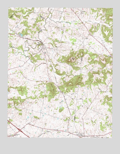
Gracey, KY USGS Topographic Map
Click on map above to begin viewing in our Map Viewer.

This topographic map contains these locations and features:
Feature Name Type Latitude Longitude GNIS ID View Map
BainbridgePopulated PlaceN36.9956°W87.6611°507435View Map
BuffaloPopulated PlaceN36.9195°W87.6861°507612View Map
Buffalo KnobSummitN36.9209°W87.6958°488330View Map
Buie KnobSummitN36.9512°W87.6728°488341View Map
Burgess CemeteryCemeteryN36.9124°W87.6639°488416View Map
CeruleanPopulated PlaceN36.9595°W87.7100°489295View Map
Cerulean Census Designated PlaceCensusN36.9552°W87.7089°2629588View Map
Cerulean Volunteer Fire DepartmentBuildingN36.9618°W87.7109°2636957View Map
Childress CemeteryCemeteryN36.9889°W87.7214°489474View Map
Cornelius CemeteryCemeteryN36.9614°W87.6253°490119View Map
Cox CemeteryCemeteryN36.8906°W87.6611°490215View Map
Edwards CemeteryCemeteryN36.8931°W87.7475°491577View Map
GraceyPopulated PlaceN36.8781°W87.6622°493072View Map
Gracey Census Designated PlaceCensusN36.8792°W87.6639°2629622View Map
Gracey Volunteer Fire DepartmentBuildingN36.8773°W87.6593°2636930View Map
Horse CreekStreamN36.9545°W87.7303°494573View Map
Ladd CemeteryCemeteryN36.9256°W87.7186°495899View Map
Lander CemeteryCemeteryN36.9056°W87.6592°495953View Map
McCarroll Hill Baptist ChurchChurchN36.9531°W87.6267°497775View Map
Miller CemeteryCemeteryN36.9459°W87.6631°498323View Map
MontgomeryPopulated PlaceN36.8781°W87.7406°508628View Map
Montgomery ChurchChurchN36.8884°W87.7250°498507View Map
Roach CemeteryCemeteryN36.8823°W87.6892°502002View Map
Rocky Ridge ChurchChurchN36.8770°W87.7406°502261View Map
Stewart CemeteryCemeteryN36.9603°W87.6731°504380View Map
Sugar CreekStreamN36.9864°W87.6883°504654View Map
Thomas CemeteryCemeteryN36.9625°W87.6897°505161View Map
Turner CemeteryCemeteryN36.9573°W87.7053°505652View Map
Turner CemeteryCemeteryN36.9978°W87.6983°505653View Map
Wallace ForkStreamN36.9889°W87.6989°506143View Map
West Union ChurchChurchN36.8875°W87.6289°506480View Map
Wright CemeteryCemeteryN36.9737°W87.7283°507161View Map
WZZF-FM (Hopkinsville)TowerN36.9495°W87.6717°517962View Map

Note: Coordinates in the location and feature list above are referenced to NAD83 datum.


Copyright (C) 2008-2024 Ryan Niemi / Sunset Dynamics ... All Rights Reserved