TopoQuest Logo
Do you find TopoQuest useful?
Help keep TopoQuest running and adding new maps/features by donating!
Bitcoin:  19c7KJd3qBynnjoSw5npx9KScwjBe4ifkT
Litecoin:  LXs6TkuXGGXo1vDsWCkWVdjQX94eUKd6ui
Home View Maps Find Maps Find Places Resources & Links


Princeton East, Kentucky Topographic Map

USGS Map Title: Princeton East, KY
USGS Map MRC: 37087A7
DRG (GeoTIFF) Download: o37087a7.tif


Neighboring USGS Topographic Map Quads:


  Crider, KY  
37087B8
 

  Olney, KY  
37087B7
 

  Dawson Springs, KY  
37087B6
 

  Princeton West, KY  
37087A8
 

  Princeton East, KY  
37087A7
 

  Dawson Springs SW, KY  
37087A6
 

  Lamasco, KY  
36087H8
 

  Cobb, KY  
36087H7
 

  Gracey, KY  
36087H6


Map MRC Location:

N38°
W88°
N38°
W87°
H8 H7 H6 H5 H4 H3 H2 H1
G8 G7 G6 G5 G4 G3 G2 G1
F8 F7 F6 F5 F4 F3 F2 F1
E8 E7 E6 E5 E4 E3 E2 E1
D8 D7 D6 D5 D4 D3 D2 D1
C8 C7 C6 C5 C4 C3 C2 C1
B8 B7 B6 B5 B4 B3 B2 B1
A8 A7 A6 A5 A4 A3 A2 A1
N37°
W88°
N37°
W87°

Princeton East, KY USGS 1:24K Topographic Map Preview:
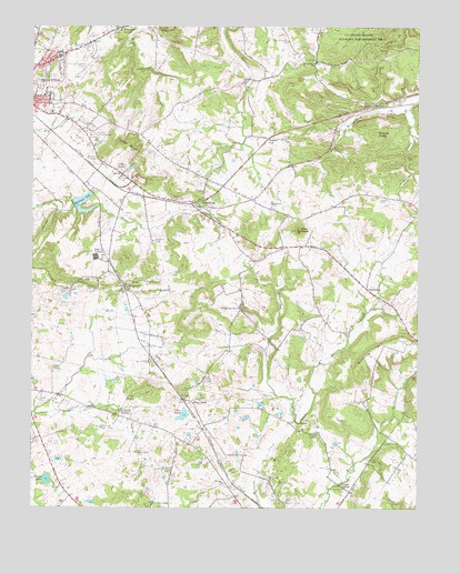
Princeton East, KY USGS Topographic Map
Click on map above to begin viewing in our Map Viewer.

This topographic map contains these locations and features:
Feature Name Type Latitude Longitude GNIS ID View Map
Baker CemeteryCemeteryN37.0648°W87.7792°486243View Map
Bald KnobSummitN37.0725°W87.7886°486265View Map
Battle CreekStreamN37.0223°W87.7881°486471View Map
Beulah Hill Missionary Baptist ChurchChurchN37.1156°W87.7839°487056View Map
Bond CemeteryCemeteryN37.0284°W87.8436°487655View Map
Cantrell CemeteryCemeteryN37.0448°W87.8372°488902View Map
Cantrell CreekStreamN37.0245°W87.8736°488903View Map
Ceda BluffCliffN37.0937°W87.8442°489161View Map
Cedar BluffPopulated PlaceN37.0884°W87.8447°507670View Map
Cedar Hill CemeteryCemeteryN37.1131°W87.8711°489218View Map
ClaxtonPopulated PlaceN37.1042°W87.7661°507709View Map
Cook CemeteryCemeteryN37.0692°W87.7522°489999View Map
Craven CreekStreamN37.0009°W87.8014°490298View Map
Dance Nichols CemeteryCemeteryN37.1212°W87.7922°490555View Map
Dawson CemeteryCemeteryN37.0953°W87.8545°490687View Map
Dripping SpringSpringN37.0516°W87.8067°491118View Map
Dunning CemeteryCemeteryN37.0434°W87.7531°491333View Map
Dunning HillSummitN37.0412°W87.7645°491336View Map
Eison BranchStreamN37.1035°W87.7529°491599View Map
FriendshipPopulated PlaceN37.0570°W87.7664°508040View Map
Glass CemeteryCemeteryN37.0798°W87.7625°492878View Map
Groom SpringSpringN37.0063°W87.7749°493418View Map
Howard CemeteryCemeteryN37.0595°W87.7611°494658View Map
Lamb CemeteryCemeteryN37.0962°W87.7939°495934View Map
Lebanon (historical)Populated PlaceN37.0781°W87.7973°2743601View Map
Lebanon Baptist ChurchChurchN37.0790°W87.7973°496135View Map
McConnell CemeteryCemeteryN37.0053°W87.7733°497798View Map
McGowanPopulated PlaceN37.0578°W87.8445°508579View Map
Midway ChurchChurchN37.0065°W87.8128°498169View Map
Millwood CemeteryCemeteryN37.0078°W87.7983°498393View Map
O'Hara CemeteryCemeteryN37.0862°W87.8458°499647View Map
Otter PondPopulated PlaceN37.0278°W87.8231°508764View Map
Otter PondLakeN37.0241°W87.8258°500033View Map
Perry CemeteryCemeteryN37.0209°W87.8525°500424View Map
Pollard CemeteryCemeteryN37.0189°W87.7850°501008View Map
Pool CemeteryCemeteryN37.0800°W87.8297°501066View Map
Princeton DivisionCivilN37.0926°W87.8315°1937211View Map
Princeton-Caldwell County AirportAirportN37.1139°W87.8587°517477View Map
Pumpkin CenterPopulated PlaceN37.1242°W87.8478°501426View Map
Railroad LakeReservoirN37.0794°W87.8592°501528View Map
Rowland CemeteryCemeteryN37.0692°W87.8356°502430View Map
ScottsburgPopulated PlaceN37.0787°W87.8214°509022View Map
Smith LakeLakeN37.0073°W87.8699°503800View Map
Tandy CemeteryCemeteryN37.0281°W87.8725°504937View Map
Wadlington CemeteryCemeteryN37.0142°W87.8406°506095View Map
Walche CutPopulated PlaceN37.0964°W87.7978°509303View Map
Wede BranchStreamN37.0392°W87.8567°506353View Map
Wildcat RidgeRidgeN37.0978°W87.7633°506742View Map
WPKY-AM (Princeton)TowerN37.1206°W87.8586°517654View Map
WPKY-FM (Princeton)TowerN37.1206°W87.8586°517733View Map

Note: Coordinates in the location and feature list above are referenced to NAD83 datum.


Copyright (C) 2008-2024 Ryan Niemi / Sunset Dynamics ... All Rights Reserved