TopoQuest Logo
Do you find TopoQuest useful?
Help keep TopoQuest running and adding new maps/features by donating!
Bitcoin:  19c7KJd3qBynnjoSw5npx9KScwjBe4ifkT
Litecoin:  LXs6TkuXGGXo1vDsWCkWVdjQX94eUKd6ui
Home View Maps Find Maps Find Places Resources & Links


Grand Bluff, Texas Topographic Map

USGS Map Title: Grand Bluff, TX
USGS Map MRC: 32094C3
DRG (GeoTIFF) Download: o32094c3.tif


Neighboring USGS Topographic Map Quads:


  Darco, TX  
32094D4
 

  Colliers Creek, TX  
32094D3
 

  Stricklin Springs, TX  
32094D2
 

  Harris Chapel, TX  
32094C4
 

  Grand Bluff, TX  
32094C3
 

  De Berry, TX  
32094C2
 

  Beckville, TX  
32094B4
 

  Carthage, TX  
32094B3
 

  River Hill, TX  
32094B2


Map MRC Location:

N33°
W95°
N33°
W94°
H8 H7 H6 H5 H4 H3 H2 H1
G8 G7 G6 G5 G4 G3 G2 G1
F8 F7 F6 F5 F4 F3 F2 F1
E8 E7 E6 E5 E4 E3 E2 E1
D8 D7 D6 D5 D4 D3 D2 D1
C8 C7 C6 C5 C4 C3 C2 C1
B8 B7 B6 B5 B4 B3 B2 B1
A8 A7 A6 A5 A4 A3 A2 A1
N32°
W95°
N32°
W94°

Grand Bluff, TX USGS 1:24K Topographic Map Preview:
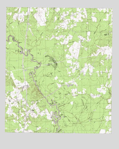
Grand Bluff, TX USGS Topographic Map
Click on map above to begin viewing in our Map Viewer.

This topographic map contains these locations and features:
Feature Name Type Latitude Longitude GNIS ID View Map
Akins LakeLakeN32.2660°W94.3069°1359659View Map
Akins LakeLakeN32.2612°W94.3168°1350922View Map
Alligator LakeLakeN32.2652°W94.3146°1351023View Map
Baker Fish HoleBendN32.3196°W94.3333°1351433View Map
Basin LakeLakeN32.2765°W94.3194°1351572View Map
Beckville Volunteer Fire DepartmentBuildingN32.2714°W94.3454°2655413View Map
Black LakeLakeN32.2781°W94.3132°1352336View Map
Black ShoalsBarN32.3152°W94.3396°1352353View Map
Caddo CreekStreamN32.2977°W94.3374°1372867View Map
Caney CreekStreamN32.3440°W94.2660°1372923View Map
Caney SloughGutN32.2918°W94.3041°1353748View Map
Carthage Gas FieldOilfieldN32.2921°W94.3560°1353902View Map
Clear LakeLakeN32.2814°W94.3172°1354639View Map
Cook LakeLakeN32.2704°W94.3163°1354903View Map
Crooked BranchGutN32.3002°W94.3105°1355377View Map
Crossroads CemeteryCemeteryN32.3185°W94.2727°1355411View Map
Crossroads SchoolSchoolN32.3096°W94.2727°1355416View Map
Dillard CreekStreamN32.2593°W94.3563°1356023View Map
Dry SloughGutN32.2602°W94.2874°1356376View Map
Eightmile CreekStreamN32.3310°W94.3463°1373598View Map
Gandia BranchStreamN32.3043°W94.3430°1357850View Map
Grand BluffPopulated PlaceN32.2718°W94.3433°1358252View Map
Grand Bluff CemeteryCemeteryN32.2807°W94.3288°1358253View Map
Greer SloughStreamN32.2735°W94.3124°1358422View Map
Hodge SloughStreamN32.2521°W94.2821°1359330View Map
HortonPopulated PlaceN32.3110°W94.2874°2034902View Map
Jernigan LakeLakeN32.2527°W94.3099°1360227View Map
Kelly CampLocaleN32.2702°W94.3108°1360538View Map
Martin CreekStreamN32.2554°W94.3121°1374808View Map
Massey PondsReservoirN32.2986°W94.3014°1362266View Map
Minnow PondsLakeN32.2935°W94.3548°1374968View Map
Mud LakesLakeN32.2826°W94.3201°1363412View Map
Piney Grove CemeteryCemeteryN32.3599°W94.3502°1365321View Map
Rock Hill ChurchChurchN32.2815°W94.3696°1366661View Map
Shady Grove CemeteryCemeteryN32.3685°W94.2988°1368017View Map
Shady Grove SchoolSchoolN32.3538°W94.2985°1368033View Map
Shoemaker BluffCliffN32.3393°W94.3591°1368221View Map
Straight LakeLakeN32.2667°W94.3074°1369260View Map
Sunny Grove ChurchChurchN32.3721°W94.3127°1369402View Map
Taylor BranchStreamN32.3488°W94.3308°1369637View Map
Twin RockPillarN32.3221°W94.3446°1370361View Map
Walnut Springs ChurchChurchN32.3110°W94.2863°1370829View Map
Watt ShoalsBarN32.3010°W94.3413°1370944View Map
Wattle Duck PondReservoirN32.3236°W94.3213°1370945View Map
West Camp BendBendN32.3302°W94.3571°1371086View Map

Note: Coordinates in the location and feature list above are referenced to NAD83 datum.


Copyright (C) 2008-2025 Ryan Niemi / Sunset Dynamics ... All Rights Reserved