TopoQuest Logo
Do you find TopoQuest useful?
Help keep TopoQuest running and adding new maps/features by donating!
Bitcoin:  19c7KJd3qBynnjoSw5npx9KScwjBe4ifkT
Litecoin:  LXs6TkuXGGXo1vDsWCkWVdjQX94eUKd6ui
Home View Maps Find Maps Find Places Resources & Links


Grand Marais, Michigan Topographic Map

USGS Map Title: Grand Marais, MI
USGS Map MRC: 46085F8
DRG (GeoTIFF) Download: o46085f8.tif


Neighboring USGS Topographic Map Quads:


  Grand Sable Lake, MI  
46086F1
 

  Grand Marais, MI  
46085F8
 

  Grand Marais NE, MI  
46085F7
 

  Au Sable Point SE, MI  
46086E1
 

  Nawakwa Lake, MI  
46085E8
 

  Grand Marais SE, MI  
46085E7


Map MRC Location:

N47°
W86°
N47°
W85°
H8 H7 H6 H5 H4 H3 H2 H1
G8 G7 G6 G5 G4 G3 G2 G1
F8 F7 F6 F5 F4 F3 F2 F1
E8 E7 E6 E5 E4 E3 E2 E1
D8 D7 D6 D5 D4 D3 D2 D1
C8 C7 C6 C5 C4 C3 C2 C1
B8 B7 B6 B5 B4 B3 B2 B1
A8 A7 A6 A5 A4 A3 A2 A1
N46°
W86°
N46°
W85°

Grand Marais, MI USGS 1:24K Topographic Map Preview:
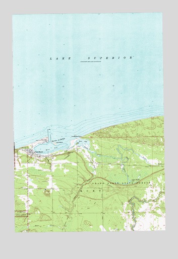
Grand Marais, MI USGS Topographic Map
Click on map above to begin viewing in our Map Viewer.

This topographic map contains these locations and features:
Feature Name Type Latitude Longitude GNIS ID View Map
Baker CreekStreamN46.6272°W85.9588°620474View Map
Baker CreekStreamN46.6700°W85.9346°620475View Map
Bird GraveCemeteryN46.6737°W85.9470°2774391View Map
Burt Township Ambulance ServiceBuildingN46.6741°W85.9845°2662024View Map
Burt Township Fire DepartmentBuildingN46.6741°W85.9845°2626946View Map
Burt Township Medical CenterHospitalN46.6692°W85.9806°2352329View Map
Burt Township SchoolSchoolN46.6681°W85.9783°2351997View Map
Carpenter CreekStreamN46.6697°W85.9741°622760View Map
Chipmunk CreekStreamN46.6722°W85.9566°623206View Map
Chipmunk FallsFallsN46.6697°W85.9557°623209View Map
East BayBayN46.6766°W85.9429°625114View Map
Endress Oil CompanyLocaleN46.6675°W85.9677°1617164View Map
First Lutheran ChurchChurchN46.6728°W85.9894°2352335View Map
Gitche Gumee MuseumBuildingN46.6725°W85.9867°2351996View Map
Grand MaraisPopulated PlaceN46.6708°W85.9852°627096View Map
Grand Marais Air Force Station (historical)MilitaryN46.6636°W85.9831°2087678View Map
Grand Marais CreekStreamN46.6667°W85.9107°627097View Map
Grand Marais Historical MarkerParkN46.6725°W85.9839°2352400View Map
Grand Marais Historical Society MuseumBuildingN46.6778°W85.9725°2351994View Map
Grand Marais LakeLakeN46.6537°W85.9034°627099View Map
Grand Marais Post OfficePost OfficeN46.6703°W85.9828°2352332View Map
Grand Marais Station (historical)LocaleN46.6689°W85.9842°2351995View Map
Grand Marais United Methodist ChurchChurchN46.6697°W85.9844°2352334View Map
Harbor of RefugeBayN46.6783°W85.9635°627750View Map
Holy Rosary Catholic CemeteryCemeteryN46.6639°W85.9936°2352394View Map
Holy Rosary ParishChurchN46.6686°W85.9783°2352333View Map
Kahle ParkLocaleN46.6750°W85.9485°629432View Map
Lonesome PointCapeN46.6786°W85.9443°630901View Map
Lost IslandIslandN46.6755°W85.9660°631078View Map
Outer LightLocaleN46.6836°W85.9716°1617165View Map
Rose Hill CemeteryCemeteryN46.6725°W85.9483°2352390View Map
Sucker RiverStreamN46.6739°W85.9427°639011View Map
West BayBayN46.6722°W85.9691°1616014View Map
Woodland ParkLocaleN46.6733°W85.9907°1616760View Map
Woodland Park CampgroundsLocaleN46.6731°W85.9886°2351993View Map

Note: Coordinates in the location and feature list above are referenced to NAD83 datum.


Copyright (C) 2008-2025 Ryan Niemi / Sunset Dynamics ... All Rights Reserved