TopoQuest Logo
Do you find TopoQuest useful?
Help keep TopoQuest running and adding new maps/features by donating!
Bitcoin:  19c7KJd3qBynnjoSw5npx9KScwjBe4ifkT
Litecoin:  LXs6TkuXGGXo1vDsWCkWVdjQX94eUKd6ui
Home View Maps Find Maps Find Places Resources & Links


Granger Lake, Texas Topographic Map

USGS Map Title: Granger Lake, TX
USGS Map MRC: 30097F3
DRG (GeoTIFF) Download: o30097f3.tif


Neighboring USGS Topographic Map Quads:


  Bartlett, TX  
30097G4
 

  Davilla, TX  
30097G3
 

  Sharp, TX  
30097G2
 

  Granger, TX  
30097F4
 

  Granger Lake, TX  
30097F3
 

  San Gabriel, TX  
30097F2
 

  Taylor, TX  
30097E4
 

  Thrall, TX  
30097E3
 

  Thorndale, TX  
30097E2


Map MRC Location:

N31°
W98°
N31°
W97°
H8 H7 H6 H5 H4 H3 H2 H1
G8 G7 G6 G5 G4 G3 G2 G1
F8 F7 F6 F5 F4 F3 F2 F1
E8 E7 E6 E5 E4 E3 E2 E1
D8 D7 D6 D5 D4 D3 D2 D1
C8 C7 C6 C5 C4 C3 C2 C1
B8 B7 B6 B5 B4 B3 B2 B1
A8 A7 A6 A5 A4 A3 A2 A1
N30°
W98°
N30°
W97°

Granger Lake, TX USGS 1:24K Topographic Map Preview:
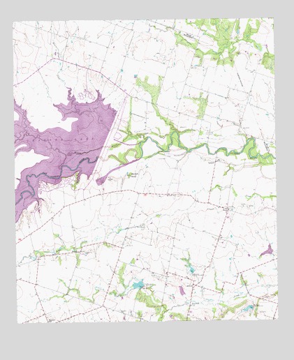
Granger Lake, TX USGS Topographic Map
Click on map above to begin viewing in our Map Viewer.

This topographic map contains these locations and features:
Feature Name Type Latitude Longitude GNIS ID View Map
Allison CemeteryCemeteryN30.6949°W97.3564°1351029View Map
C A Hamblen CemeteryCemeteryN30.7374°W97.2664°2041517View Map
Dam Number 3DamN30.6394°W97.3150°1355593View Map
Elm GrovePopulated PlaceN30.6852°W97.3200°1379716View Map
FriendshipPopulated PlaceN30.7141°W97.3303°1379804View Map
Friendship ParkParkN30.7185°W97.3294°2028335View Map
Granger DamDamN30.7035°W97.3169°1865532View Map
Granger LakeReservoirN30.7040°W97.3168°1865533View Map
Granger Lake - Taylor Park TrailTrailN30.6669°W97.3733°2033531View Map
Granger Wildlife Management AreaParkN30.6883°W97.3742°2028270View Map
HarePopulated PlaceN30.6710°W97.2731°1379889View Map
Hejl LakeReservoirN30.7452°W97.3603°1865123View Map
Hejl Lake DamDamN30.7452°W97.3603°1865122View Map
HoxiePopulated PlaceN30.6544°W97.3461°1379968View Map
LaneportPopulated PlaceN30.6908°W97.2789°1380057View Map
New Bern CemeteryCemeteryN30.6291°W97.3256°1363685View Map
Pecan Grove Wildlife AreaParkN30.6941°W97.3253°2029567View Map
SandovalPopulated PlaceN30.6402°W97.2906°1380493View Map
Soil Conservation Service Site 10 DamDamN30.6519°W97.2503°1856897View Map
Soil Conservation Service Site 10 ReservoirReservoirN30.6519°W97.2503°1856898View Map
Soil Conservation Service Site 3 DamDamN30.6385°W97.3153°1856889View Map
Soil Conservation Service Site 3 ReservoirReservoirN30.6385°W97.3153°1856890View Map
Soil Conservation Service Site 4a DamDamN30.6252°W97.3069°1856879View Map
Soil Conservation Service Site 4a ReservoirReservoirN30.6252°W97.3069°1856880View Map
Soil Conservation Service Site 6 DamDamN30.6402°W97.3003°1856891View Map
Soil Conservation Service Site 6 ReservoirReservoirN30.6400°W97.3006°1856892View Map
Soil Conservation Service Site 7 DamDamN30.6452°W97.2903°1856895View Map
Soil Conservation Service Site 7 ReservoirReservoirN30.6465°W97.2913°1856896View Map
Soil Conservation Service Site 8 DamDamN30.6302°W97.2619°1856893View Map
Soil Conservation Service Site 8 ReservoirReservoirN30.6302°W97.2641°1856894View Map
Sore Finger CreekStreamN30.7038°W97.3203°1350824View Map
Sore Finger Wildlife AreaParkN30.7163°W97.3650°2029286View Map
Taylor ParkParkN30.6691°W97.3683°2030131View Map
Willis CreekStreamN30.7016°W97.3111°1371603View Map
Wilson Fox ParkParkN30.6827°W97.3439°2029924View Map
Wuthrich HillPopulated PlaceN30.6260°W97.3606°1380807View Map
Young CemeteryCemeteryN30.6991°W97.3308°1372057View Map
Zion ChurchChurchN30.6427°W97.2928°1372091View Map

Note: Coordinates in the location and feature list above are referenced to NAD83 datum.


Copyright (C) 2008-2025 Ryan Niemi / Sunset Dynamics ... All Rights Reserved