TopoQuest Logo
Do you find TopoQuest useful?
Help keep TopoQuest running and adding new maps/features by donating!
Bitcoin:  19c7KJd3qBynnjoSw5npx9KScwjBe4ifkT
Litecoin:  LXs6TkuXGGXo1vDsWCkWVdjQX94eUKd6ui
Home View Maps Find Maps Find Places Resources & Links


Granite, Colorado Topographic Map

USGS Map Title: Granite, CO
USGS Map MRC: 39106A3
DRG (GeoTIFF) Download: o39106a3.tif


Neighboring USGS Topographic Map Quads:


  Mount Massive, CO  
39106B4
 

  Leadville South, CO  
39106B3
 

  Mount Sherman, CO  
39106B2
 

  Mount Elbert, CO  
39106A4
 

  Granite, CO  
39106A3
 

  South Peak, CO  
39106A2
 

  Winfield, CO  
38106H4
 

  Mount Harvard, CO  
38106H3
 

  Harvard Lakes, CO  
38106H2


Map MRC Location:

N40°
W107°
N40°
W106°
H8 H7 H6 H5 H4 H3 H2 H1
G8 G7 G6 G5 G4 G3 G2 G1
F8 F7 F6 F5 F4 F3 F2 F1
E8 E7 E6 E5 E4 E3 E2 E1
D8 D7 D6 D5 D4 D3 D2 D1
C8 C7 C6 C5 C4 C3 C2 C1
B8 B7 B6 B5 B4 B3 B2 B1
A8 A7 A6 A5 A4 A3 A2 A1
N39°
W107°
N39°
W106°

Granite, CO USGS 1:24K Topographic Map Preview:
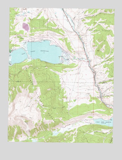
Granite, CO USGS Topographic Map
Click on map above to begin viewing in our Map Viewer.

This topographic map contains these locations and features:
Feature Name Type Latitude Longitude GNIS ID View Map
Aztec MineMineN39.0500°W106.2672°1684888View Map
BalltownPopulated PlaceN39.0778°W106.2811°180423View Map
Bartlett GulchValleyN39.0827°W106.3723°180413View Map
Beavr CityLocaleN39.0033°W106.3497°197613View Map
Belford GulchValleyN39.0015°W106.3487°189147View Map
Bell of Granite MineMineN39.0500°W106.2672°1684889View Map
Betsy MineMineN39.0500°W106.2672°1684890View Map
Box CreekStreamN39.1069°W106.2992°180424View Map
Buck MineMineN39.0500°W106.2672°1684891View Map
Cache CreekStreamN39.0422°W106.2659°180426View Map
Cache Creek MineMineN39.0500°W106.2672°1684892View Map
Clear Creek ReservoirReservoirN39.0195°W106.2570°202700View Map
Columbia GulchValleyN39.0086°W106.2562°180416View Map
Columbine MineMineN39.0328°W106.3597°180435View Map
Curlew Placer MineMineN39.0642°W106.3184°1684884View Map
Driscoll MineMineN39.0500°W106.2672°1684893View Map
Eleven O'Clock MineMineN39.0500°W106.2672°1684894View Map
Florence Extension MineMineN39.0500°W106.2700°1684895View Map
Flume CreekStreamN39.0783°W106.3422°180436View Map
Franklin MineMineN39.0500°W106.2672°1684896View Map
Gold Basin MineMineN39.0500°W106.2672°1684897View Map
Gold Bottom Placer MineMineN39.0500°W106.2672°1684898View Map
Gold Run MineMineN39.0500°W106.2672°1684900View Map
Golden Cache MineMineN39.0500°W106.2672°1684899View Map
Good Hope MineMineN39.0500°W106.2672°1684901View Map
GranitePopulated PlaceN39.0436°W106.2634°180420View Map
Granite CemeteryCemeteryN39.0457°W106.2816°180422View Map
Granite HeliportAirportN39.0858°W106.2689°204428View Map
H and H MineMineN39.0500°W106.2672°1684902View Map
Hawkinsville GulchValleyN39.0457°W106.2648°180421View Map
Hayden GulchValleyN39.0437°W106.2642°180430View Map
Hayden Placer MineMineN39.0500°W106.2672°1684903View Map
Holmes GulchValleyN39.0994°W106.2904°180427View Map
Independent MineMineN39.0500°W106.2672°1684904View Map
International MineMineN39.0500°W106.2672°1684905View Map
Josephine MineMineN39.0500°W106.2672°1684906View Map
Kellog GulchValleyN39.0347°W106.2508°180433View Map
Lake CreekStreamN39.0780°W106.2811°180412View Map
Lake View CampgroundLocaleN39.0980°W106.3656°180419View Map
Little Troy MineMineN39.0500°W106.2672°1684907View Map
Lost CanyonValleyN39.0330°W106.3047°180425View Map
Low Pass GulchValleyN39.0534°W106.2699°180429View Map
Luna Placer MineMineN39.0572°W106.2775°1684922View Map
Magenta MineMineN39.0239°W106.2714°1684908View Map
Mount Elbert ForebayReservoirN39.1071°W106.3589°197617View Map
Mount Elbert Forebay DamDamN39.1112°W106.3562°198990View Map
Mount Elbert PowerplantBuildingN39.0939°W106.3525°197614View Map
Mount Harvard MineMineN39.0500°W106.2672°1684909View Map
New Year MineMineN39.0239°W106.2714°1684910View Map
Pantle MineMineN39.0667°W106.2672°1684911View Map
Penn Nevada Dredge MineMineN39.0500°W106.2672°1684912View Map
Pennsylvania PlacerMineN39.0930°W106.2922°1735973View Map
Placer MinesMineN39.1189°W106.3661°197616View Map
Raeanna MineMineN39.0667°W106.2672°1684913View Map
Savage Placer MineMineN39.0003°W106.3339°1684914View Map
Sawmill GulchValleyN39.1143°W106.2998°180183View Map
Sheephead GulchValleyN39.0023°W106.3521°180434View Map
Smith-Bullard MineMineN39.0953°W106.3536°1684887View Map
Smuggler MineMineN39.0500°W106.2672°1684915View Map
Spring CreekStreamN39.0689°W106.2764°180428View Map
Spring MineMineN39.0500°W106.2672°1684916View Map
Tiger Lilly MineMineN39.0239°W106.2714°1684917View Map
Tom Thumb MineMineN39.0686°W106.3067°1684923View Map
Trafalgar MineMineN39.0500°W106.2672°1684918View Map
Twin LakesReservoirN39.0828°W106.3420°201317View Map
Twin Lakes Census Designated PlaceCensusN39.1037°W106.3190°2583308View Map
Twin Lakes DamDamN39.0800°W106.3139°201316View Map
Twin Lakes ReservoirReservoirN39.0769°W106.3031°202699View Map
Twobit GulchValleyN39.1034°W106.2959°180417View Map
U S Dredge MineMineN39.0667°W106.2672°1684919View Map
Washington MineMineN39.0239°W106.2714°1684920View Map
Waverly GulchValleyN39.0009°W106.3383°189176View Map
White Star CampgroundLocaleN39.0900°W106.3661°197615View Map
Young America Placer MineMineN39.0500°W106.2672°1684921View Map

Note: Coordinates in the location and feature list above are referenced to NAD83 datum.


Copyright (C) 2008-2024 Ryan Niemi / Sunset Dynamics ... All Rights Reserved