TopoQuest Logo
Do you find TopoQuest useful?
Help keep TopoQuest running and adding new maps/features by donating!
Bitcoin:  19c7KJd3qBynnjoSw5npx9KScwjBe4ifkT
Litecoin:  LXs6TkuXGGXo1vDsWCkWVdjQX94eUKd6ui
Home View Maps Find Maps Find Places Resources & Links


Leadville South, Colorado Topographic Map

USGS Map Title: Leadville South, CO
USGS Map MRC: 39106B3
DRG (GeoTIFF) Download: o39106b3.tif


Neighboring USGS Topographic Map Quads:


  Homestake Reservoir, CO  
39106C4
 

  Leadville North, CO  
39106C3
 

  Climax, CO  
39106C2
 

  Mount Massive, CO  
39106B4
 

  Leadville South, CO  
39106B3
 

  Mount Sherman, CO  
39106B2
 

  Mount Elbert, CO  
39106A4
 

  Granite, CO  
39106A3
 

  South Peak, CO  
39106A2


Map MRC Location:

N40°
W107°
N40°
W106°
H8 H7 H6 H5 H4 H3 H2 H1
G8 G7 G6 G5 G4 G3 G2 G1
F8 F7 F6 F5 F4 F3 F2 F1
E8 E7 E6 E5 E4 E3 E2 E1
D8 D7 D6 D5 D4 D3 D2 D1
C8 C7 C6 C5 C4 C3 C2 C1
B8 B7 B6 B5 B4 B3 B2 B1
A8 A7 A6 A5 A4 A3 A2 A1
N39°
W107°
N39°
W106°

Leadville South, CO USGS 1:24K Topographic Map Preview:
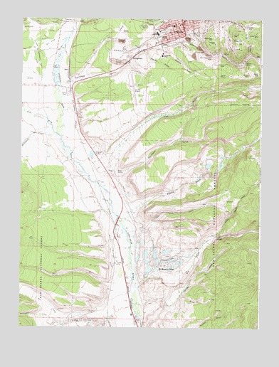
Leadville South, CO USGS Topographic Map
Click on map above to begin viewing in our Map Viewer.

This topographic map contains these locations and features:
Feature Name Type Latitude Longitude GNIS ID View Map
A V MineMineN39.2419°W106.2892°1735918View Map
Adelaide (historical)Populated PlaceN39.2472°W106.2581°180161View Map
Aetna MineMineN39.2472°W106.2822°1735902View Map
Agassiz MineMineN39.2492°W106.2684°1735901View Map
Badger State MineMineN39.2433°W106.2520°180160View Map
Bates MineMineN39.2236°W106.3200°1684534View Map
Belgian MineMineN39.2439°W106.2609°1684535View Map
Ben Burb ShaftMineN39.2319°W106.2631°1684536View Map
Benton MineMineN39.2494°W106.2511°1735895View Map
Bessie Wilgus ShaftMineN39.2267°W106.2634°1684537View Map
Big Chief MineMineN39.2394°W106.2734°1735903View Map
Big Union CreekStreamN39.1300°W106.3134°180178View Map
Bison ShaftMineN39.2486°W106.2814°1684538View Map
Blind Tom MineMineN39.2397°W106.2689°1684539View Map
Boehmer MineMineN39.2455°W106.2795°1684540View Map
Bohn MineMineN39.2492°W106.2870°1735920View Map
Bon Air MineMineN39.2436°W106.2861°1684541View Map
Box CreekStreamN39.1286°W106.3528°180130View Map
Brush CreekStreamN39.1383°W106.2909°180173View Map
Bullseye MineMineN39.2233°W106.2609°1735894View Map
Burton Placer MineMineN39.2369°W106.3378°1684542View Map
California GulchValleyN39.2246°W106.3494°180181View Map
Carbonate HillSummitN39.2425°W106.2759°180163View Map
Carbonate MineMineN39.2455°W106.2800°1735905View Map
Castle View MineMineN39.2475°W106.2731°1735904View Map
Catalpa MineMineN39.2472°W106.2811°1735906View Map
Chicago MineMineN39.2361°W106.3181°1684527View Map
City of LeadvilleCivilN39.2467°W106.2935°2411641View Map
Clarendon Placer MineMineN39.2233°W106.3375°1684543View Map
Cloud City ShaftMineN39.2469°W106.2809°1684544View Map
Codfish Balls MineMineN39.2442°W106.2670°1684545View Map
Colorado Mountain College Timberline CampusSchoolN39.2352°W106.3012°180148View Map
Columbia Number 2 MineMineN39.2317°W106.2695°180154View Map
Columbia Tunnel MineMineN39.2328°W106.2681°1684546View Map
Contract ShaftMineN39.2400°W106.2784°1684547View Map
Coon Valley MineMineN39.2269°W106.2689°1684548View Map
Cord MineMineN39.2403°W106.2636°1735897View Map
Corske CreekStreamN39.1292°W106.3297°180414View Map
Crescent MineMineN39.2347°W106.2797°1735896View Map
Crescentia ShaftMineN39.2330°W106.2686°1684549View Map
Crown Point MineMineN39.2294°W106.2609°1684550View Map
Crystal LakesLakeN39.1955°W106.3375°180170View Map
Crystal Lakes Work CenterLocaleN39.1950°W106.3331°196828View Map
De Lappe DitchCanalN39.2417°W106.3617°202685View Map
De Lappe Henderson DitchCanalN39.2369°W106.3672°202692View Map
Derry Number 1 DitchCanalN39.1544°W106.3284°180175View Map
Dodridge MineMineN39.2300°W106.2617°1684551View Map
Double Decker MineMineN39.2336°W106.2692°1684553View Map
Doublecheck MineMineN39.2497°W106.2647°1684552View Map
Dry Union GulchValleyN39.1677°W106.3066°180172View Map
East Flagstaff MineMineN39.2458°W106.2561°1684554View Map
Emmett MineMineN39.2350°W106.2659°1684528View Map
Empire GulchValleyN39.1700°W106.3191°180179View Map
Evelyn MineMineN39.2442°W106.2753°1735907View Map
Evening Star MineMineN39.2492°W106.2797°1684555View Map
Fairview MineMineN39.2494°W106.2572°1735932View Map
Fanny Rawlins MineMineN39.2314°W106.2617°1684351View Map
Gallagher MineMineN39.2483°W106.2656°1684557View Map
Gambetta MineMineN39.2250°W106.2692°1735933View Map
Georgia GulchValleyN39.2387°W106.3007°180167View Map
Glass-Pendery MineMineN39.2442°W106.2839°1684558View Map
Gleason MineMineN39.2303°W106.2617°1684559View Map
Great O'Sullivan MineMineN39.2233°W106.2603°1735898View Map
Habendum MineMineN39.2311°W106.2750°1684560View Map
Halfmoon CreekStreamN39.2028°W106.3561°180111View Map
Hegeman MineMineN39.2439°W106.2822°1735909View Map
Henrietta MineMineN39.2483°W106.2753°1735908View Map
Herrington CreekStreamN39.1286°W106.3528°180131View Map
Hess Tunnel MineMineN39.2494°W106.2636°1684305View Map
Highland Mary Tunnel MineMineN39.2494°W106.2659°1684561View Map
Home Extension MineMineN39.2492°W106.2892°1735922View Map
Iowa GulchValleyN39.1869°W106.3306°180180View Map
Iowa Gulch MineMineN39.2175°W106.2853°1684562View Map
Iron HillSummitN39.2411°W106.2622°180158View Map
J R Loker MineMineN39.2414°W106.2803°1684563View Map
Johnson MineMineN39.2303°W106.2614°1684564View Map
Kathy K MineMineN39.1586°W106.3200°1684665View Map
Keno ShaftMineN39.2314°W106.2681°1684565View Map
KobePopulated PlaceN39.1294°W106.3147°202693View Map
KRMH-AM (Leadville)TowerN39.2475°W106.2997°204037View Map
KRMH-FM (Leadville)TowerN39.2475°W106.2997°204162View Map
Kroll MineMineN39.2453°W106.2797°1684566View Map
Lake CountyCivilN39.2024°W106.3448°198149View Map
Lake County AirportAirportN39.2250°W106.3162°204486View Map
Lake County High SchoolSchoolN39.2442°W106.3049°196825View Map
Lake County LandfillLocaleN39.2264°W106.2817°2678010View Map
Lake County Sheriff's OfficeBuildingN39.2480°W106.2922°2696614View Map
Lake County Sheriff's Office JailBuildingN39.2481°W106.2923°2696617View Map
Lake ForkStreamN39.2019°W106.3542°179850View Map
Lazy Bill MineMineN39.2472°W106.2845°1684567View Map
Leadville District MineMineN39.2492°W106.2775°1684882View Map
Leadville DivisionCivilN39.1539°W106.3584°1935510View Map
Leadville Historic DistrictParkN39.2473°W106.2913°2559489View Map
Leadville Post OfficePost OfficeN39.2477°W106.2932°2759203View Map
Little Giant MineMineN39.2400°W106.2867°1684568View Map
Little Sister Placer MineMineN39.2236°W106.3200°1684569View Map
Little Union CreekStreamN39.1628°W106.2731°180176View Map
Louisville MineMineN39.2414°W106.2606°1684570View Map
Mahala MineMineN39.2386°W106.2659°1735911View Map
MaltaPopulated PlaceN39.2294°W106.3509°180146View Map
Malta SubstationLocaleN39.1878°W106.3222°180169View Map
Midas MineMineN39.2497°W106.2825°1684571View Map
Midland ShaftMineN39.2444°W106.2847°1684622View Map
Mikado MineMineN39.2489°W106.2670°1684623View Map
Mike MineMineN39.2389°W106.2536°1684624View Map
Minnie Pump ShaftMineN39.2333°W106.2586°1684625View Map
Modest Girl MineMineN39.2389°W106.2789°1684626View Map
Moffat MineMineN39.2272°W106.2745°180153View Map
Montgomery MineMineN39.2317°W106.2611°1684627View Map
Mount Massive Golf CourseLocaleN39.2349°W106.3577°2724384View Map
Mount Massive LakesPopulated PlaceN39.1522°W106.3006°180174View Map
Moyer MineMineN39.2358°W106.2570°1684629View Map
Murray Tunnel MineMineN39.2330°W106.2697°1684630View Map
National Placer MineMineN39.2233°W106.3375°1684631View Map
Niles MineMineN39.2472°W106.2797°1684633View Map
North Mike MineMineN39.2403°W106.2542°1684634View Map
Nugget GulchValleyN39.2354°W106.2565°180157View Map
O'Donovan Rosa ShaftMineN39.2405°W106.2839°1684635View Map
Only Chance MineMineN39.2286°W106.2670°1684636View Map
Oregon GulchValleyN39.2404°W106.2940°180166View Map
Oro (historical)Populated PlaceN39.2353°W106.2522°180156View Map
Oro City ShaftMineN39.2317°W106.2628°1684637View Map
Ostrom MineMineN39.2300°W106.2614°1684638View Map
Pawnee GulchValleyN39.2375°W106.3102°180168View Map
Pima Placer MineMineN39.2369°W106.3378°1684639View Map
Porter MineMineN39.2483°W106.2753°1735913View Map
Pos ShaftMineN39.2436°W106.2850°1684640View Map
Prospect Mountain MineMineN39.1336°W106.2686°1684641View Map
Pyrenees MineMineN39.2458°W106.2689°1684642View Map
Red Head ShaftMineN39.2305°W106.2609°1684643View Map
Reindeer ShaftMineN39.2275°W106.2622°1684644View Map
Resurrection MillPopulated PlaceN39.2353°W106.2770°180165View Map
Revenue Number One MineMineN39.2317°W106.2795°1684645View Map
Rock HillSummitN39.2272°W106.2528°180150View Map
Rock ShaftMineN39.2311°W106.2617°1684646View Map
Saguache Placers MineMineN39.2369°W106.3378°1684647View Map
Saint Joseph CemeteryCemeteryN39.2469°W106.3120°180147View Map
Saint Marys MineMineN39.2447°W106.2809°1684652View Map
Saint Vincent HospitalHospitalN39.2452°W106.3037°2695593View Map
Savage MineMineN39.2464°W106.2795°1684648View Map
Sequin MineMineN39.2283°W106.2656°1684649View Map
Seventy-six MineMineN39.2317°W106.2609°1684650View Map
Smuggler MineMineN39.2339°W106.2636°1684651View Map
Spring CreekStreamN39.1286°W106.3120°180177View Map
Star MineMineN39.2467°W106.2856°1684531View Map
Star of Hope MineMineN39.2333°W106.2600°1684653View Map
Star of the West MineMineN39.2394°W106.2706°1735914View Map
Stevens MineMineN39.2317°W106.2584°180152View Map
Stone Number Five MineMineN39.2311°W106.2600°1684654View Map
StringtownPopulated PlaceN39.2336°W106.3192°180149View Map
Sullivan MineMineN39.2278°W106.2567°180151View Map
Surprise ShaftMineN39.2492°W106.2728°1684655View Map
Thespian MineMineN39.2400°W106.2747°180164View Map
Thompson GulchValleyN39.1857°W106.3237°180171View Map
Tucson MineMineN39.2414°W106.2628°180159View Map
Ulster Newton MineMineN39.2428°W106.2586°1684656View Map
Villa ShaftMineN39.2453°W106.2884°1684335View Map
Vining ShaftMineN39.2303°W106.2667°1684657View Map
Washburn MineMineN39.2450°W106.2814°1684658View Map
Webster Tunnel MineMineN39.2311°W106.2609°1684659View Map
White Cap MineMineN39.2350°W106.2634°1735900View Map
Whites GulchValleyN39.2341°W106.2517°180182View Map
Willow CreekStreamN39.2125°W106.3739°180127View Map
Wolftone MineMineN39.2475°W106.2731°1684530View Map
Wootten Placer MineMineN39.2369°W106.3378°1684660View Map
X ShaftMineN39.2303°W106.2614°1684662View Map
Yak TunnelMineN39.2358°W106.2703°180155View Map
Yankee Doodle MineMineN39.2447°W106.2834°1735917View Map
Younger MineMineN39.2211°W106.3675°1684663View Map
Zuni Placer MineMineN39.2361°W106.3181°1684664View Map

Note: Coordinates in the location and feature list above are referenced to NAD83 datum.


Copyright (C) 2008-2024 Ryan Niemi / Sunset Dynamics ... All Rights Reserved