TopoQuest Logo
Do you find TopoQuest useful?
Help keep TopoQuest running and adding new maps/features by donating!
Bitcoin:  19c7KJd3qBynnjoSw5npx9KScwjBe4ifkT
Litecoin:  LXs6TkuXGGXo1vDsWCkWVdjQX94eUKd6ui
Home View Maps Find Maps Find Places Resources & Links


Granton, Wisconsin Topographic Map

USGS Map Title: Granton, WI
USGS Map MRC: 44090E4
DRG (GeoTIFF) Download: o44090e4.tif


Neighboring USGS Topographic Map Quads:


  Loyal West, WI  
44090F5
 

  Loyal East, WI  
44090F4
 

  Spencer South, WI  
44090F3
 

  Neillsville, WI  
44090E5
 

  Granton, WI  
44090E4
 

  Lindsey, WI  
44090E3
 

  Hatfield NE, WI  
44090D5
 

  City Point NW, WI  
44090D4
 

  City Point NE, WI  
44090D3


Map MRC Location:

N45°
W91°
N45°
W90°
H8 H7 H6 H5 H4 H3 H2 H1
G8 G7 G6 G5 G4 G3 G2 G1
F8 F7 F6 F5 F4 F3 F2 F1
E8 E7 E6 E5 E4 E3 E2 E1
D8 D7 D6 D5 D4 D3 D2 D1
C8 C7 C6 C5 C4 C3 C2 C1
B8 B7 B6 B5 B4 B3 B2 B1
A8 A7 A6 A5 A4 A3 A2 A1
N44°
W91°
N44°
W90°

Granton, WI USGS 1:24K Topographic Map Preview:
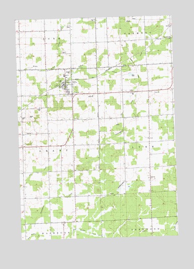
Granton, WI USGS Topographic Map
Click on map above to begin viewing in our Map Viewer.

This topographic map contains these locations and features:
Feature Name Type Latitude Longitude GNIS ID View Map
0.8 ReservoirReservoirN44.5272°W90.4209°1793266View Map
Cunningham AirportAirportN44.5299°W90.4189°1581994View Map
Cunningham School (historical)SchoolN44.5239°W90.4771°1837652View Map
Franklin School (historical)SchoolN44.6108°W90.4265°1837665View Map
GrantonPopulated PlaceN44.5889°W90.4612°1565749View Map
Granton Elementary SchoolSchoolN44.5929°W90.4624°2715671View Map
Granton High SchoolSchoolN44.5928°W90.4624°1837669View Map
Granton Volunteer Fire DepartmentBuildingN44.5892°W90.4620°2697710View Map
Hillside SchoolSchoolN44.5968°W90.4165°2715674View Map
Kurth (historical)Populated PlaceN44.5741°W90.4968°1837683View Map
Kurth School (historical)SchoolN44.5547°W90.4962°1837684View Map
Loretta Smith H1097 DamDamN44.5266°W90.4201°1793265View Map
LynnPopulated PlaceN44.5825°W90.4099°1568845View Map
Lynn CemeteryCemeteryN44.5816°W90.3907°1568846View Map
Mayflower School (historical)SchoolN44.5394°W90.4010°1837695View Map
Merryvale School (historical)SchoolN44.6186°W90.4874°1837697View Map
Pine Circle CemeteryCemeteryN44.6127°W90.3765°1571422View Map
Pine Circle School (historical)SchoolN44.6125°W90.3771°1837710View Map
Poplar Grove School (historical)SchoolN44.5836°W90.3760°1837714View Map
Roder School (historical)SchoolN44.5580°W90.4571°1837720View Map
Sunbeam School (historical)SchoolN44.5825°W90.4140°1837743View Map
Town of GrantCivilN44.5523°W90.4977°1583298View Map
Town of LynnCivilN44.5544°W90.3760°1583615View Map
Village of GrantonCivilN44.5884°W90.4614°1583304View Map
Wild Rose School (historical)SchoolN44.5822°W90.4965°1837755View Map
Windfall CemeteryCemeteryN44.5947°W90.4571°1576852View Map
Yolo CemeteryCemeteryN44.6186°W90.3760°1577101View Map
Zion CemeteryCemeteryN44.5830°W90.4543°1577144View Map
Zion School (historical)SchoolN44.5677°W90.4532°1837762View Map

Note: Coordinates in the location and feature list above are referenced to NAD83 datum.


Copyright (C) 2008-2024 Ryan Niemi / Sunset Dynamics ... All Rights Reserved