TopoQuest Logo
Do you find TopoQuest useful?
Help keep TopoQuest running and adding new maps/features by donating!
Bitcoin:  19c7KJd3qBynnjoSw5npx9KScwjBe4ifkT
Litecoin:  LXs6TkuXGGXo1vDsWCkWVdjQX94eUKd6ui
Home View Maps Find Maps Find Places Resources & Links


Loyal West, Wisconsin Topographic Map

USGS Map Title: Loyal West, WI
USGS Map MRC: 44090F5
DRG (GeoTIFF) Download: o44090f5.tif


Neighboring USGS Topographic Map Quads:


  Mead Lake East, WI  
44090G6
 

  Greenwood, WI  
44090G5
 

  Riplinger, WI  
44090G4
 

  Willard, WI  
44090F6
 

  Loyal West, WI  
44090F5
 

  Loyal East, WI  
44090F4
 

  Columbia, WI  
44090E6
 

  Neillsville, WI  
44090E5
 

  Granton, WI  
44090E4


Map MRC Location:

N45°
W91°
N45°
W90°
H8 H7 H6 H5 H4 H3 H2 H1
G8 G7 G6 G5 G4 G3 G2 G1
F8 F7 F6 F5 F4 F3 F2 F1
E8 E7 E6 E5 E4 E3 E2 E1
D8 D7 D6 D5 D4 D3 D2 D1
C8 C7 C6 C5 C4 C3 C2 C1
B8 B7 B6 B5 B4 B3 B2 B1
A8 A7 A6 A5 A4 A3 A2 A1
N44°
W91°
N44°
W90°

Loyal West, WI USGS 1:24K Topographic Map Preview:
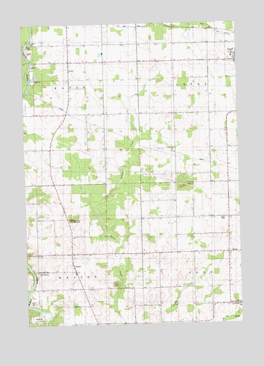
Loyal West, WI USGS Topographic Map
Click on map above to begin viewing in our Map Viewer.

This topographic map contains these locations and features:
Feature Name Type Latitude Longitude GNIS ID View Map
ChristiePopulated PlaceN44.6472°W90.5965°1563062View Map
Christie MoundSummitN44.6689°W90.5979°1563065View Map
Clark CountyCivilN44.7347°W90.6121°1581069View Map
East Side CemeteryCemeteryN44.6466°W90.6182°1564376View Map
Eaton Center School (historical)SchoolN44.7147°W90.5988°1837655View Map
Forman School (historical)SchoolN44.6580°W90.5574°1837663View Map
Lincoln School (historical)SchoolN44.6550°W90.5065°1837685View Map
Lion School (historical)SchoolN44.7122°W90.5168°1837686View Map
Loyal Elementary SchoolSchoolN44.7361°W90.5027°2715700View Map
Loyal High SchoolSchoolN44.7361°W90.5027°1837691View Map
Loyal Junior High SchoolSchoolN44.7361°W90.5027°2715869View Map
Loyal Wastewater Treatment FacilityLocaleN44.7400°W90.5356°2723708View Map
Marie Louise ChapelChurchN44.6469°W90.6185°1569035View Map
Mound School (historical)SchoolN44.6691°W90.6007°1837698View Map
Oriole Hill School (historical)SchoolN44.6255°W90.5271°1837706View Map
Pleasant View School (historical)SchoolN44.6694°W90.5062°1837713View Map
Prosperity School (historical)SchoolN44.7416°W90.5674°1837715View Map
Ross School (historical)SchoolN44.6872°W90.5365°1837723View Map
Town of EatonCivilN44.7248°W90.6195°1583122View Map
Town of WestonCivilN44.6401°W90.6189°1584411View Map
York Center CemeteryCemeteryN44.6322°W90.5001°1577106View Map
York Center ChurchChurchN44.6325°W90.5010°1577107View Map

Note: Coordinates in the location and feature list above are referenced to NAD83 datum.


Copyright (C) 2008-2024 Ryan Niemi / Sunset Dynamics ... All Rights Reserved