TopoQuest Logo
Do you find TopoQuest useful?
Help keep TopoQuest running and adding new maps/features by donating!
Bitcoin:  19c7KJd3qBynnjoSw5npx9KScwjBe4ifkT
Litecoin:  LXs6TkuXGGXo1vDsWCkWVdjQX94eUKd6ui
Home View Maps Find Maps Find Places Resources & Links


Grantsville, West Virginia Topographic Map

USGS Map Title: Grantsville, WV
USGS Map MRC: 38081H1
DRG (GeoTIFF) Download: o38081h1.tif


Neighboring USGS Topographic Map Quads:


  MacFarlan, WV  
39081A2
 

  Smithville, WV  
39081A1
 

  Burnt House, WV  
39080A8
 

  Annamoriah, WV  
38081H2
 

  Grantsville, WV  
38081H1
 

  Tanner, WV  
38080H8
 

  Arnoldsburg, WV  
38081G2
 

  Millstone, WV  
38081G1
 

  Normantown, WV  
38080G8


Map MRC Location:

N39°
W82°
N39°
W81°
H8 H7 H6 H5 H4 H3 H2 H1
G8 G7 G6 G5 G4 G3 G2 G1
F8 F7 F6 F5 F4 F3 F2 F1
E8 E7 E6 E5 E4 E3 E2 E1
D8 D7 D6 D5 D4 D3 D2 D1
C8 C7 C6 C5 C4 C3 C2 C1
B8 B7 B6 B5 B4 B3 B2 B1
A8 A7 A6 A5 A4 A3 A2 A1
N38°
W82°
N38°
W81°

Grantsville, WV USGS 1:24K Topographic Map Preview:
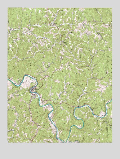
Grantsville, WV USGS Topographic Map
Click on map above to begin viewing in our Map Viewer.

This topographic map contains these locations and features:
Feature Name Type Latitude Longitude GNIS ID View Map
AyersPopulated PlaceN38.9781°W81.0984°1553771View Map
Back ForkStreamN38.9848°W81.0721°1535102View Map
Barnes KnobSummitN38.9693°W81.0221°1553802View Map
Bernard P Bell BridgeBridgeN38.9217°W81.0948°2635373View Map
Bethel CemeteryCemeteryN38.9023°W81.0151°1696828View Map
Bethel ChurchChurchN38.9031°W81.0151°1535703View Map
Bethlehem Baptist ChurchChurchN38.9134°W81.0840°1535731View Map
Bethlehem CemeteryCemeteryN38.9126°W81.0840°1696829View Map
Betts CemeteryCemeteryN38.9304°W81.1151°1696830View Map
Big ForkStreamN38.9070°W81.1215°1535845View Map
Big RunStreamN38.9037°W81.0240°1535916View Map
Big RunStreamN38.9231°W81.0343°1535917View Map
Big RunStreamN38.9801°W81.1109°1535924View Map
Big SpringsPopulated PlaceN38.9854°W81.0721°1535972View Map
Big Springs CemeteryCemeteryN38.9851°W81.0707°1696832View Map
Big Springs Post OfficePost OfficeN38.9846°W81.0733°1696833View Map
Broomstick CemeteryCemeteryN38.9670°W81.0909°1696835View Map
Broomstick ChurchChurchN38.9673°W81.0921°1536399View Map
Bull RiverStreamN38.9093°W81.0832°1536701View Map
Cabbage KnobSummitN38.9770°W81.0518°1554042View Map
Cabot StationPopulated PlaceN38.9295°W81.1112°1536843View Map
Calhoun - Gilmer Career CenterSchoolN38.8993°W81.0144°2088151View Map
Calhoun County CourthouseBuildingN38.9266°W81.0764°1696839View Map
Calhoun County High School (historical)SchoolN38.9198°W81.0934°1696840View Map
Calhoun County Sheriff's OfficeBuildingN38.9234°W81.0956°2727897View Map
Calhoun General Hospital (historical)HospitalN38.9229°W81.0923°1696842View Map
Cherry ForkStreamN38.9354°W81.0240°1537235View Map
Cherry Fork ChurchChurchN38.9354°W81.0234°1537238View Map
Chestnut Grove ChurchChurchN38.9854°W81.0712°1537279View Map
Coalbank RunStreamN38.9420°W81.0248°1537476View Map
Deadening RunStreamN38.9279°W81.1126°1538087View Map
District 3CivilN38.9084°W81.1140°1928228View Map
Enon ChurchChurchN38.8915°W81.0701°1538726View Map
Fairview ChurchChurchN38.9690°W81.1176°1538816View Map
Fairview School (historical)SchoolN38.8823°W81.0176°1696856View Map
Five ForksPopulated PlaceN38.9693°W81.0607°1554463View Map
Five Forks Post OfficePost OfficeN38.9670°W81.0590°1696857View Map
GrantsvillePopulated PlaceN38.9234°W81.0959°1539593View Map
Grantsville Graded School (historical)SchoolN38.9198°W81.0932°1696862View Map
Grantsville Police DepartmentBuildingN38.9233°W81.0953°2727896View Map
Grantsville Post OfficePost OfficeN38.9233°W81.0966°1696863View Map
Grantsville Volunteer Fire DepartmentBuildingN38.9176°W81.0960°2578040View Map
Hardman ChapelChurchN38.9301°W81.1148°1539943View Map
HattiePopulated PlaceN38.8998°W81.0126°1554663View Map
HenriettaPopulated PlaceN38.9081°W81.0448°1554683View Map
Hog KnobSummitN38.9084°W81.0621°1554723View Map
Hog Knob School (historical)SchoolN38.8998°W81.0509°1696869View Map
Index (historical)Populated PlaceN38.8765°W81.0157°1696873View Map
Jackson RunStreamN38.9831°W81.0890°1540788View Map
Jackson School (historical)SchoolN38.9837°W81.0973°1696875View Map
Kite KnobSummitN38.9465°W81.0529°1554890View Map
Klipstine School (historical)SchoolN38.9848°W81.0718°1696878View Map
Laurel CreekStreamN38.9079°W81.0407°1541407View Map
Leafbank RunStreamN38.9343°W81.0926°1541582View Map
Lick RunStreamN38.9206°W81.0332°1541914View Map
Little Kanawha River BridgeBridgeN38.9218°W81.0948°1696885View Map
LovadaPopulated PlaceN38.9631°W81.0732°1555001View Map
Lower RunStreamN38.9015°W81.0073°1542569View Map
Lower Run ChurchChurchN38.8943°W81.0079°1542570View Map
Minnie Hamilton Health Care CenterHospitalN38.9227°W81.0926°2026678View Map
Minnie Hamilton Health Care Center Emergency Medical ServiceBuildingN38.9234°W81.0918°2775501View Map
Mudlick RunStreamN38.8898°W81.0029°1543972View Map
Mudlick RunStreamN38.9868°W81.0126°1543973View Map
Mussel ShoalsBarN38.8979°W81.0115°1544023View Map
NobePopulated PlaceN38.9865°W81.0343°1555230View Map
Nobe Post OfficePost OfficeN38.9848°W81.0359°1696898View Map
Oak HillPopulated PlaceN38.9223°W81.0184°1555253View Map
Oak Hill School (historical)SchoolN38.9218°W81.0196°1696900View Map
Old House RunStreamN38.9837°W81.0912°1544363View Map
Perkins RunStreamN38.9143°W81.0748°1544716View Map
Philip RunStreamN38.9215°W81.0943°1544778View Map
Philip Run ChurchChurchN38.9043°W81.0982°1544779View Map
Philip Run School (historical)SchoolN38.9045°W81.0979°1696902View Map
Pine CreekStreamN38.9279°W81.1101°1544866View Map
Pleasant HillPopulated PlaceN38.9537°W81.0607°1555368View Map
Pleasant Hill CemeteryCemeteryN38.9509°W81.0626°1696907View Map
Pleasant Hill Elementary SchoolSchoolN38.9498°W81.0593°1696908View Map
Revere School (historical)SchoolN38.9834°W81.0021°1689725View Map
RhodaPopulated PlaceN38.9798°W81.1221°1555469View Map
Riffle RunStreamN38.8801°W81.0673°1545593View Map
Right Fork Pine CreekStreamN38.8865°W81.1176°1545686View Map
Road ForkStreamN38.9454°W81.0262°1545813View Map
Road RunStreamN38.9837°W81.0968°1545829View Map
Simon RunStreamN38.9220°W81.0957°1546807View Map
Slab ForkStreamN38.9545°W81.0237°1546887View Map
Snider School (historical)SchoolN38.9998°W81.0776°1696925View Map
Spring ForkStreamN38.9784°W81.0996°1547191View Map
Spruce Hollow School (historical)SchoolN38.9770°W81.1226°1696928View Map
Stevens School (historical)SchoolN38.9204°W81.1057°1547400View Map
Taylor RunStreamN38.9795°W81.1212°1547937View Map
Town of GrantsvilleCivilN38.9204°W81.0933°2390216View Map
Upper Pine Creek School (historical)SchoolN38.8798°W81.1187°1548544View Map
Waggoner CemeteryCemeteryN38.9802°W81.1199°2574005View Map
West Virginia State Police Troop 4 - Grantsville DetachmentBuildingN38.8901°W81.0890°2727895View Map
White PinePopulated PlaceN38.9468°W81.0293°1549987View Map
Wildcat RunStreamN38.8998°W81.0193°1549136View Map

Note: Coordinates in the location and feature list above are referenced to NAD83 datum.


Copyright (C) 2008-2024 Ryan Niemi / Sunset Dynamics ... All Rights Reserved