TopoQuest Logo
Do you find TopoQuest useful?
Help keep TopoQuest running and adding new maps/features by donating!
Bitcoin:  19c7KJd3qBynnjoSw5npx9KScwjBe4ifkT
Litecoin:  LXs6TkuXGGXo1vDsWCkWVdjQX94eUKd6ui
Home View Maps Find Maps Find Places Resources & Links


Gray Head Peak, Utah Topographic Map

USGS Map Title: Gray Head Peak, UT
USGS Map MRC: 39110H7
DRG (GeoTIFF) Download: o39110h7.tif


Neighboring USGS Topographic Map Quads:


  Strawberry Peak, UT  
40110A8
 

  Avintaquin Canyon, UT  
40110A7
 

  Sams Canyon, UT  
40110A6
 

  Flat Ridge, UT  
39110H8
 

  Gray Head Peak, UT  
39110H7
 

  Jones Hollow, UT  
39110H6
 

  Kyune, UT  
39110G8
 

  Matts Summit, UT  
39110G7
 

  Minnie Maud Creek West, UT  
39110G6


Map MRC Location:

N40°
W111°
N40°
W110°
H8 H7 H6 H5 H4 H3 H2 H1
G8 G7 G6 G5 G4 G3 G2 G1
F8 F7 F6 F5 F4 F3 F2 F1
E8 E7 E6 E5 E4 E3 E2 E1
D8 D7 D6 D5 D4 D3 D2 D1
C8 C7 C6 C5 C4 C3 C2 C1
B8 B7 B6 B5 B4 B3 B2 B1
A8 A7 A6 A5 A4 A3 A2 A1
N39°
W111°
N39°
W110°

Gray Head Peak, UT USGS 1:24K Topographic Map Preview:
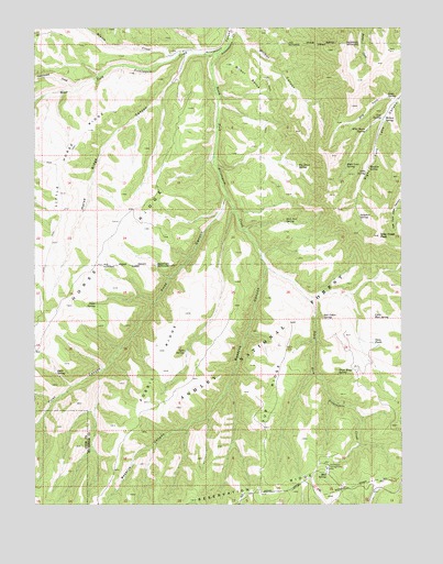
Gray Head Peak, UT USGS Topographic Map
Click on map above to begin viewing in our Map Viewer.

This topographic map contains these locations and features:
Feature Name Type Latitude Longitude GNIS ID View Map
Avintaquin CampgroundLocaleN39.8841°W110.7760°1437948View Map
Avintaquin Wildlife Management AreaParkN39.9666°W110.8629°1448098View Map
Big Draw SpringSpringN39.9635°W110.7860°1425482View Map
Cottonwood CreekStreamN39.9841°W110.8607°1440017View Map
Cow SpringSpringN39.9755°W110.7574°1427010View Map
Dry ForkStreamN39.9813°W110.7515°1427541View Map
First CanyonValleyN39.9555°W110.8107°1441049View Map
Fossil RidgeRidgeN39.9108°W110.8332°1428051View Map
Gray Head PeakSummitN39.9455°W110.7582°1428364View Map
High Line SpringSpringN39.9638°W110.7696°1428704View Map
Horse RidgeRidgeN39.9288°W110.8638°1441895View Map
Horse Ridge CanyonValleyN39.9925°W110.8235°1428865View Map
Lake SpringSpringN39.9622°W110.7624°1429441View Map
Little Horse RidgeRidgeN39.9611°W110.8671°1429744View Map
Little Mud SpringSpringN39.9243°W110.7599°1429773View Map
Meadow SpringSpringN39.9632°W110.7615°1430212View Map
Minnie CreekStreamN39.9933°W110.8265°1443520View Map
Mud SpringSpringN39.8833°W110.7763°1430570View Map
Olsen SpringSpringN39.9280°W110.8549°1431003View Map
Pinto SpringSpringN39.9819°W110.7555°1431305View Map
Red Cedar SpringSpringN39.9240°W110.7772°1431628View Map
Reserve CanyonValleyN39.9366°W110.7968°1431753View Map
Sick Cow SpringSpringN39.9491°W110.7899°1432435View Map
South Fork Avintaquin CreekStreamN39.9936°W110.8129°1432671View Map
Split SpringSpringN39.9151°W110.8244°1432807View Map
Steer SpringSpringN39.9094°W110.8682°1432959View Map
Sulphur SpringSpringN39.9505°W110.7646°1433047View Map
Trail Ridge SpringSpringN39.9094°W110.7722°1433651View Map
Tub RidgeRidgeN39.9130°W110.7915°1433688View Map
Twin PondsLakeN39.9174°W110.7601°1433752View Map
West Fork Avintaquin CreekStreamN39.9933°W110.8132°1447127View Map
Wilbur BenchBenchN39.9869°W110.8035°1434242View Map
Wilbur CanyonValleyN39.9991°W110.8068°1434243View Map
Wilbur SpringSpringN39.9759°W110.7571°1434244View Map
Wild Horse SpringSpringN39.9730°W110.7621°1434262View Map

Note: Coordinates in the location and feature list above are referenced to NAD83 datum.


Copyright (C) 2008-2025 Ryan Niemi / Sunset Dynamics ... All Rights Reserved