TopoQuest Logo
Do you find TopoQuest useful?
Help keep TopoQuest running and adding new maps/features by donating!
Bitcoin:  19c7KJd3qBynnjoSw5npx9KScwjBe4ifkT
Litecoin:  LXs6TkuXGGXo1vDsWCkWVdjQX94eUKd6ui
Home View Maps Find Maps Find Places Resources & Links


Sams Canyon, Utah Topographic Map

USGS Map Title: Sams Canyon, UT
USGS Map MRC: 40110A6
DRG (GeoTIFF) Download: o40110a6.tif


Neighboring USGS Topographic Map Quads:


  Fruitland, UT  
40110B7
 

  Strawberry Pinnacles, UT  
40110B6
 

  Rabbit Gulch, UT  
40110B5
 

  Avintaquin Canyon, UT  
40110A7
 

  Sams Canyon, UT  
40110A6
 

  Buck Knoll, UT  
40110A5
 

  Gray Head Peak, UT  
39110H7
 

  Jones Hollow, UT  
39110H6
 

  Lance Canyon, UT  
39110H5


Map MRC Location:

N41°
W111°
N41°
W110°
H8 H7 H6 H5 H4 H3 H2 H1
G8 G7 G6 G5 G4 G3 G2 G1
F8 F7 F6 F5 F4 F3 F2 F1
E8 E7 E6 E5 E4 E3 E2 E1
D8 D7 D6 D5 D4 D3 D2 D1
C8 C7 C6 C5 C4 C3 C2 C1
B8 B7 B6 B5 B4 B3 B2 B1
A8 A7 A6 A5 A4 A3 A2 A1
N40°
W111°
N40°
W110°

Sams Canyon, UT USGS 1:24K Topographic Map Preview:
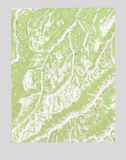
Sams Canyon, UT USGS Topographic Map
Click on map above to begin viewing in our Map Viewer.

This topographic map contains these locations and features:
Feature Name Type Latitude Longitude GNIS ID View Map
Avintaquin CanyonValleyN40.1238°W110.7410°1438310View Map
Avintaquin CreekStreamN40.1238°W110.7410°1438311View Map
Bear GulchValleyN40.0102°W110.6940°1438466View Map
Big SpringSpringN40.0666°W110.7139°1425550View Map
Britt CanyonValleyN40.1158°W110.6715°1425978View Map
Dipping Vat HollowValleyN40.0830°W110.7046°1427404View Map
East Dry CanyonValleyN40.0944°W110.6304°1427681View Map
East Fork Sams CanyonValleyN40.1044°W110.6799°1427699View Map
Frank MineMineN40.1002°W110.6318°1428081View Map
Freds DrawValleyN40.0241°W110.6718°1441219View Map
Garden HollowValleyN40.0922°W110.7440°1441265View Map
Half Moon HollowValleyN40.0691°W110.7154°1428475View Map
Lake Canyon Wildlife Management AreaParkN40.0161°W110.6821°1448564View Map
Left Fork Lake CanyonValleyN40.0069°W110.7057°1442505View Map
Linley HollowValleyN40.1211°W110.7249°1429648View Map
Lion HollowValleyN40.0772°W110.7463°1442646View Map
Monument GulchValleyN40.0208°W110.6810°1443571View Map
O'Driscoll SpringSpringN40.0822°W110.6760°1430898View Map
Payne MineMineN40.0980°W110.6318°1431149View Map
Raspberry HollowValleyN40.0466°W110.7160°1431580View Map
Right Fork Lake CanyonValleyN40.0069°W110.7060°1444927View Map
Rosie HollowValleyN40.0369°W110.6513°1432009View Map
Twin HollowValleyN40.0241°W110.7279°1433729View Map
Wildhorse SpringSpringN40.0658°W110.6457°1434286View Map

Note: Coordinates in the location and feature list above are referenced to NAD83 datum.


Copyright (C) 2008-2025 Ryan Niemi / Sunset Dynamics ... All Rights Reserved