TopoQuest Logo
Do you find TopoQuest useful?
Help keep TopoQuest running and adding new maps/features by donating!
Bitcoin:  19c7KJd3qBynnjoSw5npx9KScwjBe4ifkT
Litecoin:  LXs6TkuXGGXo1vDsWCkWVdjQX94eUKd6ui
Home View Maps Find Maps Find Places Resources & Links


Grays Bend, California Topographic Map

USGS Map Title: Grays Bend, CA
USGS Map MRC: 38121F6
DRG (GeoTIFF) Download: o38121f6.tif


Neighboring USGS Topographic Map Quads:


  Eldorado Bend, CA  
38121G7
 

  Knights Landing, CA  
38121G6
 

  Verona, CA  
38121G5
 

  Woodland, CA  
38121F7
 

  Grays Bend, CA  
38121F6
 

  Taylor Monument, CA  
38121F5
 

  Merritt, CA  
38121E7
 

  Davis, CA  
38121E6
 

  Sacramento West, CA  
38121E5


Map MRC Location:

N39°
W122°
N39°
W121°
H8 H7 H6 H5 H4 H3 H2 H1
G8 G7 G6 G5 G4 G3 G2 G1
F8 F7 F6 F5 F4 F3 F2 F1
E8 E7 E6 E5 E4 E3 E2 E1
D8 D7 D6 D5 D4 D3 D2 D1
C8 C7 C6 C5 C4 C3 C2 C1
B8 B7 B6 B5 B4 B3 B2 B1
A8 A7 A6 A5 A4 A3 A2 A1
N38°
W122°
N38°
W121°

Grays Bend, CA USGS 1:24K Topographic Map Preview:
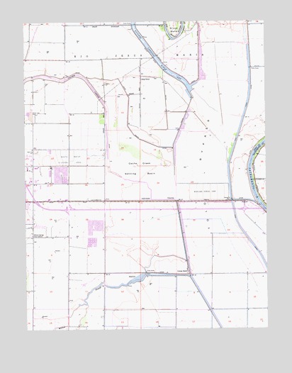
Grays Bend, CA USGS Topographic Map
Click on map above to begin viewing in our Map Viewer.

This topographic map contains these locations and features:
Feature Name Type Latitude Longitude GNIS ID View Map
Cache Creek Settling BasinBasinN38.6899°W121.6916°220357View Map
Cache Creek SinkBasinN38.7152°W121.6552°1662200View Map
ConawayPopulated PlaceN38.6771°W121.6730°252655View Map
Conway RanchLocaleN38.6482°W121.6677°221477View Map
Debacco 2465 DamDamN38.6716°W121.6344°1664374View Map
FremontPopulated PlaceN38.6766°W121.6350°1658579View Map
Grays BendBendN38.7449°W121.6736°224524View Map
Hayes Truck MuseumBuildingN38.6763°W121.7297°1703163View Map
Hebron (historical)Populated PlaceN38.6774°W121.7286°1662205View Map
Idle Wheel Mobile EstatesPopulated PlaceN38.6675°W121.7447°2507917View Map
King FarmsPopulated PlaceN38.7266°W121.6914°1658905View Map
Laugenour (historical)Populated PlaceN38.7396°W121.7483°1662208View Map
Old RiverStreamN38.7499°W121.6694°229982View Map
Rio Jesus MariaCivilN38.7341°W121.7016°231620View Map
Royal Palms Mobile EstatesPopulated PlaceN38.6692°W121.7492°2507908View Map
Sacramento City Fire Department Station 3BuildingN38.6850°W121.6253°2624100View Map
Willow SloughStreamN38.6466°W121.6666°237932View Map
Willow Spring Elementary SchoolSchoolN38.6632°W121.7480°237948View Map
Woodland Community CollegeSchoolN38.6605°W121.7354°1703244View Map
Woodland Fire Department Station 3BuildingN38.6736°W121.7488°2624383View Map
Woodland Sewage FarmLocaleN38.6793°W121.6577°1654526View Map
Yolo County Sheriff's OfficeBuildingN38.6620°W121.7319°2755691View Map

Note: Coordinates in the location and feature list above are referenced to NAD83 datum.


Copyright (C) 2008-2025 Ryan Niemi / Sunset Dynamics ... All Rights Reserved