TopoQuest Logo
Do you find TopoQuest useful?
Help keep TopoQuest running and adding new maps/features by donating!
Bitcoin:  19c7KJd3qBynnjoSw5npx9KScwjBe4ifkT
Litecoin:  LXs6TkuXGGXo1vDsWCkWVdjQX94eUKd6ui
Home View Maps Find Maps Find Places Resources & Links


Grays Prairie, Texas Topographic Map

USGS Map Title: Grays Prairie, TX
USGS Map MRC: 32096D3
DRG (GeoTIFF) Download: o32096d3.tif


Neighboring USGS Topographic Map Quads:


  Scurry, TX  
32096E4
 

  Kaufman, TX  
32096E3
 

  Ola, TX  
32096E2
 

  Rosser, TX  
32096D4
 

  Grays Prairie, TX  
32096D3
 

  Kemp, TX  
32096D2
 

  Rosser SW, TX  
32096C4
 

  Styx, TX  
32096C3
 

  Tool, TX  
32096C2


Map MRC Location:

N33°
W97°
N33°
W96°
H8 H7 H6 H5 H4 H3 H2 H1
G8 G7 G6 G5 G4 G3 G2 G1
F8 F7 F6 F5 F4 F3 F2 F1
E8 E7 E6 E5 E4 E3 E2 E1
D8 D7 D6 D5 D4 D3 D2 D1
C8 C7 C6 C5 C4 C3 C2 C1
B8 B7 B6 B5 B4 B3 B2 B1
A8 A7 A6 A5 A4 A3 A2 A1
N32°
W97°
N32°
W96°

Grays Prairie, TX USGS 1:24K Topographic Map Preview:
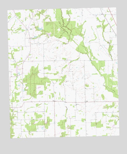
Grays Prairie, TX USGS Topographic Map
Click on map above to begin viewing in our Map Viewer.

This topographic map contains these locations and features:
Feature Name Type Latitude Longitude GNIS ID View Map
Big Cottonwood CreekStreamN32.4832°W96.3100°1372535View Map
Coffee LakeReservoirN32.4368°W96.3653°1860822View Map
Coffee Lake DamDamN32.4368°W96.3653°1860821View Map
Erco FieldAirportN32.4979°W96.2705°1386993View Map
Grays PrairiePopulated PlaceN32.4721°W96.3494°1378379View Map
Grays Prairie City HallBuildingN32.4763°W96.3516°2753951View Map
Kaufman DivisionCivilN32.4865°W96.2760°1938878View Map
Little Cottonwood CreekStreamN32.4204°W96.2575°1340059View Map
LivelyPopulated PlaceN32.4099°W96.3233°1378591View Map
Shady Grove ChurchChurchN32.4060°W96.2991°1346938View Map
Shilo ChurchChurchN32.3768°W96.2878°1347038View Map
Soil Conservation Service Site 68 DamDamN32.4985°W96.3319°1863104View Map
Soil Conservation Service Site 68 ReservoirReservoirN32.4985°W96.3319°1863105View Map
Soil Conservation Service Site 69 DamDamN32.4768°W96.3253°1863106View Map
Soil Conservation Service Site 69 ReservoirReservoirN32.4768°W96.3253°1863107View Map
Soil Conservation Service Site 70 DamDamN32.4651°W96.3136°1863108View Map
Soil Conservation Service Site 70 ReservoirReservoirN32.4651°W96.3136°1863109View Map
Soil Conservation Service Site 71 DamDamN32.4468°W96.3053°1863110View Map
Soil Conservation Service Site 71 ReservoirReservoirN32.4468°W96.3053°1863111View Map
Soil Conservation Service Site 83 DamDamN32.4701°W96.2753°1863112View Map
Soil Conservation Service Site 83 ReservoirReservoirN32.4701°W96.2753°1863113View Map
Soil Conservation Service Site 84 DamDamN32.4535°W96.2503°1863114View Map
Soil Conservation Service Site 84 ReservoirReservoirN32.4535°W96.2503°1863115View Map
StubbsPopulated PlaceN32.4088°W96.2878°1379126View Map
Vaughn LakeReservoirN32.4241°W96.3411°1860820View Map
Vaughn Lake DamDamN32.4235°W96.3419°1860819View Map
Village of Grays PrairieCivilN32.4726°W96.3507°2413555View Map
Wells DamDamN32.4801°W96.3369°1860817View Map
Wells LakeReservoirN32.4801°W96.3369°1860818View Map

Note: Coordinates in the location and feature list above are referenced to NAD83 datum.


Copyright (C) 2008-2025 Ryan Niemi / Sunset Dynamics ... All Rights Reserved